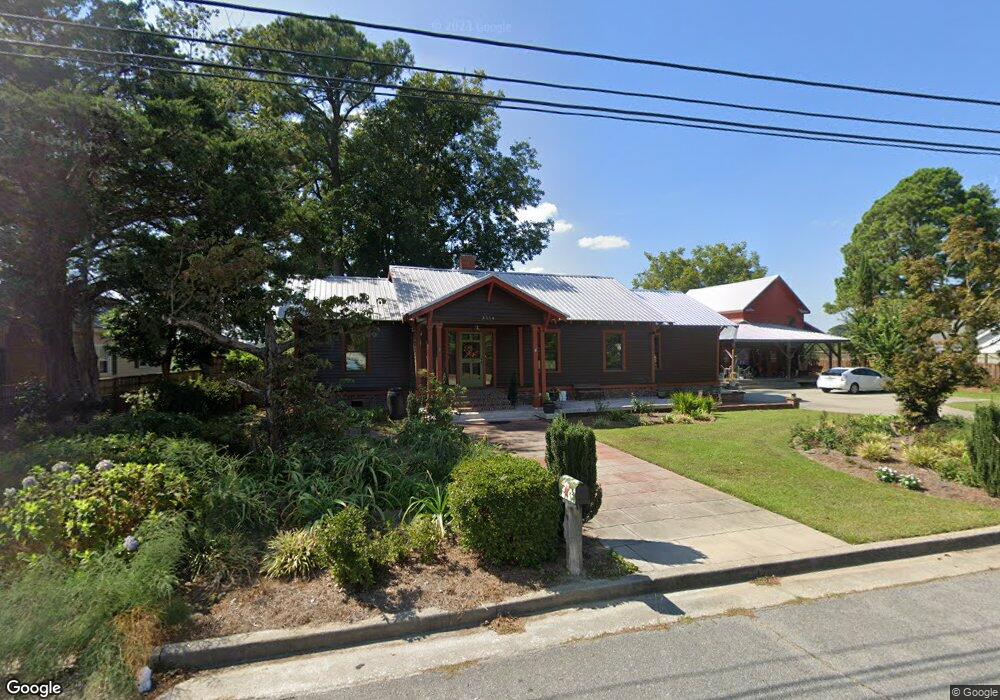
3514 Old Hwy 11 Deep Run, NC 28525
Estimated Value: $141,000 - $244,000
3
Beds
2
Baths
1,476
Sq Ft
$133/Sq Ft
Est. Value
About This Home
This home is located at 3514 Old Hwy 11, Deep Run, NC 28525 and is currently estimated at $196,692, approximately $133 per square foot. 3514 Old Hwy 11 is a home with nearby schools including Pink Hill Elementary School, Woodington Middle School, and South Lenoir High School.
Ownership History
Date
Name
Owned For
Owner Type
Purchase Details
Closed on
Feb 2, 2023
Sold by
Grubbs Christopher A and Grubbs Jennifer L
Bought by
Grubbs Herman Adrian and Grubbs Jo Ann
Current Estimated Value
Purchase Details
Closed on
Jan 6, 2012
Sold by
Grubbs Christopher A
Bought by
Grubbs Christopher A and Grubbs Jennifer L
Home Financials for this Owner
Home Financials are based on the most recent Mortgage that was taken out on this home.
Original Mortgage
$92,700
Interest Rate
4.06%
Mortgage Type
New Conventional
Create a Home Valuation Report for This Property
The Home Valuation Report is an in-depth analysis detailing your home's value as well as a comparison with similar homes in the area
Home Values in the Area
Average Home Value in this Area
Purchase History
| Date | Buyer | Sale Price | Title Company |
|---|---|---|---|
| Grubbs Herman Adrian | $85,500 | -- | |
| Grubbs Christopher A | -- | None Available |
Source: Public Records
Mortgage History
| Date | Status | Borrower | Loan Amount |
|---|---|---|---|
| Previous Owner | Grubbs Christopher A | $92,700 |
Source: Public Records
Tax History Compared to Growth
Tax History
| Year | Tax Paid | Tax Assessment Tax Assessment Total Assessment is a certain percentage of the fair market value that is determined by local assessors to be the total taxable value of land and additions on the property. | Land | Improvement |
|---|---|---|---|---|
| 2025 | $1,178 | $149,069 | $10,322 | $138,747 |
| 2024 | $1,001 | $98,454 | $8,509 | $89,945 |
| 2023 | $864 | $98,454 | $8,509 | $89,945 |
| 2022 | $864 | $85,498 | $8,509 | $76,989 |
| 2021 | $774 | $85,498 | $8,509 | $76,989 |
| 2020 | $864 | $85,498 | $8,509 | $76,989 |
| 2019 | $864 | $85,498 | $8,509 | $76,989 |
| 2018 | $851 | $85,498 | $8,509 | $76,989 |
| 2017 | $849 | $85,498 | $8,509 | $76,989 |
| 2014 | $918 | $93,171 | $8,510 | $84,661 |
| 2013 | -- | $93,171 | $8,510 | $84,661 |
| 2011 | -- | $36,341 | $8,510 | $27,831 |
Source: Public Records
Map
Nearby Homes
- 2705 John Green Smith Rd
- 1774 Walnut Run Dr
- 1787 Walnut Run Dr
- 1760 Woodland Ave
- 1752 Woodland Ave
- 1739 Cardinal Dr
- 1810 Hickerson Cir
- 2707 Nathan Hill Rd
- 733 Tracy Rd
- 729 Tracy Rd
- 2048 Town Crier Rd
- 1031 Post Rider Dr
- 3030 Falcon Ct
- Off of Earl Price Rd
- Off Earl Price Rd
- 46 Hwy 258 S
- 5199 Hwy 258 S
- 1084 Jonestown Rd
- 3292 Sargett Brown Rd
- 919 Albrittons Rd
- 3530 Old Hwy 11
- 3510 Old Hwy 11
- 3523 Old Hwy 11
- 3509 Old Hwy 11
- 3500 Old Hwy 11
- 3505 Old Hwy 11
- 3500 Old Nc 11
- 730 A R Munn Rd
- 724 Armunn Rd
- 3491 Old Hwy 11
- 2779 John Green Smith Rd
- 740 Second St
- 2769 John Green Smith Rd
- 743 A R Munn Rd
- 1833 Liddell Rd
- 3478 Old Hwy 11
- 730 Second St
- 1841 Liddell Rd
- 2767 John Green Smith Rd
- 2782 John Green Smith Rd