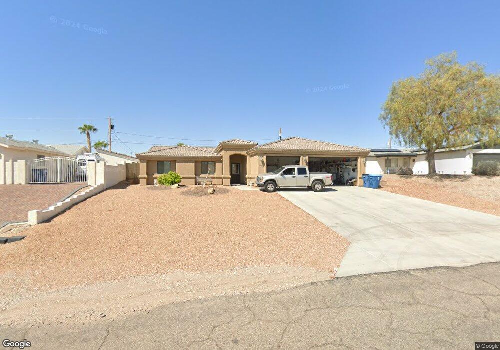
3515 Offshore Dr Lake Havasu City, AZ 86406
Estimated Value: $603,000 - $660,808
--
Bed
--
Bath
1,770
Sq Ft
$362/Sq Ft
Est. Value
About This Home
This home is located at 3515 Offshore Dr, Lake Havasu City, AZ 86406 and is currently estimated at $640,702, approximately $361 per square foot. 3515 Offshore Dr is a home located in Mohave County with nearby schools including Jamaica Elementary School, Thunderbolt Middle School, and Lake Havasu High School.
Ownership History
Date
Name
Owned For
Owner Type
Purchase Details
Closed on
Jul 30, 2020
Sold by
Murray Edward Leo and Murray Susan Dianne
Bought by
Murray Edward L and Murray Susan D
Current Estimated Value
Purchase Details
Closed on
Jul 23, 2014
Sold by
Behney Steve R
Bought by
Murray Edward Leo and Murray Susan Diane
Home Financials for this Owner
Home Financials are based on the most recent Mortgage that was taken out on this home.
Original Mortgage
$140,000
Outstanding Balance
$106,518
Interest Rate
4.13%
Mortgage Type
New Conventional
Estimated Equity
$534,184
Purchase Details
Closed on
Oct 16, 2013
Sold by
Kendrick Michael A and Kendrick Carol
Bought by
Behney Steve R
Purchase Details
Closed on
Nov 26, 2002
Sold by
Rucker Alan and Rucker Margarethe
Bought by
Kendrick Michael A and Kendrick Carol
Create a Home Valuation Report for This Property
The Home Valuation Report is an in-depth analysis detailing your home's value as well as a comparison with similar homes in the area
Home Values in the Area
Average Home Value in this Area
Purchase History
| Date | Buyer | Sale Price | Title Company |
|---|---|---|---|
| Murray Edward L | -- | None Available | |
| Murray Edward Leo | $240,000 | Stewart Title & Trust Of Pho | |
| Behney Steve R | $36,000 | Stewart Title & Trust Of Pho | |
| Kendrick Michael A | $32,000 | First American Title Ins Co |
Source: Public Records
Mortgage History
| Date | Status | Borrower | Loan Amount |
|---|---|---|---|
| Open | Murray Edward Leo | $140,000 |
Source: Public Records
Tax History Compared to Growth
Tax History
| Year | Tax Paid | Tax Assessment Tax Assessment Total Assessment is a certain percentage of the fair market value that is determined by local assessors to be the total taxable value of land and additions on the property. | Land | Improvement |
|---|---|---|---|---|
| 2026 | -- | -- | -- | -- |
| 2025 | $1,971 | $53,154 | $0 | $0 |
| 2024 | $1,971 | $56,138 | $0 | $0 |
| 2023 | $1,971 | $48,238 | $0 | $0 |
| 2022 | $1,898 | $35,594 | $0 | $0 |
| 2021 | $2,116 | $33,621 | $0 | $0 |
| 2019 | $2,009 | $29,780 | $0 | $0 |
| 2018 | $1,941 | $27,321 | $0 | $0 |
| 2017 | $1,907 | $26,047 | $0 | $0 |
| 2016 | $1,628 | $22,851 | $0 | $0 |
| 2015 | $1,585 | $20,211 | $0 | $0 |
Source: Public Records
Map
Nearby Homes
- 3500 Offshore Dr
- 3485 White Cap Dr
- 3475 Offshore Dr
- 3560 Offshore Ct
- 3431 Offshore Dr
- 3575 White Cap Dr
- 3580 Whitecap Dr
- 3515 Thunderhawk Dr
- 3415 Saratoga Ave
- 3515 Chemehuevi Blvd
- 3528 Bluegrass Dr
- 645 Mohican Dr
- 3393 Cinnamon Dr
- 3554 Chemehuevi Blvd
- 3330 Saddleback Dr
- 3385 Saratoga Ave
- 3449 Indian Peak Dr
- 3345 Cinnamon Dr
- 3329 Saddleback Dr
- 3489 Lasser Ln
- 3515 Offshore Dr
- 3513 Offshore Dr
- 3519 Offshore Dr
- 540 Whitecap Cir
- 3509 Offshore Dr
- 3521 Offshore Dr
- 3509 Offshore Dr
- 530 Whitecap Cir
- 550 Whitecap Cir
- 3501 Offshore Ct
- 3516 Offshore Dr
- 560 Whitecap Cir
- 3505 Offshore Dr
- 3520 Offshore Dr
- 3523 Offshore Dr
- 520 Whitecap Cir
- 3510 Offshore Dr
- 3505 Offshore Ct
- 3524 Whitecap Dr
- 3522 Offshore Dr