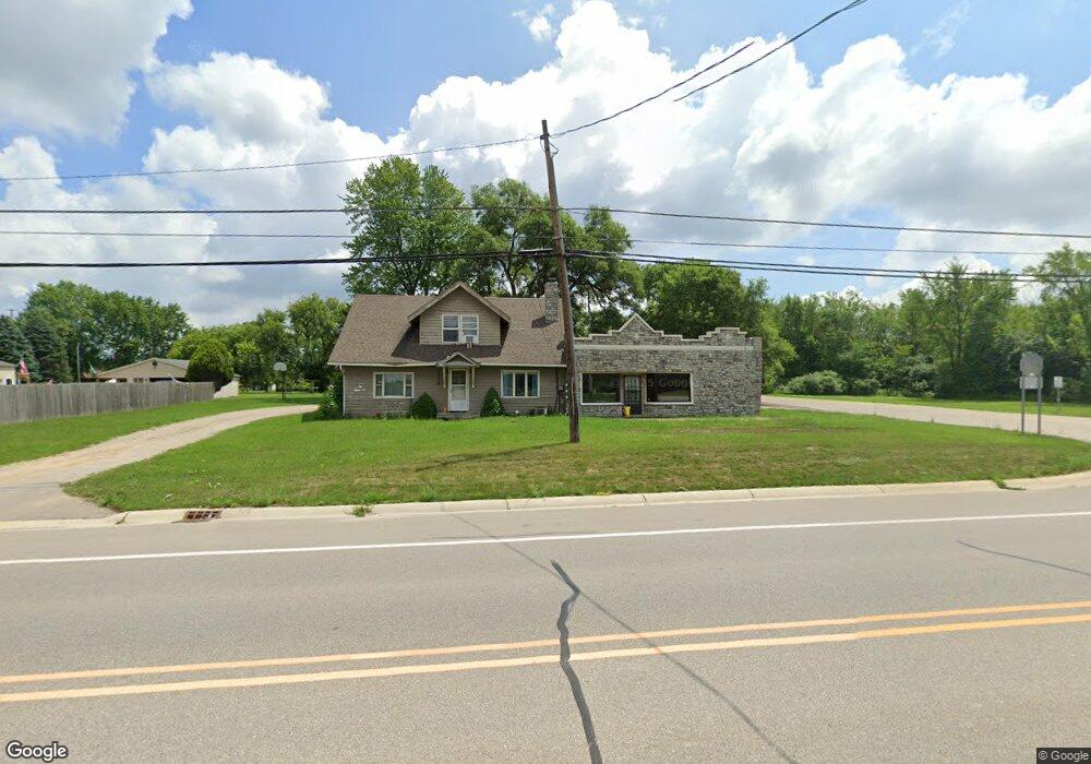
3515 S State Rd Davison, MI 48423
Estimated Value: $264,024 - $381,000
4
Beds
2
Baths
1,944
Sq Ft
$158/Sq Ft
Est. Value
About This Home
This home is located at 3515 S State Rd, Davison, MI 48423 and is currently estimated at $308,006, approximately $158 per square foot. 3515 S State Rd is a home located in Genesee County with nearby schools including Thomson Elementary School, Gates Elementary School, and Hill Elementary School.
Ownership History
Date
Name
Owned For
Owner Type
Purchase Details
Closed on
Nov 3, 2009
Sold by
Compass Bank
Bought by
3515 Llc
Current Estimated Value
Purchase Details
Closed on
Dec 22, 2008
Sold by
Mortgage Electronic Registration Systems
Bought by
Guaranty Bank Fsb
Purchase Details
Closed on
Sep 22, 2003
Sold by
C R I G Inc
Bought by
Marougi Thomas J and Marougi Tania M
Home Financials for this Owner
Home Financials are based on the most recent Mortgage that was taken out on this home.
Original Mortgage
$81,000
Interest Rate
6.52%
Mortgage Type
Purchase Money Mortgage
Purchase Details
Closed on
Apr 18, 2003
Sold by
Ragan June E and Carpp Larry D
Bought by
C R I G Inc
Purchase Details
Closed on
Aug 21, 2002
Sold by
Carpp Terry L
Bought by
Ragan June E
Create a Home Valuation Report for This Property
The Home Valuation Report is an in-depth analysis detailing your home's value as well as a comparison with similar homes in the area
Home Values in the Area
Average Home Value in this Area
Purchase History
| Date | Buyer | Sale Price | Title Company |
|---|---|---|---|
| 3515 Llc | $11,000 | Fidelity National Title | |
| Guaranty Bank Fsb | -- | E Title Agency | |
| Marougi Thomas J | -- | Centennial Title Co | |
| C R I G Inc | -- | Cislo Title Company | |
| Ragan June E | -- | -- |
Source: Public Records
Mortgage History
| Date | Status | Borrower | Loan Amount |
|---|---|---|---|
| Previous Owner | Marougi Thomas J | $81,000 |
Source: Public Records
Tax History
| Year | Tax Paid | Tax Assessment Tax Assessment Total Assessment is a certain percentage of the fair market value that is determined by local assessors to be the total taxable value of land and additions on the property. | Land | Improvement |
|---|---|---|---|---|
| 2025 | $4,109 | $108,600 | $0 | $0 |
| 2024 | $643 | $102,800 | $0 | $0 |
| 2023 | $613 | $102,600 | $0 | $0 |
| 2022 | $2,872 | $103,500 | $0 | $0 |
| 2021 | $2,855 | $94,400 | $0 | $0 |
| 2020 | $561 | $84,700 | $0 | $0 |
| 2019 | $552 | $81,700 | $0 | $0 |
| 2018 | $2,960 | $91,800 | $0 | $0 |
| 2017 | $2,861 | $91,800 | $0 | $0 |
| 2016 | $2,804 | $92,400 | $0 | $0 |
| 2015 | -- | $92,600 | $0 | $0 |
| 2014 | -- | $84,500 | $0 | $0 |
| 2012 | -- | $88,800 | $32,000 | $56,800 |
Source: Public Records
Map
Nearby Homes
- 9121 E Bristol Rd
- 0000 E Bristol Rd
- V/L Rivershyre Pkwy
- 9338 Orchard Valley Ln
- 9111 Copper Ridge Ct
- 10452 E Maple Ave
- 9505 E Atherton Rd
- 9519 Country Club Ln
- 10440 Golfview Ct
- 10460 Golfview Ct
- 2296 S State Rd
- 9247 Copper Ridge Dr Unit 2
- 10415 Golfview Ct
- 10425 Golfview Ct
- 10435 Golfview Ct
- 10451 Golfview Ct
- 9161 Copper Ridge Dr
- 9268 La Spezia Dr
- 2024 Montague Rd
- 10263 E Bristol Rd
- 3477 S State Rd
- 10275 E Bristol Rd
- 10275 E Bristol Rd
- 10275 E Bristol Rd
- 4010 S State Rd
- 10281 E Bristol Rd
- 10264 E Bristol Rd
- 10297 E Bristol Rd
- 3462 S State Rd
- 3453 S State Rd
- 10303 E Bristol Rd
- 3443 S State Rd
- 3483 S State Rd
- 3448 S State Rd
- 3433 S State Rd
- 4071 S State Rd
- 3432 S State Rd
- 4081 S State Rd
- 10139 E Bristol Rd
Your Personal Tour Guide
Ask me questions while you tour the home.