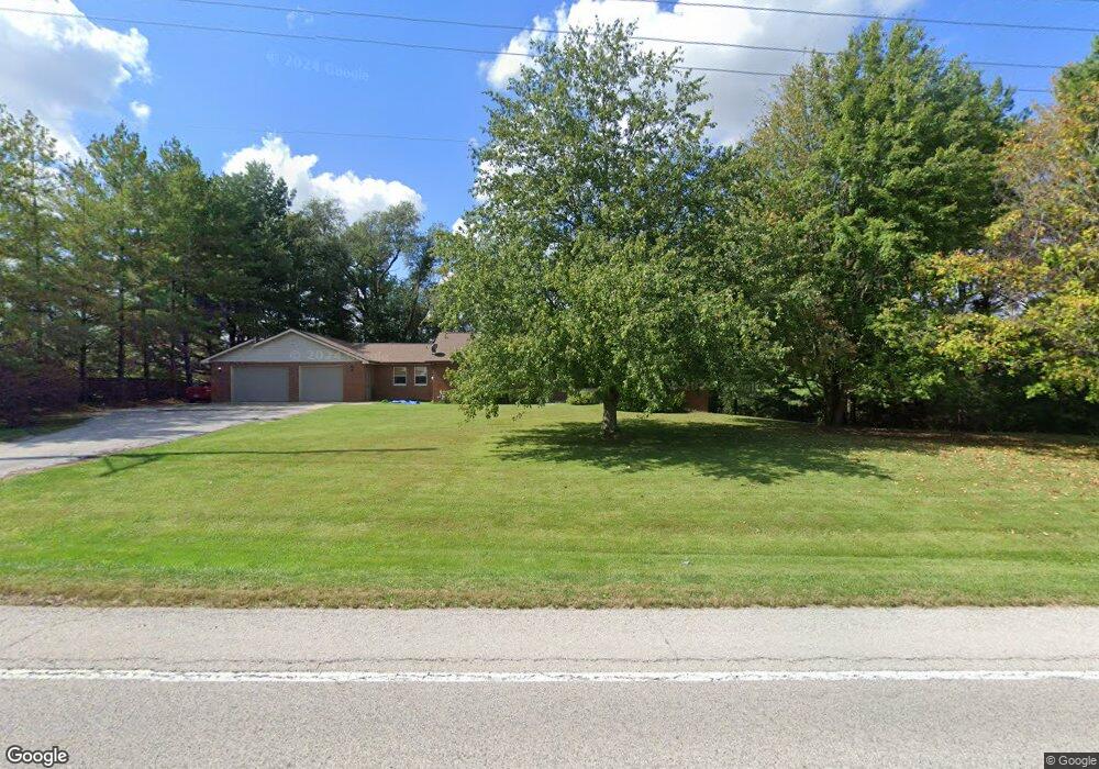
3515 State Route 159 Freeburg, IL 62243
Estimated Value: $306,000 - $363,000
Studio
--
Bath
1,784
Sq Ft
$191/Sq Ft
Est. Value
About This Home
This home is located at 3515 State Route 159, Freeburg, IL 62243 and is currently estimated at $340,425, approximately $190 per square foot. 3515 State Route 159 is a home located in St. Clair County with nearby schools including Freeburg Elementary School, Freeburg Community High School, and St John the Baptist Catholic School.
Ownership History
Date
Name
Owned For
Owner Type
Purchase Details
Closed on
Apr 12, 2002
Sold by
Lickenbrock Wayne J and Lickenbrook Tracy D
Bought by
Manning Brian and Cinotto Vicki
Current Estimated Value
Home Financials for this Owner
Home Financials are based on the most recent Mortgage that was taken out on this home.
Original Mortgage
$153,827
Outstanding Balance
$63,814
Interest Rate
6.82%
Mortgage Type
FHA
Estimated Equity
$276,611
Create a Home Valuation Report for This Property
The Home Valuation Report is an in-depth analysis detailing your home's value as well as a comparison with similar homes in the area
Home Values in the Area
Average Home Value in this Area
Purchase History
| Date | Buyer | Sale Price | Title Company |
|---|---|---|---|
| Manning Brian | $156,000 | First American Title |
Source: Public Records
Mortgage History
| Date | Status | Borrower | Loan Amount |
|---|---|---|---|
| Open | Manning Brian | $153,827 |
Source: Public Records
Tax History
| Year | Tax Paid | Tax Assessment Tax Assessment Total Assessment is a certain percentage of the fair market value that is determined by local assessors to be the total taxable value of land and additions on the property. | Land | Improvement |
|---|---|---|---|---|
| 2024 | $6,498 | $95,687 | $13,864 | $81,823 |
| 2023 | $6,165 | $88,937 | $12,886 | $76,051 |
| 2022 | $5,772 | $81,623 | $11,826 | $69,797 |
| 2021 | $5,500 | $76,858 | $11,136 | $65,722 |
| 2020 | $5,322 | $71,881 | $10,743 | $61,138 |
| 2019 | $5,143 | $71,881 | $10,743 | $61,138 |
| 2018 | $4,943 | $69,363 | $10,367 | $58,996 |
| 2017 | $4,589 | $66,149 | $9,887 | $56,262 |
| 2016 | $4,443 | $60,863 | $6,858 | $54,005 |
| 2014 | $3,821 | $59,893 | $6,749 | $53,144 |
| 2013 | $3,726 | $61,197 | $6,896 | $54,301 |
Source: Public Records
Map
Nearby Homes
- 3402 Arbor View Ct
- 753 Fieldview Dr
- 202 Sun Valley Dr
- 14 N High St
- 410 S Smith St
- 227 Suburban Place
- 416 Telluride Dr
- 222 Alamosa Dr
- 363 Sleeping Indian Dr
- 359 Sleeping Indian Dr
- 4507 Elk Meadows Ln
- 440 Foxtail Dr
- 420 Foxtail Dr
- 225 River Laurel Dr
- 4805 Lone Rock Ln
- 2049 Park Rd
- 225 Kenley Ct
- 2030 Woodsong Way Ln
- 1933 Celebration Park Cir
- 2058 Celebration Park Cir
- 3468 State Route 159
- 3522 State Route 159
- 5418 Illinois 159
- 3536 State Route 159
- 3554 State Route 159
- 3601 State Route 159
- 3609 State Route 159
- 3422 State Route 159
- 6034 Schiemeier Rd
- 6034 Schiermeier Rd
- 0 State Route 159 Unit 19037699
- 0 State Route 159 Unit 19010879
- 6100 Country School Ln
- 6106 Country School Ln
- 3667 State Route 159
- 5924 Schmidt Ln
- 3260 S Illinois St
- 3407 Robin Ln
- 3420 Robin Ln
Your Personal Tour Guide
Ask me questions while you tour the home.