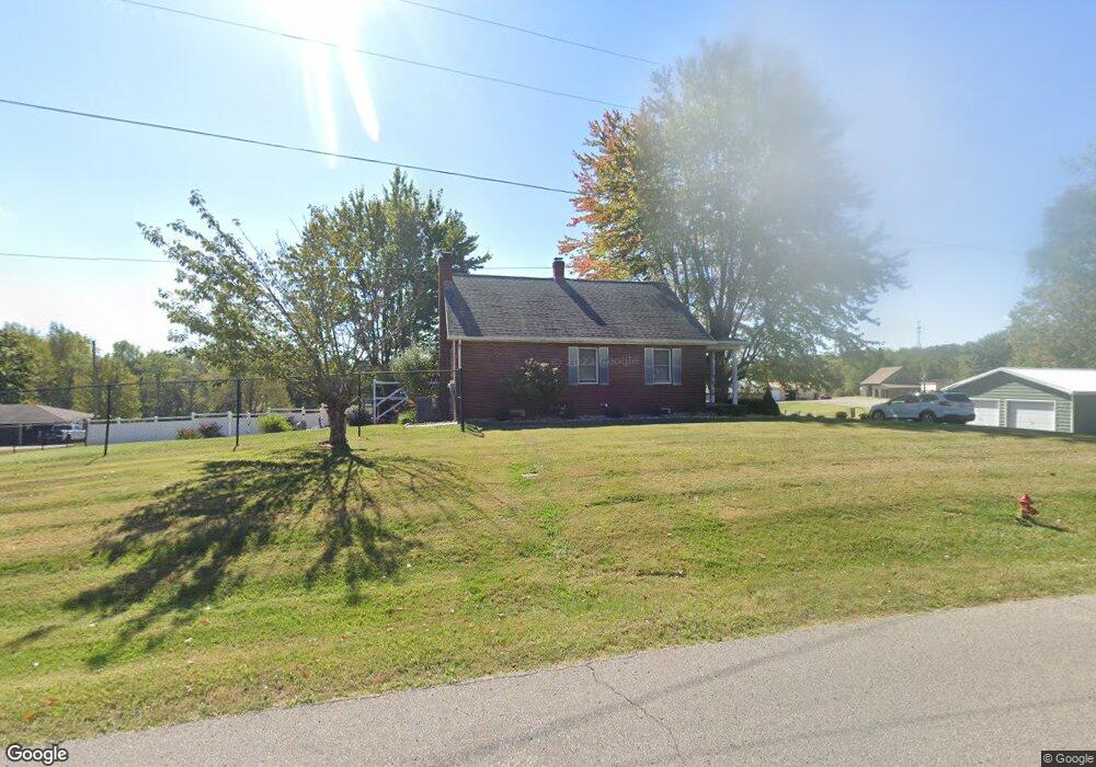
3515 Stone Rd Tell City, IN 47586
Estimated Value: $260,000 - $304,000
3
Beds
2
Baths
1,888
Sq Ft
$154/Sq Ft
Est. Value
About This Home
This home is located at 3515 Stone Rd, Tell City, IN 47586 and is currently estimated at $289,928, approximately $153 per square foot. 3515 Stone Rd is a home located in Perry County with nearby schools including William Tell Elementary School and Tell City Junior/Senior High School.
Ownership History
Date
Name
Owned For
Owner Type
Purchase Details
Closed on
Jan 23, 2021
Sold by
Braunecker Duane E
Bought by
Braunecker Duane E and Braunecker Kimberly L
Current Estimated Value
Home Financials for this Owner
Home Financials are based on the most recent Mortgage that was taken out on this home.
Original Mortgage
$130,000
Interest Rate
2.65%
Mortgage Type
New Conventional
Create a Home Valuation Report for This Property
The Home Valuation Report is an in-depth analysis detailing your home's value as well as a comparison with similar homes in the area
Home Values in the Area
Average Home Value in this Area
Purchase History
| Date | Buyer | Sale Price | Title Company |
|---|---|---|---|
| Braunecker Duane E | -- | None Available |
Source: Public Records
Mortgage History
| Date | Status | Borrower | Loan Amount |
|---|---|---|---|
| Closed | Braunecker Duane E | $130,000 |
Source: Public Records
Tax History Compared to Growth
Tax History
| Year | Tax Paid | Tax Assessment Tax Assessment Total Assessment is a certain percentage of the fair market value that is determined by local assessors to be the total taxable value of land and additions on the property. | Land | Improvement |
|---|---|---|---|---|
| 2024 | $1,735 | $198,600 | $33,900 | $164,700 |
| 2023 | $1,825 | $197,700 | $33,900 | $163,800 |
| 2022 | $1,451 | $161,000 | $27,500 | $133,500 |
| 2021 | $1,533 | $139,600 | $19,700 | $119,900 |
| 2020 | $1,404 | $133,600 | $19,700 | $113,900 |
| 2019 | $1,411 | $131,600 | $19,000 | $112,600 |
| 2018 | $723 | $96,200 | $19,000 | $77,200 |
| 2017 | $676 | $93,600 | $19,000 | $74,600 |
| 2016 | $710 | $93,600 | $19,000 | $74,600 |
| 2014 | $747 | $91,100 | $19,000 | $72,100 |
| 2013 | $747 | $89,500 | $19,000 | $70,500 |
Source: Public Records
Map
Nearby Homes
- 9485 Singleton Rd
- 9765 Stardust Rd
- Revolution Craftsman Plan at Forest Canton Heights
- Patriot Craftsman Plan at Forest Canton Heights
- National Craftsman Plan at Forest Canton Heights
- Cumberland Craftsman Plan at Forest Canton Heights
- Teton Craftsman Plan at Forest Canton Heights
- Summit Craftsman Plan at Forest Canton Heights
- 0 Brushy Fork Rd
- 9150 Doctor N A James Ave Unit 4
- 9040 Steward Rd
- 0 Starlite Rd
- 9225 Sunset Rd
- 8700 Brushy Fork Rd
- 1804 12th St
- 1634 13th St
- 1241 20th St
- 1341 17th St
- 1148 20th St
- 1104 34th St
- 9450 Singleton Rd
- 3519 Stone Rd
- 9445 Singleton Rd
- 9460 Singleton Rd
- 9450 Sherwood Rd
- 3549 Stone Rd
- 3544 Stone Rd
- 9490 Singleton Rd
- 3511 Stone Rd
- 3461 Stone Rd
- 9490 Sherwood Rd
- 3375 Stone Rd
- 9445 Sherwood Rd
- 3369 Stone Rd
- 3590 Stone Rd
- 3500 Summerfield Rd
- 9485 Sherwood Rd
- 3478 Summerfield Rd
- 3526 Summerfield Rd
- 3550 Summerfield Rd