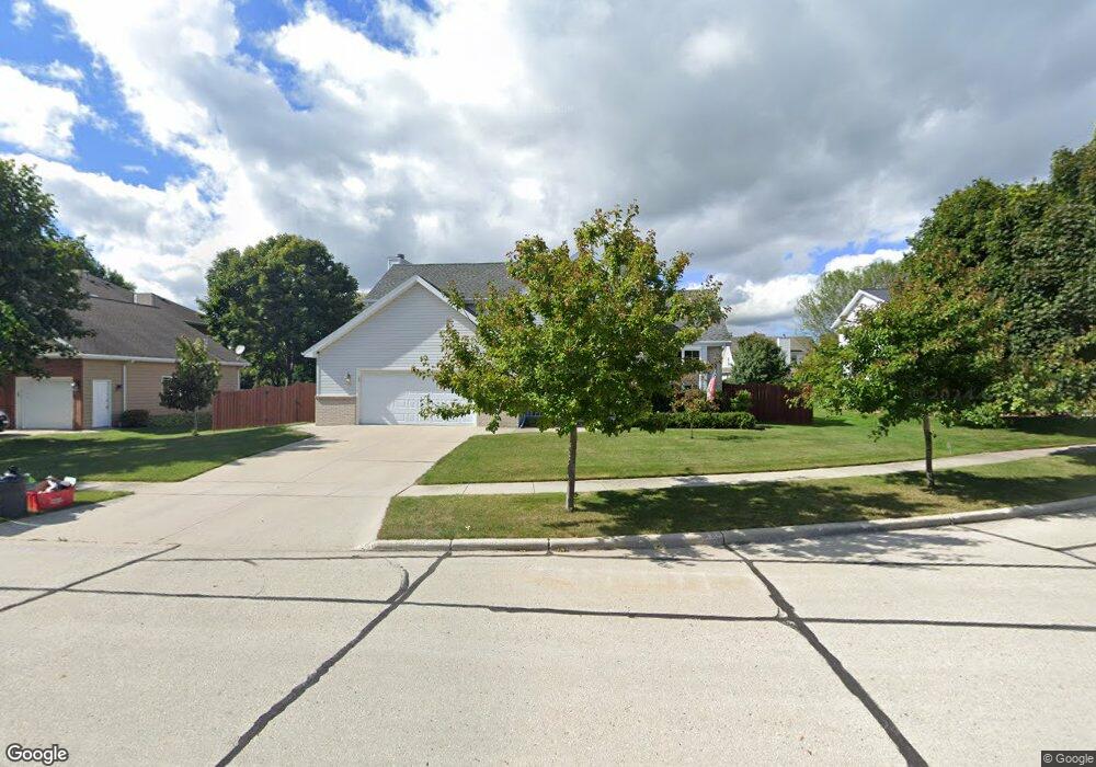
3516 Foxfire Ct Manitowoc, WI 54220
Estimated Value: $372,000 - $439,000
3
Beds
3
Baths
936
Sq Ft
$422/Sq Ft
Est. Value
About This Home
This home is located at 3516 Foxfire Ct, Manitowoc, WI 54220 and is currently estimated at $395,235, approximately $422 per square foot. 3516 Foxfire Ct is a home located in Manitowoc County with nearby schools including Jackson Elementary School, Wilson Middle School, and Lincoln High School.
Ownership History
Date
Name
Owned For
Owner Type
Purchase Details
Closed on
Sep 4, 2014
Sold by
Dedering Robert L and Dedering Mary Lou
Bought by
Weyer Robert G and Weyer Bren M
Current Estimated Value
Home Financials for this Owner
Home Financials are based on the most recent Mortgage that was taken out on this home.
Original Mortgage
$199,500
Outstanding Balance
$152,561
Interest Rate
4.11%
Mortgage Type
New Conventional
Estimated Equity
$242,674
Create a Home Valuation Report for This Property
The Home Valuation Report is an in-depth analysis detailing your home's value as well as a comparison with similar homes in the area
Home Values in the Area
Average Home Value in this Area
Purchase History
| Date | Buyer | Sale Price | Title Company |
|---|---|---|---|
| Weyer Robert G | $210,000 | -- |
Source: Public Records
Mortgage History
| Date | Status | Borrower | Loan Amount |
|---|---|---|---|
| Open | Weyer Robert G | $199,500 |
Source: Public Records
Tax History Compared to Growth
Tax History
| Year | Tax Paid | Tax Assessment Tax Assessment Total Assessment is a certain percentage of the fair market value that is determined by local assessors to be the total taxable value of land and additions on the property. | Land | Improvement |
|---|---|---|---|---|
| 2024 | $5,285 | $312,300 | $39,800 | $272,500 |
| 2023 | $4,874 | $312,300 | $39,800 | $272,500 |
| 2022 | $4,301 | $231,700 | $39,800 | $191,900 |
| 2021 | $4,334 | $231,700 | $39,800 | $191,900 |
| 2020 | $4,336 | $212,600 | $39,800 | $172,800 |
| 2019 | $4,285 | $212,600 | $39,800 | $172,800 |
| 2018 | $4,205 | $212,600 | $39,800 | $172,800 |
| 2017 | $4,137 | $212,600 | $39,800 | $172,800 |
| 2016 | $4,295 | $212,600 | $39,800 | $172,800 |
| 2015 | $4,410 | $212,600 | $39,800 | $172,800 |
| 2014 | $4,296 | $212,600 | $39,800 | $172,800 |
| 2013 | $4,345 | $212,600 | $39,800 | $172,800 |
Source: Public Records
Map
Nearby Homes
- 3718 Westwood Ln
- 3608 Menasha Ave
- 2122 Paul Rd
- 3912 Wildwood Dr
- Lt2 Virginia Dr
- Lt3 Virginia Dr
- Lt1 Virginia Dr
- Lt4 Virginia Dr
- 4207 Menasha Ave
- 1127 Tanglewood Rd
- 2205 Kellner St
- 1933 Kellner St
- 1008 N 23rd St
- 4326 Michigan Ave
- 4911 Elmer Ln
- 2415 N Rapids Rd
- 1936 Ravenswood Ln
- 1934 Ravenswood Ln
- 1928 Ravenswood Ln
- 1926 Ravenswood Ln
- 3511 Foxfire Ct
- 3510 Foxfire Ct
- 3507 Foxfire Ct
- 3520 Foxfire Ct
- 3519 Foxfire Ct
- 3504 Foxfire Ct
- 3503 Foxfire Ct
- 3410 Windwood Ct
- 3406 Windwood Ct
- 1607 Fleetwood Dr
- 3611 Deer Run Ct
- 3617 Deer Run Ct
- 1627 Fleetwood Dr
- 3302 Windwood Ct
- 3606 Deer Run Ct
- 3415 Windwood Ct
- 3311 Windwood Ct
- 3507 Menasha Ave
- 3319 Windwood Ct
- 3407 Windwood Ct