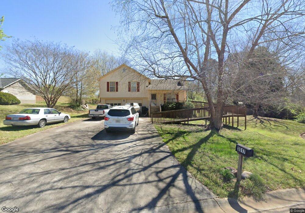
3517 Freeport Dr Flowery Branch, GA 30542
Estimated Value: $263,799 - $311,000
3
Beds
2
Baths
1,140
Sq Ft
$250/Sq Ft
Est. Value
About This Home
This home is located at 3517 Freeport Dr, Flowery Branch, GA 30542 and is currently estimated at $284,450, approximately $249 per square foot. 3517 Freeport Dr is a home located in Hall County with nearby schools including Chicopee Elementary School, South Hall Middle School, and Johnson High School.
Ownership History
Date
Name
Owned For
Owner Type
Purchase Details
Closed on
Jun 30, 2003
Sold by
Pinner Darrell L
Bought by
Pinner Darrell L and Pinner Vicki
Current Estimated Value
Purchase Details
Closed on
Apr 28, 1999
Sold by
Mccarthy Matthew M and Mccarthy Beth Mary
Bought by
Pinner Darrell L
Home Financials for this Owner
Home Financials are based on the most recent Mortgage that was taken out on this home.
Original Mortgage
$102,347
Interest Rate
7.06%
Mortgage Type
FHA
Purchase Details
Closed on
Jul 28, 1995
Sold by
Silverwood Prop Erties Inc
Bought by
Mccarthy Matthew W and Mccarthy Mary Beth
Purchase Details
Closed on
Jun 1, 1995
Purchase Details
Closed on
Mar 1, 1995
Create a Home Valuation Report for This Property
The Home Valuation Report is an in-depth analysis detailing your home's value as well as a comparison with similar homes in the area
Home Values in the Area
Average Home Value in this Area
Purchase History
| Date | Buyer | Sale Price | Title Company |
|---|---|---|---|
| Pinner Darrell L | -- | -- | |
| Pinner Darrell L | $102,400 | -- | |
| Mccarthy Matthew W | $80,900 | -- | |
| -- | $28,500 | -- | |
| -- | $33,000 | -- |
Source: Public Records
Mortgage History
| Date | Status | Borrower | Loan Amount |
|---|---|---|---|
| Previous Owner | Pinner Darrell L | $102,347 | |
| Closed | Mccarthy Matthew W | $0 |
Source: Public Records
Tax History Compared to Growth
Tax History
| Year | Tax Paid | Tax Assessment Tax Assessment Total Assessment is a certain percentage of the fair market value that is determined by local assessors to be the total taxable value of land and additions on the property. | Land | Improvement |
|---|---|---|---|---|
| 2024 | $785 | $84,960 | $7,720 | $77,240 |
| 2023 | $668 | $84,280 | $7,720 | $76,560 |
| 2022 | $695 | $68,480 | $7,720 | $60,760 |
| 2021 | $1,752 | $61,800 | $7,720 | $54,080 |
| 2020 | $1,729 | $59,160 | $7,720 | $51,440 |
| 2019 | $1,368 | $45,800 | $7,720 | $38,080 |
| 2018 | $1,236 | $39,280 | $7,720 | $31,560 |
| 2017 | $1,113 | $35,280 | $7,720 | $27,560 |
| 2016 | $1,089 | $35,240 | $7,720 | $27,520 |
| 2015 | $866 | $26,858 | $5,440 | $21,418 |
| 2014 | $866 | $26,858 | $5,440 | $21,418 |
Source: Public Records
Map
Nearby Homes
- 3478 Abbey Way
- 3617 Winder Hwy
- 3607 Wood Point Way
- 3969 Bolding Rd
- 3936 Overlook Ridge Ln
- 4008 Amberleigh Trace
- 5351 Fox Den Rd
- 5117 Fox Den Rd
- 5209 Fox Den Rd
- 4013 Amberleigh Trace
- 4044 Amberleigh Trace
- 4020 Parks Rd
- 4086 Parks Rd
- 3732 Acorn Dr
- 4287 Skyline View
- 3929 Perry Ln
- Wakehurst Plan at Falls Creek
- 3511 Freeport Dr
- 3610 Bolding Rd
- 3521 Freeport Dr
- 3507 Freeport Dr
- 3520 Freeport Dr
- 3622 Bolding Rd
- 3512 Freeport Dr
- 3516 Freeport Dr
- 3609 Bolding Rd
- 3503 Freeport Dr
- 3621 Bolding Rd
- 3706 Bolding Cir
- 3508 Freeport Dr
- 3625 Bolding Rd
- 3612 E Bolding Rd
- 3703 Bolding Rd
- 3504 Freeport Dr
- 3515 Bolding Rd
- 3509 Bolding Rd
- 3618 E Bolding Rd