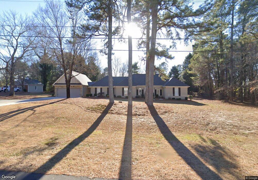
3517 Samantha Dr Unit 5 Buford, GA 30519
Estimated Value: $571,000 - $646,000
4
Beds
4
Baths
3,442
Sq Ft
$182/Sq Ft
Est. Value
About This Home
This home is located at 3517 Samantha Dr Unit 5, Buford, GA 30519 and is currently estimated at $625,345, approximately $181 per square foot. 3517 Samantha Dr Unit 5 is a home located in Gwinnett County with nearby schools including Ivy Creek Elementary School and Glenn C. Jones Middle School.
Ownership History
Date
Name
Owned For
Owner Type
Purchase Details
Closed on
Jul 26, 2016
Sold by
Turpin Eleanor
Bought by
Upshaw Samuel Todd and Upshaw Shelly D
Current Estimated Value
Home Financials for this Owner
Home Financials are based on the most recent Mortgage that was taken out on this home.
Original Mortgage
$220,500
Outstanding Balance
$175,933
Interest Rate
3.48%
Estimated Equity
$449,412
Purchase Details
Closed on
Jun 4, 1998
Sold by
Meincer John H and Meincer Sara E
Bought by
Turpin Ken and Turpin Eleanor
Home Financials for this Owner
Home Financials are based on the most recent Mortgage that was taken out on this home.
Original Mortgage
$140,000
Interest Rate
7.99%
Mortgage Type
New Conventional
Create a Home Valuation Report for This Property
The Home Valuation Report is an in-depth analysis detailing your home's value as well as a comparison with similar homes in the area
Home Values in the Area
Average Home Value in this Area
Purchase History
| Date | Buyer | Sale Price | Title Company |
|---|---|---|---|
| Upshaw Samuel Todd | $245,000 | -- | |
| Turpin Ken | $175,000 | -- |
Source: Public Records
Mortgage History
| Date | Status | Borrower | Loan Amount |
|---|---|---|---|
| Open | Upshaw Samuel Todd | $220,500 | |
| Previous Owner | Turpin Ken | $140,000 |
Source: Public Records
Tax History Compared to Growth
Tax History
| Year | Tax Paid | Tax Assessment Tax Assessment Total Assessment is a certain percentage of the fair market value that is determined by local assessors to be the total taxable value of land and additions on the property. | Land | Improvement |
|---|---|---|---|---|
| 2024 | $6,691 | $243,960 | $34,400 | $209,560 |
| 2023 | $6,691 | $187,520 | $34,400 | $153,120 |
| 2022 | $5,500 | $187,520 | $34,400 | $153,120 |
| 2021 | $4,482 | $135,080 | $26,680 | $108,400 |
| 2020 | $4,513 | $135,080 | $26,680 | $108,400 |
| 2019 | $4,346 | $149,840 | $26,680 | $123,160 |
| 2018 | $4,469 | $140,360 | $24,000 | $116,360 |
| 2016 | $1,179 | $80,520 | $14,640 | $65,880 |
| 2015 | $1,196 | $80,520 | $14,640 | $65,880 |
| 2014 | $1,207 | $71,640 | $14,640 | $57,000 |
Source: Public Records
Map
Nearby Homes
- 3487 Samantha Dr
- 3375 Woodward Ct
- 3105 Hamilton Mill Rd
- 3050 Ogden Trail
- 3123 Milloak Ct
- 3311 Lindenridge Dr
- 2988 Hamilton Mill Rd
- 3411 Lindenridge Dr
- 3134 Victoria Park Ln
- 3447 Haddon Hall Ct Unit 1
- 2995 Ivy Mill Dr
- 3408 Hamilton Mill Rd
- 4320 Easter Lily (Lot 13) Ave
- 3531 Haddon Hall Dr Unit I
- 2898 Hamilton Mill Rd
- 2264 Morgan Place Dr
- 3508 Cast Palm Dr
- 3238 Leyden Ct
- 2845 Sardis Dr
- 3517 Samantha Dr
- 3537 Samantha Dr
- 3497 Samantha Dr
- 3245 Hamilton Mill Rd
- 3235 Hamilton Mill Rd Unit 3235
- 3235 Hamilton Mill Rd
- 3235 Hamilton Mill Rd
- 3518 Samantha Dr
- 3538 Samantha Dr Unit 17
- 3538 Samantha Dr
- 3498 Samantha Dr
- 3255 Hamilton Mill Rd
- 3557 Samantha Dr
- 0 Hamilton Mill Rd NE Unit 8632113
- 0 Hamilton Mill Rd NE Unit 8180575
- 0 Hamilton Mill Rd NE Unit 8023029
- 0 Hamilton Mill Rd NE Unit 3275776
- 0 Hamilton Mill Rd NE Unit 3234722
- 0 Hamilton Mill Rd NE Unit 7038225
- 0 Hamilton Mill Rd NE Unit 7493211