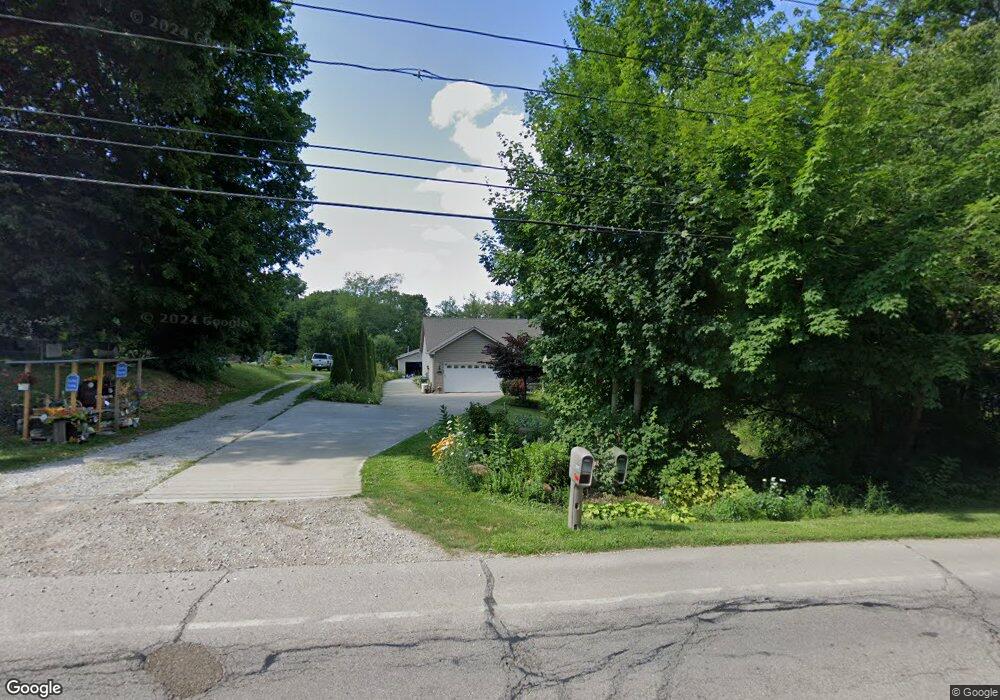
3517 Wadsworth Rd Norton, OH 44203
Estimated Value: $256,000 - $343,000
3
Beds
3
Baths
1,796
Sq Ft
$169/Sq Ft
Est. Value
About This Home
This home is located at 3517 Wadsworth Rd, Norton, OH 44203 and is currently estimated at $303,823, approximately $169 per square foot. 3517 Wadsworth Rd is a home located in Summit County with nearby schools including Norton Primary Elementary School, Norton Middle School, and Norton High School.
Ownership History
Date
Name
Owned For
Owner Type
Purchase Details
Closed on
May 10, 2012
Sold by
Nine Duff Ruth
Bought by
Nine Duff Ruth N and Duff Daryl G
Current Estimated Value
Home Financials for this Owner
Home Financials are based on the most recent Mortgage that was taken out on this home.
Original Mortgage
$176,000
Interest Rate
3.99%
Mortgage Type
Construction
Create a Home Valuation Report for This Property
The Home Valuation Report is an in-depth analysis detailing your home's value as well as a comparison with similar homes in the area
Home Values in the Area
Average Home Value in this Area
Purchase History
| Date | Buyer | Sale Price | Title Company |
|---|---|---|---|
| Nine Duff Ruth N | -- | Attorney |
Source: Public Records
Mortgage History
| Date | Status | Borrower | Loan Amount |
|---|---|---|---|
| Closed | Nine Duff Ruth N | $176,000 |
Source: Public Records
Tax History Compared to Growth
Tax History
| Year | Tax Paid | Tax Assessment Tax Assessment Total Assessment is a certain percentage of the fair market value that is determined by local assessors to be the total taxable value of land and additions on the property. | Land | Improvement |
|---|---|---|---|---|
| 2025 | $3,350 | $90,794 | $14,427 | $76,367 |
| 2024 | $3,350 | $90,794 | $14,427 | $76,367 |
| 2023 | $3,350 | $90,794 | $14,427 | $76,367 |
| 2022 | $4,006 | $80,273 | $11,827 | $68,446 |
| 2021 | $4,026 | $80,273 | $11,827 | $68,446 |
| 2020 | $3,760 | $80,280 | $11,830 | $68,450 |
| 2019 | $4,369 | $81,910 | $12,240 | $69,670 |
| 2018 | $4,296 | $81,910 | $12,240 | $69,670 |
| 2017 | $4,689 | $81,910 | $12,240 | $69,670 |
| 2016 | $4,689 | $81,910 | $12,240 | $69,670 |
| 2015 | $4,689 | $81,910 | $12,240 | $69,670 |
| 2014 | $4,661 | $82,270 | $12,240 | $70,030 |
| 2013 | $2,454 | $43,750 | $12,240 | $31,510 |
Source: Public Records
Map
Nearby Homes
- 3270 Glenbrook Dr
- 3303 Glenbrook Dr
- 3520 Shellhart Rd
- S/L 179 Belt Line Dr
- S/L 183 Belt Line Dr
- 3660 Golf Course Dr
- Grand Bahama Plan at Brookside Greens - Ranches
- Aruba Bay Plan at Brookside Greens - Ranches
- Eden Cay Plan at Brookside Greens - Ranches
- Grand Cayman Plan at Brookside Greens - Ranches
- 3733 Alumina Dr
- 3726 Alumina Dr
- 2817 Kay Blvd
- 3017 Greenridge Rd
- 2711 S Cleveland Massillon Rd
- 3012 Shellhart Rd
- 2982 Fair Oaks Dr
- 3738 Kirkham Dr
- 2910 S/L 17 Willow Way
- 3999 Stimson Rd
- 3523 Wadsworth Rd
- 3525 Akron-Wadsworth Rd
- 3525 Wadsworth Rd
- 3510 Wadsworth Rd
- 3500 Wadsworth Rd
- 3520 Wadsworth Rd
- 3483 Wadsworth Rd
- 3530 Wadsworth Rd
- 3488 Wadsworth Rd
- 3118 Orchard Hill Dr
- 3540 Wadsworth Rd
- 3559 Wadsworth Rd
- 3469 Wadsworth Rd
- 3550 Wadsworth Rd
- 3569 Wadsworth Rd
- 3475 Wadsworth Rd
- 3459 Wadsworth Rd
- 3464 Wadsworth Rd
- 3154 Orchard Hill Dr
- 3107 Orchard Hill Dr