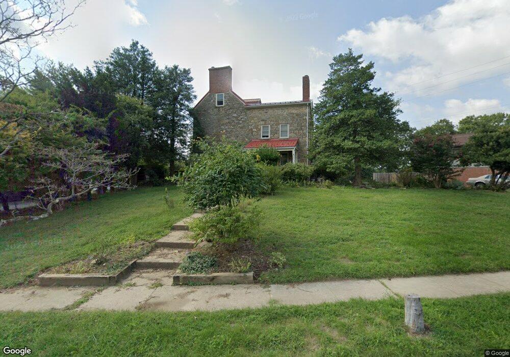
3519 Cabot Rd Randallstown, MD 21133
Estimated Value: $393,609 - $453,000
4
Beds
3
Baths
2,208
Sq Ft
$189/Sq Ft
Est. Value
About This Home
This home is located at 3519 Cabot Rd, Randallstown, MD 21133 and is currently estimated at $417,652, approximately $189 per square foot. 3519 Cabot Rd is a home located in Baltimore County with nearby schools including Hernwood Elementary School, Deer Park Middle Magnet School, and New Town High.
Ownership History
Date
Name
Owned For
Owner Type
Purchase Details
Closed on
Oct 31, 2011
Sold by
Cahill Lamont M
Bought by
Goluboff Ii Arnold
Current Estimated Value
Home Financials for this Owner
Home Financials are based on the most recent Mortgage that was taken out on this home.
Original Mortgage
$200,000
Outstanding Balance
$140,268
Interest Rate
4.62%
Mortgage Type
New Conventional
Estimated Equity
$277,384
Purchase Details
Closed on
Aug 2, 2011
Sold by
Cahill Elizabeth D
Bought by
Goluboff Ii Arnold and Goluboff Ann M
Home Financials for this Owner
Home Financials are based on the most recent Mortgage that was taken out on this home.
Original Mortgage
$200,000
Interest Rate
4.62%
Mortgage Type
New Conventional
Purchase Details
Closed on
Jan 14, 1993
Sold by
Stenley Thomas
Bought by
Cahill Lamont M
Purchase Details
Closed on
Oct 21, 1988
Sold by
Herrera Wilson
Bought by
Stenley Thomas
Create a Home Valuation Report for This Property
The Home Valuation Report is an in-depth analysis detailing your home's value as well as a comparison with similar homes in the area
Home Values in the Area
Average Home Value in this Area
Purchase History
| Date | Buyer | Sale Price | Title Company |
|---|---|---|---|
| Goluboff Ii Arnold | $250,000 | -- | |
| Goluboff Ii Arnold | $250,000 | Greenleaf Title | |
| Goluboff Ii Arnold | $250,000 | -- | |
| Cahill Lamont M | $143,000 | -- | |
| Stenley Thomas | $79,900 | -- |
Source: Public Records
Mortgage History
| Date | Status | Borrower | Loan Amount |
|---|---|---|---|
| Open | Goluboff Ii Arnold | $200,000 | |
| Previous Owner | Goluboff Ii Arnold | $200,000 |
Source: Public Records
Tax History
| Year | Tax Paid | Tax Assessment Tax Assessment Total Assessment is a certain percentage of the fair market value that is determined by local assessors to be the total taxable value of land and additions on the property. | Land | Improvement |
|---|---|---|---|---|
| 2025 | $4,086 | $275,800 | -- | -- |
| 2024 | $4,086 | $260,700 | $82,900 | $177,800 |
| 2023 | $2,052 | $258,133 | $0 | $0 |
| 2022 | $3,829 | $255,567 | $0 | $0 |
| 2021 | $3,502 | $253,000 | $82,900 | $170,100 |
| 2020 | $3,502 | $239,233 | $0 | $0 |
| 2019 | $3,408 | $225,467 | $0 | $0 |
| 2018 | $3,187 | $211,700 | $68,900 | $142,800 |
| 2017 | $3,214 | $211,700 | $0 | $0 |
| 2016 | $2,534 | $211,700 | $0 | $0 |
| 2015 | $2,534 | $215,500 | $0 | $0 |
| 2014 | $2,534 | $215,500 | $0 | $0 |
Source: Public Records
Map
Nearby Homes
- 9713 Mendoza Rd
- 9605 Mendoza Rd
- 10 Kiska Ct
- 10 Geier Ct
- 3516 Corn Stream Rd
- 9804 Marriottsville Rd
- 3558 Corn Stream Rd
- 3618 Granite Rd
- 3200 Peddicoat Ct
- 3715 Peace Chance Dr
- 9301 Silver Charm Dr
- 9401 Summer Squal Dr
- 3986 Red Deer Cir
- 9839 Branchleigh Rd
- 3 Dajobe Ct
- 3320 Offutt Rd
- 9208A Liberty Rd
- 10013 Village Green Dr
- 3332 Offutt Rd
- 4264 Cayuga Rd
- 3517 Cabot Rd
- 3521 Cabot Rd
- 9730 Mendoza Rd
- 9728 Mendoza Rd
- 3523 Cabot Rd
- 3515 Cabot Rd
- 3524 Cabot Rd
- 9726 Mendoza Rd
- 3526 Cabot Rd
- 3522 Cabot Rd
- 3528 Cabot Rd
- 9724 Mendoza Rd
- 3518 Cabot Rd
- 9800 Mendoza Rd
- 9722 Mendoza Rd
- 3530 Cabot Rd
- 9725 Mendoza Rd
- 9809 Plowline Rd
- 9727 Mendoza Rd
- 9729 Mendoza Rd
Your Personal Tour Guide
Ask me questions while you tour the home.