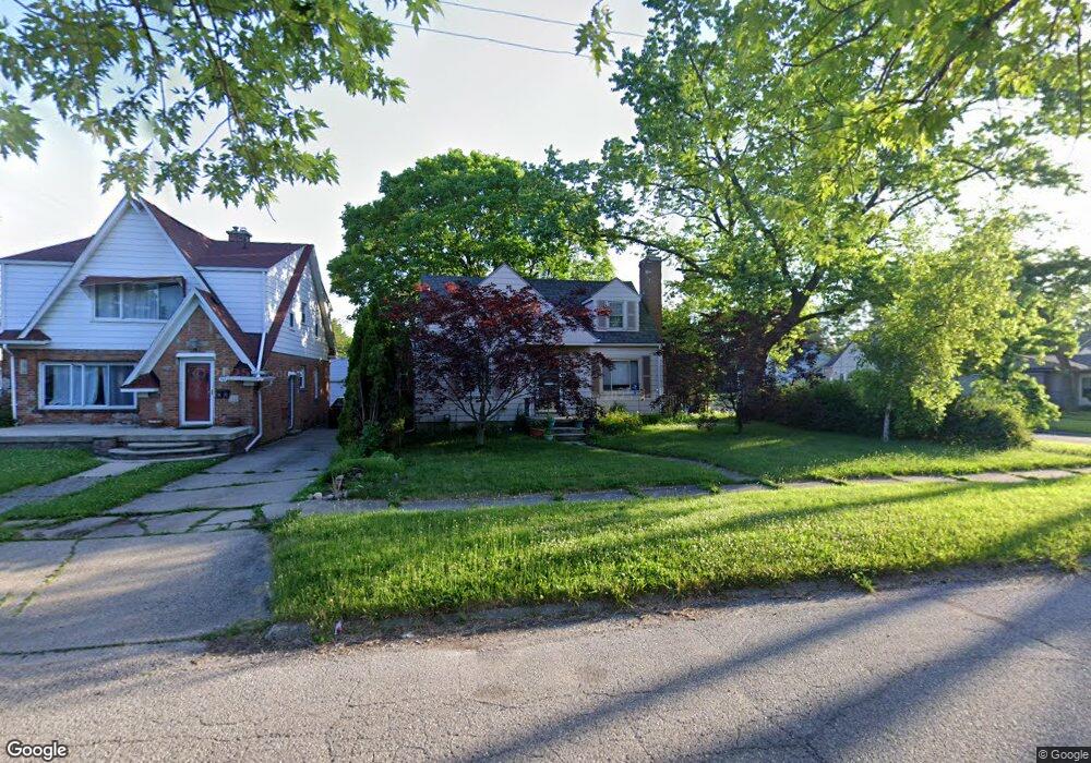
352 Commonwealth Ave Flint, MI 48503
College Cultural Neighborhood NeighborhoodEstimated Value: $89,099 - $127,000
3
Beds
1
Bath
1,071
Sq Ft
$100/Sq Ft
Est. Value
About This Home
This home is located at 352 Commonwealth Ave, Flint, MI 48503 and is currently estimated at $107,275, approximately $100 per square foot. 352 Commonwealth Ave is a home located in Genesee County with nearby schools including Pierce Elementary School, Flint Cultural Center Academy, and WAY Academy of Flint.
Ownership History
Date
Name
Owned For
Owner Type
Purchase Details
Closed on
Mar 17, 2003
Sold by
Cendant Mobility Financial Corp
Bought by
Shamel Lonnie
Current Estimated Value
Purchase Details
Closed on
Jan 10, 2003
Sold by
Malkin Michelle
Bought by
Cendant Mobility Financial Corp
Purchase Details
Closed on
Apr 26, 2001
Sold by
Kuhlmann Hans J
Bought by
Malkin Michelle
Home Financials for this Owner
Home Financials are based on the most recent Mortgage that was taken out on this home.
Original Mortgage
$87,850
Interest Rate
6.95%
Create a Home Valuation Report for This Property
The Home Valuation Report is an in-depth analysis detailing your home's value as well as a comparison with similar homes in the area
Home Values in the Area
Average Home Value in this Area
Purchase History
| Date | Buyer | Sale Price | Title Company |
|---|---|---|---|
| Shamel Lonnie | $105,000 | First American Title | |
| Cendant Mobility Financial Corp | $105,000 | First American Title | |
| Malkin Michelle | $92,500 | First American Title Ins Co |
Source: Public Records
Mortgage History
| Date | Status | Borrower | Loan Amount |
|---|---|---|---|
| Previous Owner | Malkin Michelle | $87,850 |
Source: Public Records
Tax History
| Year | Tax Paid | Tax Assessment Tax Assessment Total Assessment is a certain percentage of the fair market value that is determined by local assessors to be the total taxable value of land and additions on the property. | Land | Improvement |
|---|---|---|---|---|
| 2025 | $1,154 | $38,500 | $0 | $0 |
| 2024 | $1,039 | $32,900 | $0 | $0 |
| 2023 | $1,018 | $27,400 | $0 | $0 |
| 2022 | $0 | $22,500 | $0 | $0 |
| 2021 | $1,062 | $25,900 | $0 | $0 |
| 2020 | $952 | $19,200 | $0 | $0 |
| 2019 | $924 | $16,000 | $0 | $0 |
| 2018 | $936 | $16,600 | $0 | $0 |
| 2017 | $909 | $0 | $0 | $0 |
| 2016 | $903 | $0 | $0 | $0 |
| 2015 | -- | $0 | $0 | $0 |
| 2012 | -- | $18,200 | $0 | $0 |
Source: Public Records
Map
Nearby Homes
- 301 Chandler St
- 434 Chalmers St
- 605 S Lynch St
- 2605 Nebraska Ave
- 2119 Mountain Ave
- 2301 Missouri Ave
- 2013 E Court St
- 2415 Pennsylvania Ave
- 2610 Pennsylvania Ave
- 1318 Cronk Ave
- 2613 Pennsylvania Ave
- 1216 Minnesota Ave
- 1501 Arlington Ave
- 1622 Arlington Ave
- 2601 Illinois Ave
- 1114 W Vernon Dr
- 1609 Ohio Ave
- 1210 Blanchard Ave
- 1540 Illinois Ave
- 1510 S Franklin Ave
- 358 Commonwealth Ave
- 310 Chandler St
- 364 Commonwealth Ave
- 320 Commonwealth Ave
- 306 Chandler St
- 370 Commonwealth Ave
- 311 S Vernon Ave
- 305 Chandler St
- 351 Commonwealth Ave
- 359 Commonwealth Ave
- 314 Commonwealth Ave
- 302 Chandler St
- 307 S Vernon Ave
- 302 Chandler Ave
- 363 Commonwealth Ave
- 321 Commonwealth Ave
- 301 S Vernon Ave
- 401 S Vernon Ave
- 308 Commonwealth Ave
- 216 Chandler St
Your Personal Tour Guide
Ask me questions while you tour the home.