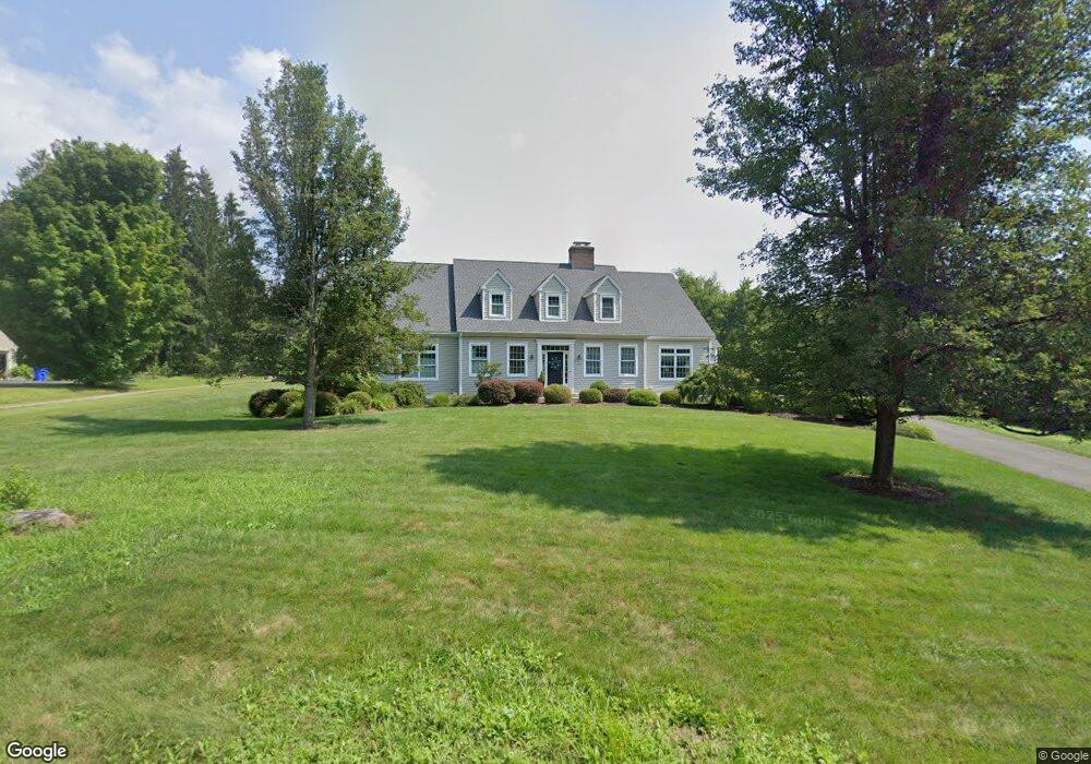
352 Firetown Rd Simsbury, CT 06070
Estimated Value: $532,000 - $823,000
2
Beds
4
Baths
3,153
Sq Ft
$224/Sq Ft
Est. Value
About This Home
This home is located at 352 Firetown Rd, Simsbury, CT 06070 and is currently estimated at $707,609, approximately $224 per square foot. 352 Firetown Rd is a home located in Hartford County with nearby schools including Squadron Line School, Henry James Memorial School, and Simsbury High School.
Ownership History
Date
Name
Owned For
Owner Type
Purchase Details
Closed on
Nov 16, 2001
Sold by
Girard Michael A
Bought by
Folk Charity P
Current Estimated Value
Home Financials for this Owner
Home Financials are based on the most recent Mortgage that was taken out on this home.
Original Mortgage
$150,000
Interest Rate
6.7%
Purchase Details
Closed on
May 31, 2001
Sold by
Simscraft Echo Farms
Bought by
Girard Michael A
Purchase Details
Closed on
Apr 9, 2001
Sold by
River Bend Assoc Inc
Bought by
Simscroft Echo Farms
Create a Home Valuation Report for This Property
The Home Valuation Report is an in-depth analysis detailing your home's value as well as a comparison with similar homes in the area
Home Values in the Area
Average Home Value in this Area
Purchase History
| Date | Buyer | Sale Price | Title Company |
|---|---|---|---|
| Folk Charity P | $44,200 | -- | |
| Girard Michael A | $88,400 | -- | |
| Simscroft Echo Farms | $87,500 | -- |
Source: Public Records
Mortgage History
| Date | Status | Borrower | Loan Amount |
|---|---|---|---|
| Open | Simscroft Echo Farms | $100,000 | |
| Closed | Simscroft Echo Farms | $100,000 | |
| Closed | Simscroft Echo Farms | $151,600 | |
| Closed | Simscroft Echo Farms | $150,000 |
Source: Public Records
Tax History
| Year | Tax Paid | Tax Assessment Tax Assessment Total Assessment is a certain percentage of the fair market value that is determined by local assessors to be the total taxable value of land and additions on the property. | Land | Improvement |
|---|---|---|---|---|
| 2025 | $15,519 | $454,300 | $63,070 | $391,230 |
| 2024 | $15,492 | $465,080 | $63,070 | $402,010 |
| 2023 | $12,273 | $385,700 | $63,070 | $322,630 |
| 2022 | $12,984 | $336,120 | $96,340 | $239,780 |
| 2021 | $12,984 | $336,120 | $96,340 | $239,780 |
| 2020 | $12,467 | $336,120 | $96,340 | $239,780 |
| 2019 | $12,544 | $336,120 | $96,340 | $239,780 |
| 2018 | $12,635 | $336,120 | $96,340 | $239,780 |
| 2017 | $12,518 | $322,950 | $93,870 | $229,080 |
| 2016 | $11,988 | $322,950 | $93,870 | $229,080 |
| 2015 | $11,988 | $322,950 | $93,870 | $229,080 |
| 2014 | $11,994 | $322,950 | $93,870 | $229,080 |
Source: Public Records
Map
Nearby Homes
- 36 Clifdon Dr
- 7 Grimes Brook Place
- 42 Holcomb St
- 324 Old Farms Rd
- 7 School House Ln
- 60 Barry Ln
- 90 Seminary Rd
- 9 Barry Ln
- 79 Cambridge Ct
- 28 Great Pond Rd
- 59 Cambridge Ct
- 12 The Glade
- 31 Oxford Ct
- 15 Winhart Dr
- 117 N Saddle Ridge
- 6 Heritage Ln
- 9 Carriage Dr Unit 9
- 40 Firetown Rd Unit 22
- 5 Shady Ln
- 42 Library Ln Unit 42
Your Personal Tour Guide
Ask me questions while you tour the home.