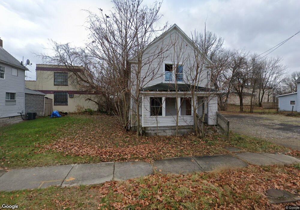
352 Howe St Akron, OH 44307
Sherbondy Hill NeighborhoodEstimated Value: $53,000 - $79,000
3
Beds
1
Bath
1,144
Sq Ft
$55/Sq Ft
Est. Value
About This Home
This home is located at 352 Howe St, Akron, OH 44307 and is currently estimated at $62,634, approximately $54 per square foot. 352 Howe St is a home located in Summit County with nearby schools including St. Bernard-St. Mary Elementary School.
Ownership History
Date
Name
Owned For
Owner Type
Purchase Details
Closed on
Dec 19, 2007
Sold by
Warren Jeffrey D and Warren Patricia S
Bought by
Summit Housing Llc
Current Estimated Value
Purchase Details
Closed on
Sep 10, 2007
Sold by
Kelley Properties Inc
Bought by
Warren Jeff and Warren Patricia
Home Financials for this Owner
Home Financials are based on the most recent Mortgage that was taken out on this home.
Original Mortgage
$69,300
Interest Rate
6.72%
Mortgage Type
Purchase Money Mortgage
Purchase Details
Closed on
Jan 26, 2007
Sold by
Federal Home Loan Mortgage Corporation
Bought by
Kelley Properties Inc
Purchase Details
Closed on
Nov 2, 2006
Sold by
Campbell Paul
Bought by
Federal Home Loan Mortgage Corporation
Create a Home Valuation Report for This Property
The Home Valuation Report is an in-depth analysis detailing your home's value as well as a comparison with similar homes in the area
Home Values in the Area
Average Home Value in this Area
Purchase History
| Date | Buyer | Sale Price | Title Company |
|---|---|---|---|
| Summit Housing Llc | -- | First Security Title Corp | |
| Warren Jeffrey D | -- | First Security Title Corp | |
| Warren Jeff | $77,000 | First Security Title Corp | |
| Kelley Properties Inc | -- | Attorney | |
| Federal Home Loan Mortgage Corporation | $22,000 | None Available |
Source: Public Records
Mortgage History
| Date | Status | Borrower | Loan Amount |
|---|---|---|---|
| Previous Owner | Warren Jeff | $69,300 |
Source: Public Records
Tax History Compared to Growth
Tax History
| Year | Tax Paid | Tax Assessment Tax Assessment Total Assessment is a certain percentage of the fair market value that is determined by local assessors to be the total taxable value of land and additions on the property. | Land | Improvement |
|---|---|---|---|---|
| 2025 | $12,631 | $7,900 | $2,093 | $5,807 |
| 2024 | $2,438 | $7,900 | $2,093 | $5,807 |
| 2023 | $12,631 | $7,900 | $2,093 | $5,807 |
| 2022 | $1,093 | $4,648 | $1,232 | $3,416 |
| 2021 | $2,074 | $4,648 | $1,232 | $3,416 |
| 2020 | $2,073 | $4,650 | $1,230 | $3,420 |
| 2019 | $1,544 | $4,920 | $1,690 | $3,230 |
| 2018 | $742 | $4,920 | $1,690 | $3,230 |
| 2017 | $421 | $4,920 | $1,690 | $3,230 |
| 2016 | $651 | $5,010 | $1,690 | $3,320 |
| 2015 | $421 | $5,010 | $1,690 | $3,320 |
| 2014 | $468 | $5,010 | $1,690 | $3,320 |
| 2013 | $1,943 | $5,570 | $1,690 | $3,880 |
Source: Public Records
Map
Nearby Homes
- 949 Raymond St
- 364 Campbell St
- 1063 Raymond St
- 834 Kenyon St
- 810 Amherst St
- 817 Raymond St
- 849 Amherst St
- 151 Russell Ave
- 963 Penn Ave
- 1001 Celina Ave
- 832 Yale St
- 829 Yale St
- 837 Yale St
- 677 Vernon Odom Blvd
- 849 Yale St
- 4 Manila Place
- 1132 Bristol Terrace
- 721 Vernon Odom Blvd
- 794 Ruth Ave
- 737 Vernon Odom Blvd