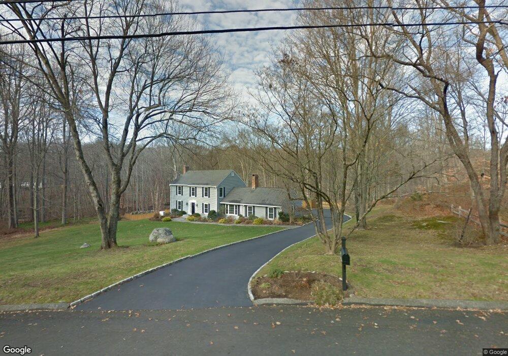
352 Jennie Ln Fairfield, CT 06824
Greenfield Hill NeighborhoodEstimated Value: $1,415,000 - $1,790,000
4
Beds
4
Baths
2,292
Sq Ft
$704/Sq Ft
Est. Value
About This Home
This home is located at 352 Jennie Ln, Fairfield, CT 06824 and is currently estimated at $1,614,625, approximately $704 per square foot. 352 Jennie Ln is a home located in Fairfield County with nearby schools including Dwight Elementary School, Roger Ludlowe Middle School, and Fairfield Ludlowe High School.
Ownership History
Date
Name
Owned For
Owner Type
Purchase Details
Closed on
Jul 31, 2006
Sold by
Wright Andrew and Barnett Liz
Bought by
Stroud Julian H and Stroud Christine H
Current Estimated Value
Purchase Details
Closed on
Aug 8, 2002
Sold by
Mcgaughy Larry S and Mcgaughy Nancy E
Bought by
Wright Andrew
Purchase Details
Closed on
Jul 17, 1990
Sold by
Barnard Jacqueline L
Bought by
Mcgaughy Larry S
Create a Home Valuation Report for This Property
The Home Valuation Report is an in-depth analysis detailing your home's value as well as a comparison with similar homes in the area
Home Values in the Area
Average Home Value in this Area
Purchase History
We collect this data history from publicly available records. To have your information removed, we recommend requesting removal directly through your county’s website.
| Date | Buyer | Sale Price | Title Company |
|---|---|---|---|
| Stroud Julian H | $1,050,000 | -- | |
| Stroud Julian H | $1,050,000 | -- | |
| Wright Andrew | $795,000 | -- | |
| Wright Andrew | $795,000 | -- | |
| Mcgaughy Larry S | $425,000 | -- |
Source: Public Records
Mortgage History
We collect this data history from publicly available records. To have your information removed, we recommend requesting removal directly through your county’s website.
| Date | Status | Borrower | Loan Amount |
|---|---|---|---|
| Closed | Mcgaughy Larry S | $219,000 | |
| Closed | Mcgaughy Larry S | $219,000 |
Source: Public Records
Tax History
| Year | Tax Paid | Tax Assessment Tax Assessment Total Assessment is a certain percentage of the fair market value that is determined by local assessors to be the total taxable value of land and additions on the property. | Land | Improvement |
|---|---|---|---|---|
| 2025 | $16,510 | $581,560 | $308,070 | $273,490 |
| 2024 | $16,226 | $581,560 | $308,070 | $273,490 |
| 2023 | $15,999 | $581,560 | $308,070 | $273,490 |
| 2022 | $15,842 | $581,560 | $308,070 | $273,490 |
| 2021 | $15,690 | $581,560 | $308,070 | $273,490 |
| 2020 | $16,861 | $629,370 | $347,200 | $282,170 |
| 2019 | $16,861 | $629,370 | $347,200 | $282,170 |
| 2018 | $16,590 | $629,370 | $347,200 | $282,170 |
| 2017 | $16,250 | $629,370 | $347,200 | $282,170 |
| 2016 | $16,017 | $629,370 | $347,200 | $282,170 |
| 2015 | $16,791 | $677,320 | $400,190 | $277,130 |
| 2014 | $16,527 | $677,320 | $400,190 | $277,130 |
Source: Public Records
Map
Nearby Homes
- 324 Jennie Ln
- 155 Labbance Ln
- 129 Quarter Horse Ln
- 2177 Cross Hwy
- 209 Merwins Ln
- 21 Daniel Ct
- 5 Baldwin Place
- 22 Dawn Dr
- 10 Mary Jane Ln
- 13 Highland Rd
- 80 Bayberry Ln
- 4 Baywood Ln
- 21 Sturges Commons
- 688 Hulls Farm Rd
- 35 Woody Ln
- 3050 Bronson Rd
- 21 Lockwood Cir
- 17 Vineyard Ln
- 10 Sprucewood Ln
- 19 Half Mile Common
- 375 Jennie Ln
- 495 Old Hickory Rd
- 110 Hollow Tree Cir
- 103 Hollow Tree Cir
- 10 Queens Grant Rd
- 222 Spring Hill Rd
- 168 Spring Hill Rd
- 240 Jennie Ln
- 102 Spring Hill Rd
- 183 Spring Hill Rd
- 280 Spring Hill Rd
- 70 Queens Grant Ln
- 120 Spring Hill Rd
- 425 Old Hickory Rd
- 255 Jennie Ln
- 106 Hollow Tree Cir
- 150 Jennie Ln
- 102 Queens Grant Rd
- 104 Queens Grant Ln
- 80 Spring Hill Rd
Your Personal Tour Guide
Ask me questions while you tour the home.