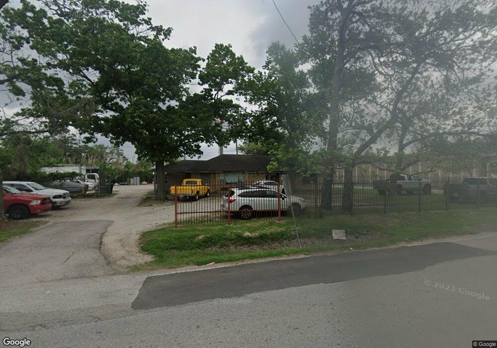
352 Link Rd Houston, TX 77009
Greater Heights NeighborhoodEstimated Value: $484,000 - $768,000
3
Beds
2
Baths
1,912
Sq Ft
$343/Sq Ft
Est. Value
About This Home
This home is located at 352 Link Rd, Houston, TX 77009 and is currently estimated at $656,598, approximately $343 per square foot. 352 Link Rd is a home located in Harris County with nearby schools including Jefferson Elementary School, Hamilton Middle, and Heights High School.
Ownership History
Date
Name
Owned For
Owner Type
Purchase Details
Closed on
Jun 10, 2015
Sold by
Massimin Thomas
Bought by
Fami Kenneth D and Fami Tisha Kay Browning Jr
Current Estimated Value
Purchase Details
Closed on
Apr 24, 2007
Sold by
Ali Mohammad and Ali Mohammed
Bought by
Massimin Thomas B
Home Financials for this Owner
Home Financials are based on the most recent Mortgage that was taken out on this home.
Original Mortgage
$152,000
Outstanding Balance
$91,802
Interest Rate
6.13%
Mortgage Type
Purchase Money Mortgage
Estimated Equity
$564,796
Create a Home Valuation Report for This Property
The Home Valuation Report is an in-depth analysis detailing your home's value as well as a comparison with similar homes in the area
Home Values in the Area
Average Home Value in this Area
Purchase History
| Date | Buyer | Sale Price | Title Company |
|---|---|---|---|
| Fami Kenneth D | -- | None Available | |
| Massimin Thomas B | -- | American Title Co |
Source: Public Records
Mortgage History
| Date | Status | Borrower | Loan Amount |
|---|---|---|---|
| Open | Massimin Thomas B | $152,000 |
Source: Public Records
Tax History Compared to Growth
Tax History
| Year | Tax Paid | Tax Assessment Tax Assessment Total Assessment is a certain percentage of the fair market value that is determined by local assessors to be the total taxable value of land and additions on the property. | Land | Improvement |
|---|---|---|---|---|
| 2025 | $14,191 | $996,162 | $778,826 | $217,336 |
| 2024 | $14,191 | $647,283 | $432,681 | $214,602 |
| 2023 | $14,191 | $644,651 | $432,681 | $211,970 |
| 2022 | $13,491 | $579,948 | $432,681 | $147,267 |
| 2021 | $13,282 | $569,899 | $432,681 | $137,218 |
| 2020 | $13,586 | $561,019 | $432,681 | $128,338 |
| 2019 | $14,002 | $553,341 | $432,681 | $120,660 |
| 2018 | $13,980 | $552,478 | $432,681 | $119,797 |
| 2017 | $12,277 | $550,083 | $432,681 | $117,402 |
| 2016 | $7,239 | $337,083 | $271,681 | $65,402 |
| 2015 | $6,440 | $300,055 | $233,445 | $66,610 |
| 2014 | $6,440 | $241,128 | $175,084 | $66,044 |
Source: Public Records
Map
Nearby Homes
- 5511 Enid St
- 408 Robert Lee Rd
- 1511 Cordell St
- 408 Eichwurzel Ln Unit A
- 1638 Tabor St
- 1606 Walton St
- 1510 Walton St
- 1630 1/2 Tabor St
- 5715 Enid St
- 1737 Tabor St
- 1408 Enid St
- 213 Sylvester Rd
- 1609 Tabor St
- 1818 & 1820 Lula St
- 1833 Tabor St
- 1626 Enid St
- 119 Sylvester Rd
- 0000 W Cavalcade St
- 5510 Fulton St
- 1611 Sylvester Rd
- 351 Link Rd
- 405 Robert Lee Rd Unit LEE
- 409 Robert Lee Rd
- 5506 Enid St
- 411 Robert Lee Rd
- 405 Robert e Lee Rd
- 5508 Enid St
- 5505 Enid St
- 407 Robert Lee Rd
- 307 Robert Lee Rd
- 5507 Enid St
- 5311 Angelo St
- 5319 Angelo St
- 5307 Angelo St
- 5323 Angelo St
- 5303 Angelo St
- 5327 Angelo St
- 3131 North Fwy Unit 31
- 5401 Angelo St
- 408 and 408-1/2 Robert Lee