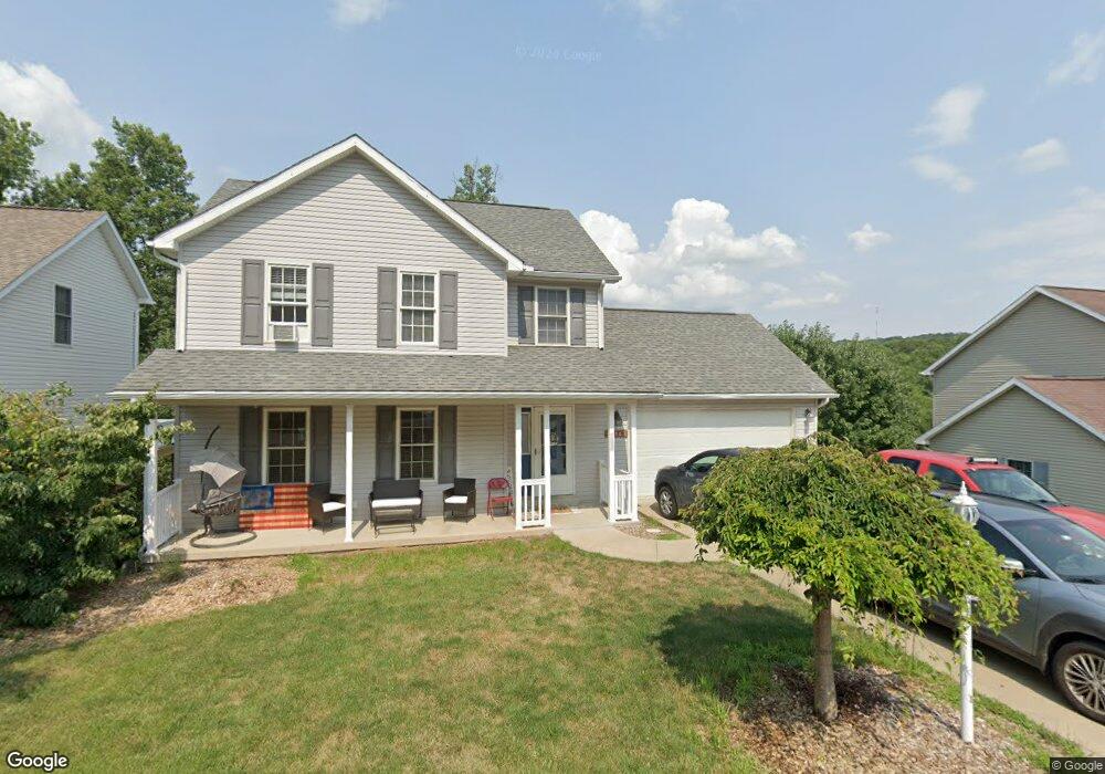
352 March Ln Morgantown, WV 26508
Estimated Value: $316,000 - $342,000
3
Beds
2
Baths
1,480
Sq Ft
$220/Sq Ft
Est. Value
About This Home
This home is located at 352 March Ln, Morgantown, WV 26508 and is currently estimated at $325,762, approximately $220 per square foot. 352 March Ln is a home located in Monongalia County with nearby schools including Cheat Lake Elementary School, Mountaineer Middle School, and University High School.
Ownership History
Date
Name
Owned For
Owner Type
Purchase Details
Closed on
Feb 21, 2020
Sold by
Moodispaw Forrest H and Moodispaw Lydia M
Bought by
Smith Steven Durwood
Current Estimated Value
Home Financials for this Owner
Home Financials are based on the most recent Mortgage that was taken out on this home.
Original Mortgage
$216,000
Outstanding Balance
$191,253
Interest Rate
3.6%
Mortgage Type
New Conventional
Estimated Equity
$134,509
Purchase Details
Closed on
Aug 17, 2007
Sold by
Brown Larry Nelson and Brown Deborah L
Bought by
Moodispaw Forrest H and Moodispaw Lydia M
Home Financials for this Owner
Home Financials are based on the most recent Mortgage that was taken out on this home.
Original Mortgage
$185,000
Interest Rate
6.67%
Mortgage Type
New Conventional
Create a Home Valuation Report for This Property
The Home Valuation Report is an in-depth analysis detailing your home's value as well as a comparison with similar homes in the area
Home Values in the Area
Average Home Value in this Area
Purchase History
| Date | Buyer | Sale Price | Title Company |
|---|---|---|---|
| Smith Steven Durwood | $240,000 | None Available | |
| Moodispaw Forrest H | $186,000 | None Available |
Source: Public Records
Mortgage History
| Date | Status | Borrower | Loan Amount |
|---|---|---|---|
| Open | Smith Steven Durwood | $216,000 | |
| Previous Owner | Moodispaw Forrest H | $185,000 |
Source: Public Records
Tax History Compared to Growth
Tax History
| Year | Tax Paid | Tax Assessment Tax Assessment Total Assessment is a certain percentage of the fair market value that is determined by local assessors to be the total taxable value of land and additions on the property. | Land | Improvement |
|---|---|---|---|---|
| 2024 | $1,402 | $131,220 | $37,440 | $93,780 |
| 2023 | $1,398 | $131,220 | $37,440 | $93,780 |
| 2022 | $1,328 | $129,540 | $37,440 | $92,100 |
| 2021 | $1,334 | $129,540 | $37,440 | $92,100 |
| 2020 | $1,229 | $118,800 | $26,700 | $92,100 |
| 2019 | $1,238 | $118,800 | $26,700 | $92,100 |
| 2018 | $1,242 | $118,800 | $26,700 | $92,100 |
| 2017 | $1,210 | $115,200 | $25,200 | $90,000 |
| 2016 | $1,195 | $113,040 | $23,040 | $90,000 |
| 2015 | $1,124 | $111,180 | $21,180 | $90,000 |
| 2014 | $1,051 | $109,020 | $19,380 | $89,640 |
Source: Public Records
Map
Nearby Homes
- 317 March Ln
- 315 March Ln
- 102 June Ln
- 70 Pounds Hollow Rd
- 436 December Ln
- 52 Riffle Ridge Dr
- TBD Pounds Hollow Rd
- 205 Marble Dr
- 213 Greenview Dr
- 0 S Pierpont Rd
- 13 Pierpont Fields Village Unit v
- 106 Tivoli Garden Dr
- 104 Tivoli Garden Dr
- 1300 Deer Run
- 62 Pinnacle Ln
- 305 Anini Dr
- TBD Harner Run Rd
- 107 Nelson Dr
- 313 Salonika Dr
- 108 Legacy Dr