Estimated Value: $435,207 - $516,000
2
Beds
2
Baths
2,246
Sq Ft
$219/Sq Ft
Est. Value
About This Home
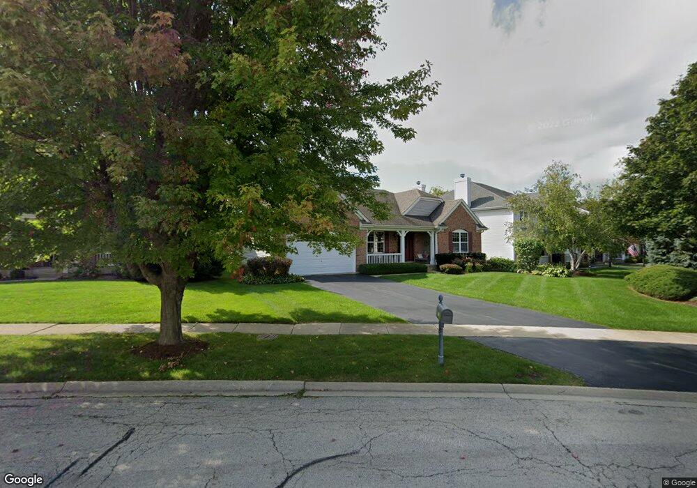
This home is located at 352 Merion Dr Unit 2, Cary, IL 60013 and is currently estimated at $492,802, approximately $219 per square foot. 352 Merion Dr Unit 2 is a home located in McHenry County with nearby schools including Deer Path Elementary School, Cary Jr High School, and Cary-Grove High School.
Ownership History
Date
Name
Owned For
Owner Type
Purchase Details
Closed on
Nov 10, 2009
Sold by
Kraft Mary K and Kraft David G
Bought by
Kraft David G and Kraft Mary K
Current Estimated Value
Purchase Details
Closed on
Oct 15, 2003
Sold by
Pinnacle Corp
Bought by
Kraft David G and Kraft Mary K
Home Financials for this Owner
Home Financials are based on the most recent Mortgage that was taken out on this home.
Original Mortgage
$298,507
Outstanding Balance
$141,971
Interest Rate
6.49%
Mortgage Type
Purchase Money Mortgage
Estimated Equity
$350,832
Create a Home Valuation Report for This Property
The Home Valuation Report is an in-depth analysis detailing your home's value as well as a comparison with similar homes in the area
Home Values in the Area
Average Home Value in this Area
Purchase History
We collect this data history from publicly available records. To have your information removed, we recommend requesting removal directly through your county’s website.
| Date | Buyer | Sale Price | Title Company |
|---|---|---|---|
| Kraft David G | -- | None Available | |
| Kraft David G | $373,134 | Chicago Title Insurance Co |
Source: Public Records
Mortgage History
We collect this data history from publicly available records. To have your information removed, we recommend requesting removal directly through your county’s website.
| Date | Status | Borrower | Loan Amount |
|---|---|---|---|
| Open | Kraft David G | $298,507 |
Source: Public Records
Tax History
| Year | Tax Paid | Tax Assessment Tax Assessment Total Assessment is a certain percentage of the fair market value that is determined by local assessors to be the total taxable value of land and additions on the property. | Land | Improvement |
|---|---|---|---|---|
| 2024 | $10,796 | $120,451 | $27,454 | $92,997 |
| 2023 | $10,697 | $107,728 | $24,554 | $83,174 |
| 2022 | $11,063 | $104,881 | $24,660 | $80,221 |
| 2021 | $10,571 | $97,709 | $22,974 | $74,735 |
| 2020 | $11,393 | $106,552 | $41,328 | $65,224 |
| 2019 | $11,115 | $101,983 | $39,556 | $62,427 |
| 2018 | $10,569 | $94,210 | $36,541 | $57,669 |
| 2017 | $10,358 | $88,752 | $34,424 | $54,328 |
| 2016 | $10,293 | $83,242 | $32,287 | $50,955 |
| 2013 | -- | $69,972 | $30,119 | $39,853 |
Source: Public Records
Map
Nearby Homes
- Lot 10 Grove Ln
- Lot 11 Grove Ln
- 1405 Elk Trail
- LOT 02 Three Oaks Rd
- 110 Courtney Ln
- 842 Pin Oak Cir
- 680 Spruce Tree Dr
- 321 Bryan Dr
- 6705 Pheasant Trail
- 260 Hillhurst Dr Unit 2
- 931 S Rawson Bridge Rd
- 106 Sherwood Dr
- 6305 Robert Rd
- 102 Bright Oaks Cir
- 0000 Newbold Rd
- 309 Three Oaks Rd
- 349 Park Ave
- 20 Red Oak Trail
- 64 Bright Oaks Cir Unit 1
- 32 Bright Oaks Cir Unit 1
- 338 Foxford Dr
- 354 Merion Dr Unit 2
- 336 Foxford Dr Unit 1
- 356 Merion Dr
- 353 Merion Dr Unit 2
- 321 Foxford Dr
- 334 Foxford Dr
- 358 Merion Dr Unit 2
- 323 Foxford Dr
- 319 Foxford Dr
- 355 Merion Dr Unit 2
- 332 Foxford Dr Unit 1
- 317 Foxford Dr Unit 1
- 325 Foxford Dr
- 360 Merion Dr
- 340 Foxford Dr Unit 1
- 357 Merion Dr
- 317 Inverness Dr Unit 1
- 315 Foxford Dr
- 330 Foxford Dr
Your Personal Tour Guide
Ask me questions while you tour the home.