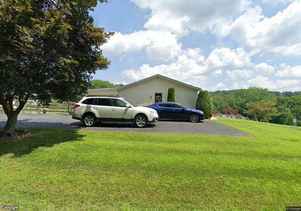
352 Miller Rd Delta, PA 17314
Susquehanna Trails NeighborhoodEstimated Value: $193,000 - $275,000
2
Beds
1
Bath
1,232
Sq Ft
$195/Sq Ft
Est. Value
About This Home
This home is located at 352 Miller Rd, Delta, PA 17314 and is currently estimated at $240,503, approximately $195 per square foot. 352 Miller Rd is a home located in York County with nearby schools including South Eastern Intermediate School, South Eastern Middle School, and Kennard-Dale High School.
Ownership History
Date
Name
Owned For
Owner Type
Purchase Details
Closed on
Mar 26, 2003
Sold by
Jenkins Scott E and Mccarney Cynthia M
Bought by
Jenkins Scott E and Jenkins Cynthia M
Current Estimated Value
Home Financials for this Owner
Home Financials are based on the most recent Mortgage that was taken out on this home.
Original Mortgage
$128,200
Interest Rate
5.53%
Mortgage Type
Purchase Money Mortgage
Purchase Details
Closed on
Nov 13, 2001
Sold by
Jenkins Scott E and Jenkins Cynthia M
Bought by
Jenkins Scott E and Jenkins Cynthia M
Create a Home Valuation Report for This Property
The Home Valuation Report is an in-depth analysis detailing your home's value as well as a comparison with similar homes in the area
Home Values in the Area
Average Home Value in this Area
Purchase History
| Date | Buyer | Sale Price | Title Company |
|---|---|---|---|
| Jenkins Scott E | -- | -- | |
| Jenkins Scott E | -- | -- |
Source: Public Records
Mortgage History
| Date | Status | Borrower | Loan Amount |
|---|---|---|---|
| Closed | Jenkins Scott E | $128,200 |
Source: Public Records
Tax History Compared to Growth
Tax History
| Year | Tax Paid | Tax Assessment Tax Assessment Total Assessment is a certain percentage of the fair market value that is determined by local assessors to be the total taxable value of land and additions on the property. | Land | Improvement |
|---|---|---|---|---|
| 2025 | $3,781 | $125,520 | $33,710 | $91,810 |
| 2024 | $3,781 | $125,520 | $33,710 | $91,810 |
| 2023 | $3,781 | $125,520 | $33,710 | $91,810 |
| 2022 | $3,781 | $125,520 | $33,710 | $91,810 |
| 2021 | $3,655 | $125,520 | $33,710 | $91,810 |
| 2020 | $3,592 | $125,520 | $33,710 | $91,810 |
| 2019 | $3,580 | $125,520 | $33,710 | $91,810 |
| 2018 | $3,580 | $125,520 | $33,710 | $91,810 |
| 2017 | $3,580 | $125,520 | $33,710 | $91,810 |
| 2016 | $0 | $125,520 | $33,710 | $91,810 |
| 2015 | -- | $125,520 | $33,710 | $91,810 |
| 2014 | -- | $125,520 | $33,710 | $91,810 |
Source: Public Records
Map
Nearby Homes
- Parcel 859 Neill Run Rd
- 46 Corn Tassel Rd
- 216 Meadow Trail
- 267 Cook Rd
- 194 Cook Rd
- 76 Laurel Dr
- 8290 Woodbine Rd
- 45 Wenzel Rd
- 0 Dogwood Rd
- 53 Dogwood Rd
- 63 Cherry Rd
- 0 Valley Ln
- 0 Highview Dr
- 556 Bair Rd
- Lot C Bryansville Rd
- Lot 4 Ridge Rd
- 55 Highfield Rd
- 115 Highfield Rd
- 387 Garvine Mill Rd
- 2913 Whiteford Rd
- Lot B043 Miller Rd
- 15 Cardinal Trail
- 1 Burns Rd
- 5 Burns Rd
- 4 Bluebird Trail
- 28 Cardinal Trail
- 349 Miller Rd
- 6 Bluebird Trail
- 16 Bluebird Trail
- 37 Cardinal Trail
- 297 Miller Rd
- 26 Bluebird Trail
- 47 Cardinal Trail
- 0 Bluebird Trail
- 38 Bluebird Trail
- 7 Bluebird Trail
- 55 Cardinal Trail
- 48 Bluebird Trail
- 58 Bluebird Trail
- 43 Bluebird Trail