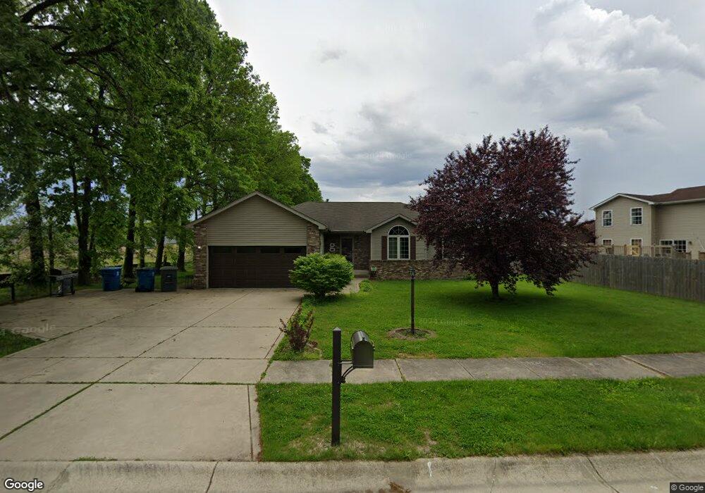
352 S Boo Rd Chesterton, IN 46304
Estimated Value: $341,000 - $396,000
4
Beds
3
Baths
1,524
Sq Ft
$246/Sq Ft
Est. Value
About This Home
This home is located at 352 S Boo Rd, Chesterton, IN 46304 and is currently estimated at $375,138, approximately $246 per square foot. 352 S Boo Rd is a home located in Porter County with nearby schools including Newton Yost Elementary School, Westchester Intermediate School, and Chesterton Middle School.
Ownership History
Date
Name
Owned For
Owner Type
Purchase Details
Closed on
Mar 18, 2011
Sold by
Frye Walter R
Bought by
Games Holly A
Current Estimated Value
Home Financials for this Owner
Home Financials are based on the most recent Mortgage that was taken out on this home.
Original Mortgage
$192,980
Outstanding Balance
$135,433
Interest Rate
5.25%
Mortgage Type
FHA
Estimated Equity
$239,705
Purchase Details
Closed on
Aug 6, 2009
Sold by
Frye Walter R and Frye Toni L
Bought by
Frye Walter R
Home Financials for this Owner
Home Financials are based on the most recent Mortgage that was taken out on this home.
Original Mortgage
$185,940
Interest Rate
5.36%
Mortgage Type
VA
Purchase Details
Closed on
Jun 30, 2008
Sold by
Davis Richard
Bought by
Frye Walter R and Frye Toni L
Home Financials for this Owner
Home Financials are based on the most recent Mortgage that was taken out on this home.
Original Mortgage
$166,516
Interest Rate
5.96%
Mortgage Type
VA
Purchase Details
Closed on
Aug 31, 2006
Sold by
Davis & Son Excavating Llc
Bought by
Davis Richard
Create a Home Valuation Report for This Property
The Home Valuation Report is an in-depth analysis detailing your home's value as well as a comparison with similar homes in the area
Home Values in the Area
Average Home Value in this Area
Purchase History
| Date | Buyer | Sale Price | Title Company |
|---|---|---|---|
| Games Holly A | -- | Community Title Company | |
| Frye Walter R | -- | Chicago Title Insurance Co | |
| Frye Walter R | -- | Chicago Title Insurance Co | |
| Davis Richard | -- | None Available | |
| Davis & Son Excavating Llc | -- | None Available |
Source: Public Records
Mortgage History
| Date | Status | Borrower | Loan Amount |
|---|---|---|---|
| Open | Games Holly A | $192,980 | |
| Previous Owner | Frye Walter R | $185,940 | |
| Previous Owner | Frye Walter R | $166,516 |
Source: Public Records
Tax History Compared to Growth
Tax History
| Year | Tax Paid | Tax Assessment Tax Assessment Total Assessment is a certain percentage of the fair market value that is determined by local assessors to be the total taxable value of land and additions on the property. | Land | Improvement |
|---|---|---|---|---|
| 2024 | $3,554 | $365,500 | $40,600 | $324,900 |
| 2023 | $3,534 | $350,900 | $40,600 | $310,300 |
| 2022 | $3,383 | $323,600 | $40,600 | $283,000 |
| 2021 | $2,630 | $277,000 | $40,600 | $236,400 |
| 2020 | $2,644 | $274,400 | $35,300 | $239,100 |
| 2019 | $2,512 | $251,400 | $35,300 | $216,100 |
| 2018 | $2,389 | $244,900 | $35,300 | $209,600 |
| 2017 | $2,220 | $238,500 | $35,300 | $203,200 |
| 2016 | $1,651 | $191,500 | $35,400 | $156,100 |
| 2014 | $1,774 | $206,200 | $33,800 | $172,400 |
| 2013 | -- | $186,700 | $32,500 | $154,200 |
Source: Public Records
Map
Nearby Homes
- 1164 Tanya St
- 1609 Melanie Ln
- 326 Clifford Way
- 1138 Weaver Way
- 1136 Weaver Way
- 0 Burns Blvd
- 1162 Chesterfield Ave
- 1151 Burns Blvd
- 357 Melton Rd
- The Duneland Plan at Village in Burns Harbor
- 168 Harbor Way
- 169 Harbor Way
- 376 Melton Rd
- V/L U S 20
- 283 Melton Rd
- 1848 Truman St
- 1766 Samuelson Rd
- 1935 Samuelson Rd
- 2176 Mccool Rd
- 237 Cessna Dr
- 1177 Carol St
- 1175 Carol St
- 1173 Carol St
- 351 S Boo Rd
- 351 S Boo Rd Unit B
- 351 S Boo Rd Unit D
- 351 S Boo Rd Unit A
- 351 S Boo Rd Unit C
- 351 S Boo Rd
- 353 S Boo Rd
- 353 S Boo Rd Unit A
- 353 S Boo Rd Unit D
- 353 S Boo Rd Unit C
- 1171 Carol St
- 1174 Carol St
- 1176 Carol St
- 1172 Carol St
- 356 S Boo Rd
- 1169 Carol St
- 1170 Carol St