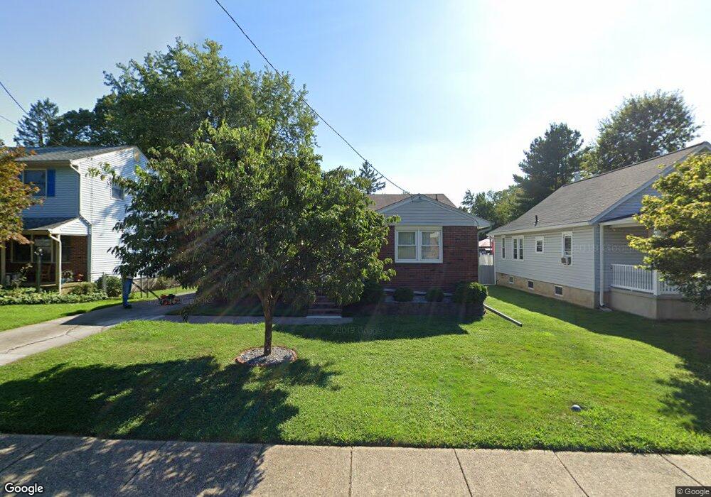
352 S Maple Ave Maple Shade, NJ 08052
Estimated Value: $311,449 - $346,000
Studio
--
Bath
1,145
Sq Ft
$287/Sq Ft
Est. Value
About This Home
This home is located at 352 S Maple Ave, Maple Shade, NJ 08052 and is currently estimated at $328,612, approximately $286 per square foot. 352 S Maple Ave is a home located in Burlington County with nearby schools including Maude M. Wilkins Elementary School, Ralph J Steinhauer Elementary School, and Howard R Yocum School.
Ownership History
Date
Name
Owned For
Owner Type
Purchase Details
Closed on
Aug 17, 2007
Sold by
Nasife Sydney N and Nasife Jiayou Tan
Bought by
Mccolgan John B
Current Estimated Value
Home Financials for this Owner
Home Financials are based on the most recent Mortgage that was taken out on this home.
Original Mortgage
$178,500
Outstanding Balance
$113,708
Interest Rate
6.78%
Mortgage Type
Purchase Money Mortgage
Estimated Equity
$214,904
Purchase Details
Closed on
Apr 7, 1997
Sold by
Nasife Sydney N
Bought by
Nasife Sydney N and Nasife Jiayou Tan
Create a Home Valuation Report for This Property
The Home Valuation Report is an in-depth analysis detailing your home's value as well as a comparison with similar homes in the area
Home Values in the Area
Average Home Value in this Area
Purchase History
| Date | Buyer | Sale Price | Title Company |
|---|---|---|---|
| Mccolgan John B | $238,000 | Affiliated Title Of South Je | |
| Nasife Sydney N | -- | -- |
Source: Public Records
Mortgage History
| Date | Status | Borrower | Loan Amount |
|---|---|---|---|
| Open | Mccolgan John B | $178,500 |
Source: Public Records
Tax History
| Year | Tax Paid | Tax Assessment Tax Assessment Total Assessment is a certain percentage of the fair market value that is determined by local assessors to be the total taxable value of land and additions on the property. | Land | Improvement |
|---|---|---|---|---|
| 2025 | $6,343 | $167,100 | $47,000 | $120,100 |
| 2024 | $6,159 | $167,100 | $47,000 | $120,100 |
| 2023 | $6,159 | $167,100 | $47,000 | $120,100 |
| 2022 | $6,064 | $167,100 | $47,000 | $120,100 |
| 2021 | $6,006 | $167,100 | $47,000 | $120,100 |
| 2020 | $6,022 | $167,100 | $47,000 | $120,100 |
| 2019 | $5,802 | $167,100 | $47,000 | $120,100 |
| 2018 | $5,701 | $167,100 | $47,000 | $120,100 |
| 2017 | $5,635 | $167,100 | $47,000 | $120,100 |
| 2016 | $5,551 | $167,100 | $47,000 | $120,100 |
| 2015 | $5,431 | $167,100 | $47,000 | $120,100 |
| 2014 | $5,265 | $167,100 | $47,000 | $120,100 |
Source: Public Records
Map
Nearby Homes
- 452 Elm Ave
- 206 S Maple Ave
- 44 S Pine Ave
- 15 S Pine Ave
- 66 W Center Ave
- 61 S Maple Ave
- 42 Spruce Ave
- 115 E Kings Hwy Unit 187
- 115 E Kings Hwy Unit 125
- 47 S Lippincott Ave
- 26 Morris Ave
- 169 Cherry Tree Ln
- 22 Theodore Ave
- 57 S Terrace Ave
- 3005 Garfield Ave
- 114 Weather Vane Dr
- 207 E Park Ave
- 3001 Church Rd
- 411 A3 Stiles Ave Unit A-3
- 411 C12 Stiles Ave Unit C-12
Your Personal Tour Guide
Ask me questions while you tour the home.