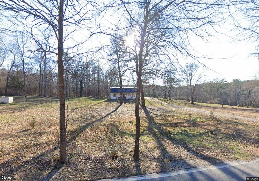
3520 Daniel Bridge Rd SW Conyers, GA 30094
Estimated Value: $292,000 - $696,000
2
Beds
2
Baths
1,600
Sq Ft
$253/Sq Ft
Est. Value
About This Home
This home is located at 3520 Daniel Bridge Rd SW, Conyers, GA 30094 and is currently estimated at $404,015, approximately $252 per square foot. 3520 Daniel Bridge Rd SW is a home located in Rockdale County with nearby schools including Lorraine Elementary School, Gen. Ray Davis Middle School, and Heritage High School.
Ownership History
Date
Name
Owned For
Owner Type
Purchase Details
Closed on
Jul 5, 2017
Sold by
Delay Edward Randall
Bought by
Carson Patricia D
Current Estimated Value
Purchase Details
Closed on
Aug 11, 2005
Sold by
Bolden Tamara A
Bought by
Delay Edward R
Purchase Details
Closed on
Jul 22, 1994
Sold by
Papacsi Istavan Joyce
Bought by
Bolden Tamara
Home Financials for this Owner
Home Financials are based on the most recent Mortgage that was taken out on this home.
Original Mortgage
$48,500
Interest Rate
8.39%
Mortgage Type
Commercial
Create a Home Valuation Report for This Property
The Home Valuation Report is an in-depth analysis detailing your home's value as well as a comparison with similar homes in the area
Home Values in the Area
Average Home Value in this Area
Purchase History
| Date | Buyer | Sale Price | Title Company |
|---|---|---|---|
| Carson Patricia D | $30,000 | -- | |
| Delay Edward R | $70,000 | -- | |
| Bolden Tamara | $50,000 | -- |
Source: Public Records
Mortgage History
| Date | Status | Borrower | Loan Amount |
|---|---|---|---|
| Previous Owner | Bolden Tamara | $48,500 |
Source: Public Records
Tax History Compared to Growth
Tax History
| Year | Tax Paid | Tax Assessment Tax Assessment Total Assessment is a certain percentage of the fair market value that is determined by local assessors to be the total taxable value of land and additions on the property. | Land | Improvement |
|---|---|---|---|---|
| 2024 | $1,715 | $101,560 | $19,040 | $82,520 |
| 2023 | $1,043 | $79,800 | $18,160 | $61,640 |
| 2022 | $1,100 | $69,760 | $18,160 | $51,600 |
| 2021 | $1,088 | $66,960 | $15,360 | $51,600 |
| 2020 | $961 | $63,440 | $11,840 | $51,600 |
| 2019 | $655 | $52,360 | $11,840 | $40,520 |
| 2018 | $1,492 | $33,080 | $8,360 | $24,720 |
| 2017 | $286 | $6,280 | $6,280 | $0 |
| 2016 | $286 | $6,280 | $6,280 | $0 |
| 2015 | $286 | $6,280 | $6,280 | $0 |
| 2014 | $289 | $6,280 | $6,280 | $0 |
| 2013 | -- | $7,840 | $7,840 | $0 |
Source: Public Records
Map
Nearby Homes
- 0 SW St Lucia Sunrise Unit 10642865
- 7069 Ravenwood Ln
- 7078 Ravenwood Ln
- 7074 Ravenwood Ln
- 6837 Mahonia Place
- 7023 Setters Way
- 7134 Ravenwood Ln
- 2580 Oneal Rd SW Unit 1
- 2576 Oneal Rd SW Unit 2
- 00 Highway 138
- 3905 Highway 138
- 2572 Oneal Rd SW Unit 3
- --- Highway 138
- 2568 Oneal Rd SW Unit 4
- 3405 Monica Ln SW Unit 4
- 3405 Monica Ln SW
- 7012 Setters Way
- 6874 Mahonia Place
- 7056 Mahonia Place
- 4741 Bob White Run
- 2601 Westwood Dr SW
- 2600 Westwood Dr SW
- 3695 Daniel Bridge Rd SW
- 3500 Daniel Bridge Rd SW
- 3675 Daniel Bridge Rd SW
- 3655 Daniel Bridge Rd SW
- 3655 Daniel Bridge Rd SW
- 0 Westwood Dr Unit 7494184
- 0 Westwood Dr Unit 7395727
- 0 Westwood Dr Unit 8553653
- 0 Westwood Dr Unit 8093119
- 0 Westwood Dr Unit 7345897
- 3655 Daniels Bridge Rd
- 3498 Daniel Bridge Rd SW
- 3496 Daniel Bridge Rd SW
- 3496 Daniels Bridge Rd
- 2611 Westwood Dr SW
- 3635 Daniel Bridge Rd SW
- 2610 Westwood Dr SW
- 3615 Daniel Bridge Rd SW