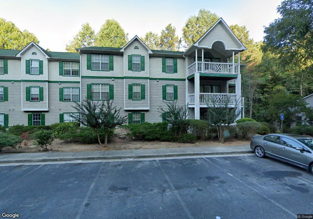
3520 Shepherds Path Unit 3520 Decatur, GA 30034
Southwest DeKalb NeighborhoodEstimated Value: $103,556 - $156,000
3
Beds
2
Baths
1,289
Sq Ft
$99/Sq Ft
Est. Value
About This Home
This home is located at 3520 Shepherds Path Unit 3520, Decatur, GA 30034 and is currently estimated at $127,389, approximately $98 per square foot. 3520 Shepherds Path Unit 3520 is a home located in DeKalb County with nearby schools including Bob Mathis Elementary School, Chapel Hill Middle School, and Southwest Dekalb High School.
Ownership History
Date
Name
Owned For
Owner Type
Purchase Details
Closed on
Jan 28, 1999
Sold by
Davidson Teddy L
Bought by
Crockett Marcyl D
Current Estimated Value
Home Financials for this Owner
Home Financials are based on the most recent Mortgage that was taken out on this home.
Original Mortgage
$75,250
Outstanding Balance
$17,499
Interest Rate
6.79%
Mortgage Type
New Conventional
Estimated Equity
$109,890
Create a Home Valuation Report for This Property
The Home Valuation Report is an in-depth analysis detailing your home's value as well as a comparison with similar homes in the area
Home Values in the Area
Average Home Value in this Area
Purchase History
| Date | Buyer | Sale Price | Title Company |
|---|---|---|---|
| Crockett Marcyl D | $75,900 | -- |
Source: Public Records
Mortgage History
| Date | Status | Borrower | Loan Amount |
|---|---|---|---|
| Open | Crockett Marcyl D | $75,250 |
Source: Public Records
Tax History Compared to Growth
Tax History
| Year | Tax Paid | Tax Assessment Tax Assessment Total Assessment is a certain percentage of the fair market value that is determined by local assessors to be the total taxable value of land and additions on the property. | Land | Improvement |
|---|---|---|---|---|
| 2025 | $790 | $35,560 | $4,000 | $31,560 |
| 2024 | $1,018 | $44,040 | $4,000 | $40,040 |
| 2023 | $1,018 | $39,320 | $4,000 | $35,320 |
| 2022 | $555 | $26,960 | $4,000 | $22,960 |
| 2021 | $318 | $20,080 | $4,000 | $16,080 |
| 2020 | $283 | $18,920 | $4,000 | $14,920 |
| 2019 | $291 | $19,280 | $2,800 | $16,480 |
| 2018 | $217 | $22,080 | $2,800 | $19,280 |
| 2017 | $135 | $14,560 | $2,800 | $11,760 |
| 2016 | $48 | $11,760 | $2,040 | $9,720 |
| 2014 | $41 | $9,800 | $2,040 | $7,760 |
Source: Public Records
Map
Nearby Homes
- 3515 Shepherds Path
- 3526 Shepherds Path Unit 1
- 3477 Shepherds Path
- 3622 Shepherds Path Unit 3622
- 3608 Shepherds Path
- 3428 Chapel Park Dr
- 3689 Harvest Dr
- Stratford Plan at Harvest Park
- Sudbury Plan at Harvest Park
- Salisbury Plan at Harvest Park
- 3756 Harvest Dr
- 3700 Harvest Dr
- 3702 Harvest Dr Unit 93
- 3704 Harvest Dr
- 3800 Cherry Ridge Blvd
- 3604 Spring Trace
- 3616 Cherry Ridge Blvd
- 3801 Cherry Ridge Blvd
- 3826 Brandeis Way
- 3302 Creekway Dr
- 3512 Shepherds Path
- 3504 Shepherds Path
- 3500 Shepherds Path
- 3505 Shepherds Path
- 3513 Shepherds Path
- 3521 Shepherds Path
- 3506 Shepherds Path Unit 3506
- 3514 Shepherds Path
- 3522 Shepherds Path
- 3507 Shepherds Path
- 3515 Shepherds Path Unit 44
- 3515 Shepherds Path Unit 3515
- 3523 Shepherds Path Unit 3523B
- 0 Shepherds Path Unit 7423402
- 0 Shepherds Path Unit 7377986
- 0 Shepherds Path Unit 7043834
- 0 Shepherds Path Unit 3097869
- 0 Shepherds Path Unit 7141656
- 0 Shepherds Path Unit 7022125
- 0 Shepherds Path Unit 7518950