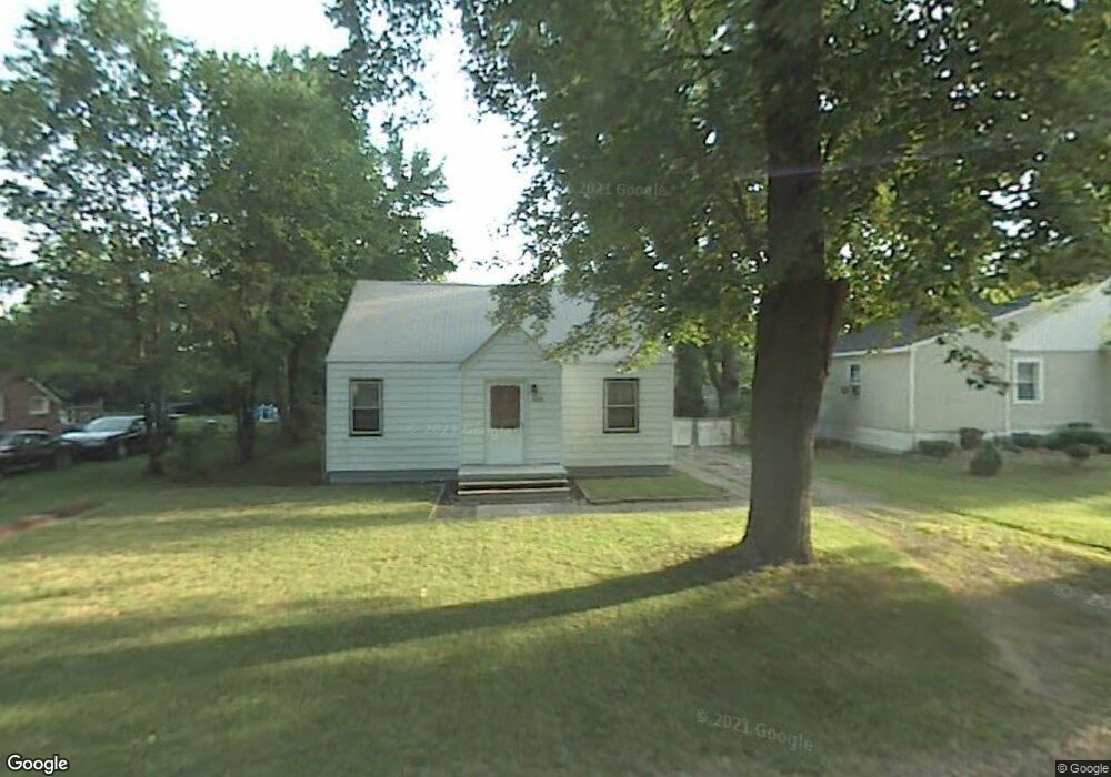
35220 Atlas St Romulus, MI 48174
Estimated Value: $133,000 - $165,000
3
Beds
1
Bath
1,020
Sq Ft
$149/Sq Ft
Est. Value
About This Home
This home is located at 35220 Atlas St, Romulus, MI 48174 and is currently estimated at $151,664, approximately $148 per square foot. 35220 Atlas St is a home with nearby schools including Wick Elementary School, Romulus Middle School, and Romulus Senior High School.
Ownership History
Date
Name
Owned For
Owner Type
Purchase Details
Closed on
Aug 28, 2024
Sold by
Clarence E Brown And Betty R Brown Trust and Kotlarczyk Belva Rae
Bought by
Mckenna Thomas
Current Estimated Value
Home Financials for this Owner
Home Financials are based on the most recent Mortgage that was taken out on this home.
Original Mortgage
$22,754
Outstanding Balance
$22,499
Interest Rate
6.49%
Mortgage Type
FHA
Estimated Equity
$129,165
Purchase Details
Closed on
Feb 6, 2024
Sold by
Brown Clarence E and Brown Betty Rae
Bought by
Clarence E Brown And Betty R Brown Trust
Create a Home Valuation Report for This Property
The Home Valuation Report is an in-depth analysis detailing your home's value as well as a comparison with similar homes in the area
Home Values in the Area
Average Home Value in this Area
Purchase History
| Date | Buyer | Sale Price | Title Company |
|---|---|---|---|
| Mckenna Thomas | $27,000 | Reputation First Title | |
| Clarence E Brown And Betty R Brown Trust | -- | None Listed On Document | |
| Clarence E Brown And Betty R Brown Trust | -- | None Listed On Document |
Source: Public Records
Mortgage History
| Date | Status | Borrower | Loan Amount |
|---|---|---|---|
| Open | Mckenna Thomas | $22,754 |
Source: Public Records
Tax History
| Year | Tax Paid | Tax Assessment Tax Assessment Total Assessment is a certain percentage of the fair market value that is determined by local assessors to be the total taxable value of land and additions on the property. | Land | Improvement |
|---|---|---|---|---|
| 2025 | $2,361 | $55,900 | $0 | $0 |
| 2024 | $1,150 | $44,500 | $0 | $0 |
| 2023 | $1,124 | $32,300 | $0 | $0 |
| 2022 | $1,234 | $30,700 | $0 | $0 |
| 2021 | $1,201 | $26,800 | $0 | $0 |
| 2020 | $1,173 | $27,900 | $0 | $0 |
| 2019 | $1,139 | $28,100 | $0 | $0 |
| 2018 | $828 | $15,000 | $0 | $0 |
| 2017 | $393 | $14,900 | $0 | $0 |
| 2016 | $1,054 | $15,400 | $0 | $0 |
| 2015 | $2,010 | $20,100 | $0 | $0 |
| 2013 | $2,401 | $25,800 | $0 | $0 |
| 2012 | $901 | $25,500 | $8,100 | $17,400 |
Source: Public Records
Map
Nearby Homes
- 35344 Ecorse Rd
- 35773 Surrey Ct
- 000 Waynecorse
- 35431 Beverly Rd
- 0000 Park Place
- 35799 Park Place
- 36227 Vinewood St
- 6358 Dexter St
- 36214 Vinewood St
- Lot 215 2nd St
- Lot 214 2nd St
- 7063 Sargent St
- Lot 227 Dexter St
- 6130 Wayne Rd
- 0 Hazel Ct
- 000 Cincinnati St
- 6073 Biddle St
- 35025 Wick Rd
- 6071 Dexter St
- 6011 Washington St
- 35206 Atlas St
- 35234 Atlas St
- 35229 Atlas St
- VAC Washington St
- 35249 Atlas St
- 35250 Atlas St
- 7259 Washington St
- 35235 Ecorse Rd
- 7219 Washington St
- 7411 Wayne Rd
- 7325 Wayne Rd
- 7309 Wayne Rd
- 7199 Washington St
- 35209 Ecorse Rd
- 7435 Wayne Rd
- 7133 Washington St Unit Bldg-Unit
- 7133 Washington St
- 7423 Wayne Rd
- 7350 Wayne Rd
- 7322 Wayne Rd
Your Personal Tour Guide
Ask me questions while you tour the home.