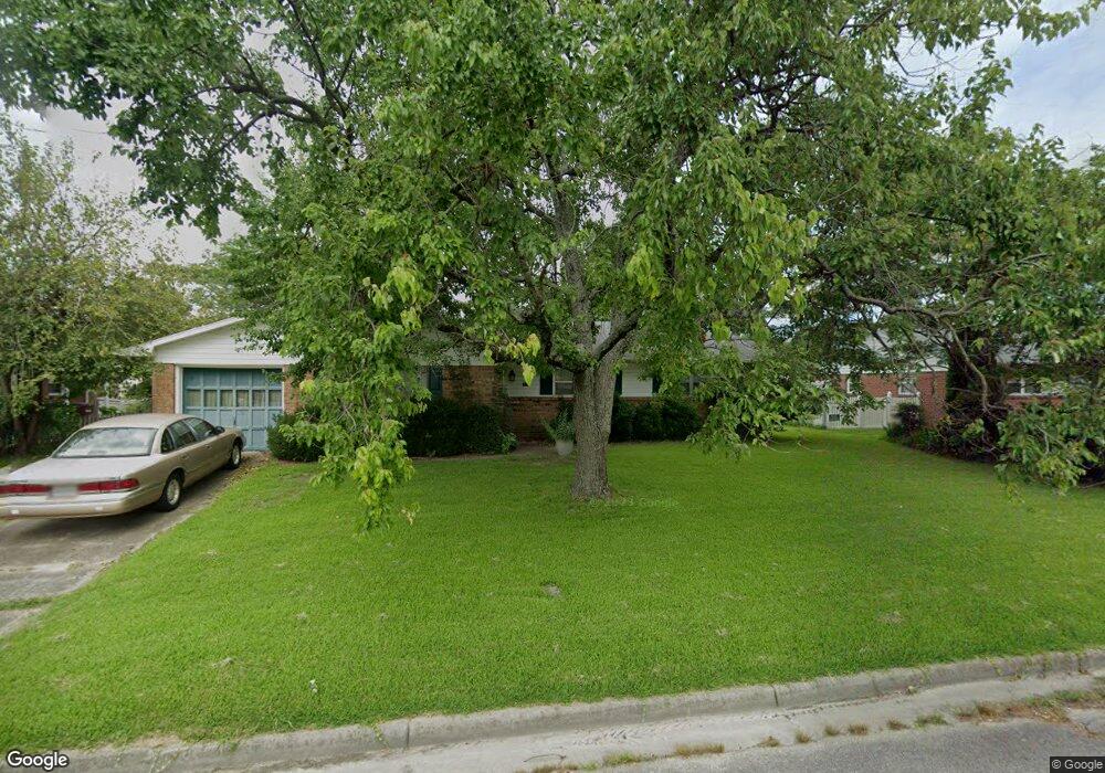
3524 Maori Dr Chesapeake, VA 23321
Western Branch NeighborhoodEstimated Value: $282,000 - $322,267
4
Beds
2
Baths
1,437
Sq Ft
$216/Sq Ft
Est. Value
About This Home
This home is located at 3524 Maori Dr, Chesapeake, VA 23321 and is currently estimated at $310,817, approximately $216 per square foot. 3524 Maori Dr is a home located in Chesapeake City with nearby schools including Western Branch Primary School, Western Branch Intermediate School, and Western Branch Middle School.
Ownership History
Date
Name
Owned For
Owner Type
Purchase Details
Closed on
Sep 28, 2006
Sold by
Harrington Ashley
Bought by
Bunty Robert D
Current Estimated Value
Home Financials for this Owner
Home Financials are based on the most recent Mortgage that was taken out on this home.
Original Mortgage
$125,000
Outstanding Balance
$74,837
Interest Rate
6.52%
Mortgage Type
New Conventional
Estimated Equity
$235,980
Create a Home Valuation Report for This Property
The Home Valuation Report is an in-depth analysis detailing your home's value as well as a comparison with similar homes in the area
Home Values in the Area
Average Home Value in this Area
Purchase History
| Date | Buyer | Sale Price | Title Company |
|---|---|---|---|
| Bunty Robert D | $225,500 | -- |
Source: Public Records
Mortgage History
| Date | Status | Borrower | Loan Amount |
|---|---|---|---|
| Open | Bunty Robert D | $125,000 |
Source: Public Records
Tax History Compared to Growth
Tax History
| Year | Tax Paid | Tax Assessment Tax Assessment Total Assessment is a certain percentage of the fair market value that is determined by local assessors to be the total taxable value of land and additions on the property. | Land | Improvement |
|---|---|---|---|---|
| 2025 | $1,394 | $295,400 | $145,000 | $150,400 |
| 2024 | $1,394 | $288,000 | $145,000 | $143,000 |
| 2023 | $828 | $272,100 | $135,000 | $137,100 |
| 2022 | $523 | $254,700 | $120,000 | $134,700 |
| 2021 | $1,307 | $213,400 | $90,000 | $123,400 |
| 2020 | $2,127 | $206,500 | $80,000 | $126,500 |
| 2019 | $2,127 | $202,600 | $75,000 | $127,600 |
| 2018 | $1,568 | $166,000 | $60,000 | $106,000 |
| 2017 | $174 | $170,700 | $60,000 | $110,700 |
| 2016 | $1,743 | $166,000 | $60,000 | $106,000 |
| 2015 | $174 | $166,000 | $60,000 | $106,000 |
| 2014 | $1,743 | $166,000 | $60,000 | $106,000 |
Source: Public Records
Map
Nearby Homes
- 3424 Brandywine Dr
- 3380 Brandywine Dr
- 3533 Forest Haven Ln
- 3404 Newport Dr
- 3440 Bernies Ct S
- 3601 Forest Haven Ln
- 3217 Bangor Dr
- 3133 Dunworken Dr
- 3601 Radford Cir
- 3113 Woodbaugh Dr
- 4007 Magnolia Dr
- 3621 Calverton Way
- 3331 Golden Oaks Ln
- 3549 Clover Meadows Dr
- 4323 Stafford Dr
- 3440 Clover Rd E
- 112 Columbus Ave
- 4362 Oneford Place
- 5226 Moreland St
- 8110 Lee Hall Ave
- 3528 Maori Dr
- 3520 Maori Dr
- 3525 Maori Dr
- 3521 Maori Dr
- 3532 Maori Dr
- 3516 Maori Dr
- 3533 Maori Dr
- 3517 Maori Dr
- 3512 Avondale Ct
- 3536 Maori Dr
- 3537 Maori Dr
- 3516 Avondale Ct
- 3508 Avondale Ct
- 3345 Pine Hill Crescent
- 3520 Avondale Ct
- 3504 Avondale Ct
- 3508 Maori Dr
- 3341 Pine Hill Crescent
- 3540 Maori Dr
- 4669 Helensburgh Dr