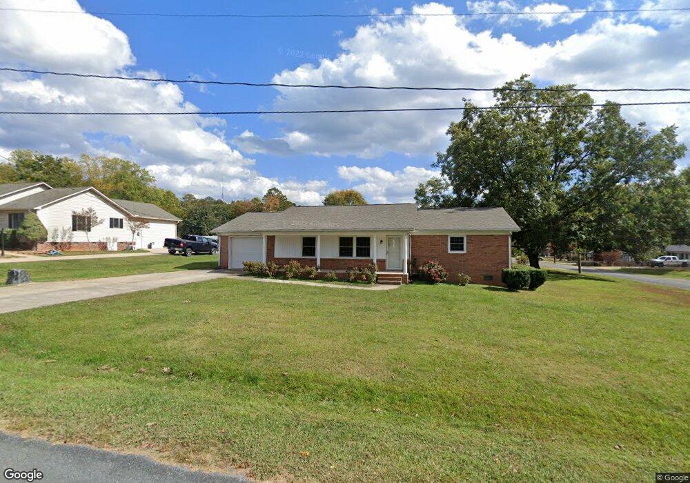
3525 Linn Ave Kannapolis, NC 28083
Estimated Value: $274,000 - $307,000
--
Bed
2
Baths
1,810
Sq Ft
$163/Sq Ft
Est. Value
About This Home
This home is located at 3525 Linn Ave, Kannapolis, NC 28083 and is currently estimated at $294,568, approximately $162 per square foot. 3525 Linn Ave is a home located in Rowan County with nearby schools including Landis Elementary School, Corriher Lipe Middle School, and South Rowan High School.
Ownership History
Date
Name
Owned For
Owner Type
Purchase Details
Closed on
Oct 5, 2022
Sold by
Lynn Upright Jeffrey and Lynn Renee M
Bought by
Upright Jeffrey Lynn and Upright Renee M
Current Estimated Value
Purchase Details
Closed on
Apr 16, 2007
Sold by
Kerr William Scott and Kerr Angela K
Bought by
Tickle Roy Michael and Tickle Dianne H
Home Financials for this Owner
Home Financials are based on the most recent Mortgage that was taken out on this home.
Original Mortgage
$110,500
Interest Rate
6.15%
Mortgage Type
Unknown
Purchase Details
Closed on
Aug 15, 2005
Sold by
Hill Randall James and Lawing Billie Jo Hill
Bought by
Kerr William Scott and Kerr Angela K
Home Financials for this Owner
Home Financials are based on the most recent Mortgage that was taken out on this home.
Original Mortgage
$88,700
Interest Rate
8.3%
Mortgage Type
Fannie Mae Freddie Mac
Create a Home Valuation Report for This Property
The Home Valuation Report is an in-depth analysis detailing your home's value as well as a comparison with similar homes in the area
Home Values in the Area
Average Home Value in this Area
Purchase History
| Date | Buyer | Sale Price | Title Company |
|---|---|---|---|
| Upright Jeffrey Lynn | -- | -- | |
| Tickle Roy Michael | $110,500 | None Available | |
| Kerr William Scott | $111,000 | Chicago Title Insurance Comp |
Source: Public Records
Mortgage History
| Date | Status | Borrower | Loan Amount |
|---|---|---|---|
| Previous Owner | Tickle Roy Michael | $110,500 | |
| Previous Owner | Kerr William Scott | $88,700 |
Source: Public Records
Tax History Compared to Growth
Tax History
| Year | Tax Paid | Tax Assessment Tax Assessment Total Assessment is a certain percentage of the fair market value that is determined by local assessors to be the total taxable value of land and additions on the property. | Land | Improvement |
|---|---|---|---|---|
| 2025 | $1,359 | $218,370 | $39,875 | $178,495 |
| 2024 | $1,359 | $218,370 | $39,875 | $178,495 |
| 2023 | $1,359 | $218,370 | $39,875 | $178,495 |
| 2022 | $472 | $134,936 | $28,600 | $106,336 |
| 2021 | $945 | $134,936 | $28,600 | $106,336 |
| 2020 | $472 | $134,936 | $28,600 | $106,336 |
| 2019 | $472 | $134,936 | $28,600 | $106,336 |
| 2018 | $367 | $105,775 | $28,617 | $77,158 |
| 2017 | $367 | $105,775 | $28,617 | $77,158 |
| 2016 | $367 | $105,775 | $28,617 | $77,158 |
| 2015 | $373 | $105,775 | $28,617 | $77,158 |
| 2014 | $368 | $105,282 | $24,165 | $81,117 |
Source: Public Records
Map
Nearby Homes
- 0 N Cannon Blvd Unit CAR4271457
- 01 Dial St
- 00 Dial St
- 00 Coldwater St
- 203 Hickory Wood Dr
- 1255 Dial St
- 805 E Mills Dr
- 0 S Chapel St
- 601 S Chapel St
- 204 E 27th St
- 400 E 27th St
- 2653 Brady Ave
- 309 E 25th St
- 0 N Chapel St
- 411 S Central Ave
- 233 E Rice St Unit 9
- 208 S Chapel St
- 1109 S Highland Ave
- 703 S Main St
- 00 E 22nd St