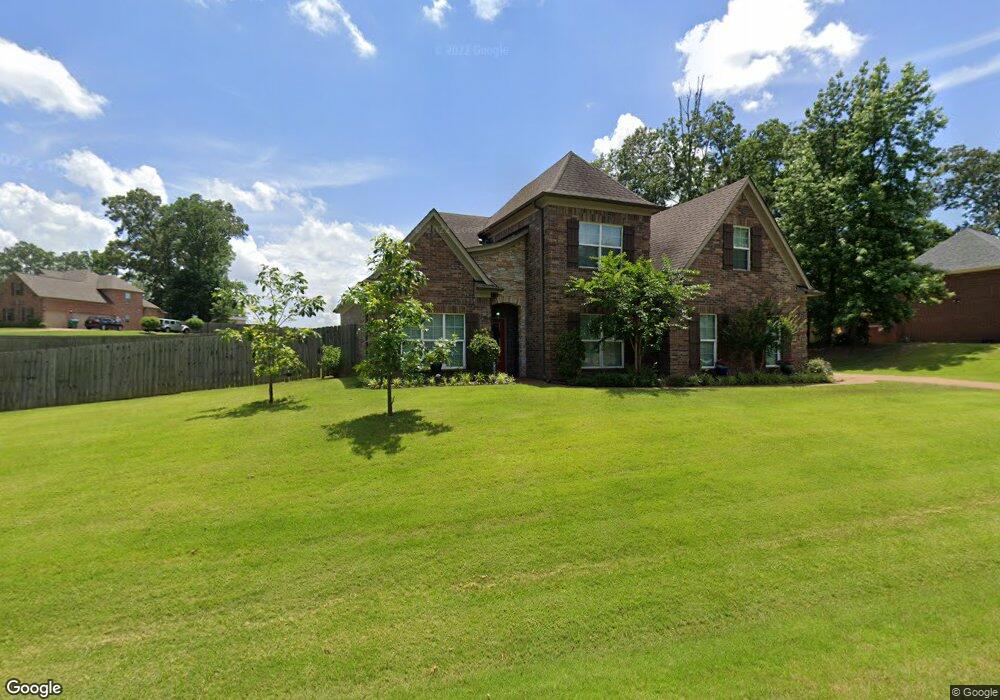
3525 Westwind Dr Nesbit, MS 38651
Pleasant Hill NeighborhoodEstimated Value: $355,000 - $434,000
About This Home
This home is located at 3525 Westwind Dr, Nesbit, MS 38651 and is currently estimated at $394,448, approximately $154 per square foot. 3525 Westwind Dr is a home located in DeSoto County with nearby schools including DeSoto Central Primary School, DeSoto Central Elementary School, and DeSoto Central Middle School.
Ownership History
We collect this data history from publicly available records. To have your information removed, we recommend requesting removal directly through your county’s website.
Purchase Details
Home Financials for this Owner
Home Financials are based on the most recent Mortgage that was taken out on this home.Purchase Details
Home Financials for this Owner
Home Financials are based on the most recent Mortgage that was taken out on this home.Purchase Details
Home Financials for this Owner
Home Financials are based on the most recent Mortgage that was taken out on this home.Home Values in the Area
Average Home Value in this Area
Purchase History
We collect this data history from publicly available records. To have your information removed, we recommend requesting removal directly through your county’s website.
| Date | Buyer | Sale Price | Title Company |
|---|---|---|---|
| -- | None Available | ||
| -- | None Available | ||
| -- | None Available |
Mortgage History
We collect this data history from publicly available records. To have your information removed, we recommend requesting removal directly through your county’s website.
| Date | Status | Borrower | Loan Amount |
|---|---|---|---|
| Open | $200,000 | ||
| Previous Owner | $218,862 | ||
| Previous Owner | $175,383 |
Tax History
We collect this data history from publicly available records. To have your information removed, we recommend requesting removal directly through your county’s website.
| Year | Tax Paid | Tax Assessment Tax Assessment Total Assessment is a certain percentage of the fair market value that is determined by local assessors to be the total taxable value of land and additions on the property. | Land | Improvement |
|---|---|---|---|---|
| 2025 | $629 | $15,131 | $3,000 | $12,131 |
| 2024 | $763 | $15,131 | $3,000 | $12,131 |
| 2023 | $763 | $15,131 | $0 | $0 |
| 2022 | $763 | $15,131 | $3,000 | $12,131 |
| 2021 | $763 | $15,131 | $3,000 | $12,131 |
| 2020 | $763 | $15,131 | $3,000 | $12,131 |
| 2019 | $1,511 | $15,116 | $3,000 | $12,116 |
| 2017 | $1,536 | $27,510 | $15,255 | $12,255 |
| 2016 | $1,536 | $15,255 | $3,000 | $12,255 |
| 2015 | $1,536 | $27,510 | $15,255 | $12,255 |
| 2014 | $1,536 | $15,255 | $0 | $0 |
| 2013 | -- | $3,375 | $0 | $0 |
Map
- 3426 Westwind Dr
- 3456 Susie Cir
- 1706 Bristol Dr
- 1768 Linden Dr
- 3133 Pleasant Hill Rd
- 3049 Pleasant Hill Rd
- 1808 Malone Rd
- 1780 Malone Rd
- 1721 Baisley Dr
- Lot 99 Baisley Dr
- 1667 Baisley Dr
- Lot 107 Brooke Dr
- 2830 Manning Cir S
- 1722 Baisley Dr
- 4232 Brooke Dr
- 4183 Edison Dr
- 4233 Edison Dr
- 4300 Brooke Dr
- 4257 Edison Dr
- 1755 Bakersfield Way
- 3498 Westwind Dr
- 3480 Westwind Dr
- 3520 Westwind Dr
- 3466 Westwind Dr
- 3485 Westwind Dr
- 3546 Westwind Dr
- 2139 W Erwin
- 2141 W Erwin
- 3459 Westwind Dr
- 2150 W Erwin
- 2169 W Erwin
- 3452 Westwind Dr
- 2021 W Erwin
- 3559 Westwind Dr
- 3559 Westwind Dr
- 3470 Delaney Dr
- 3572 Meadow Trace Cove
- 3447 Westwind Dr
- 1993 Laurel Stone Ln
- 1979 Laurel Stone Ln
Ask me questions while you tour the home.