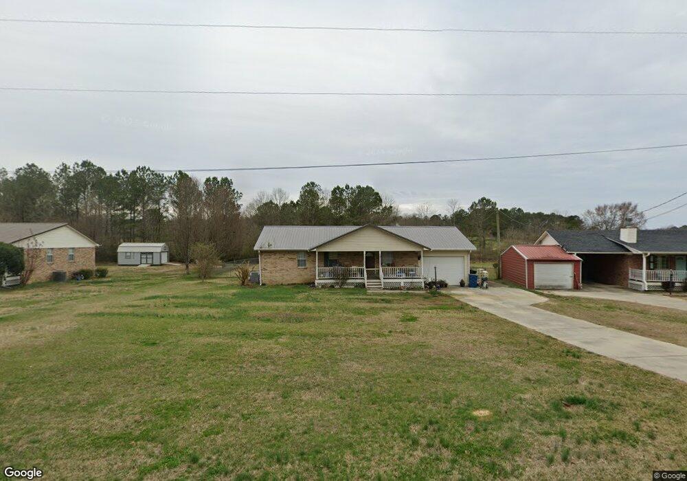
3526 County Highway 13 Locust Fork, AL 35097
Estimated Value: $163,436 - $214,000
--
Bed
--
Bath
1,324
Sq Ft
$146/Sq Ft
Est. Value
About This Home
This home is located at 3526 County Highway 13, Locust Fork, AL 35097 and is currently estimated at $193,609, approximately $146 per square foot. 3526 County Highway 13 is a home located in Blount County with nearby schools including Locust Fork Elementary School and Locust Fork High School.
Ownership History
Date
Name
Owned For
Owner Type
Purchase Details
Closed on
Jul 9, 2008
Sold by
Bank Of New York
Bought by
Carroll Michael
Current Estimated Value
Home Financials for this Owner
Home Financials are based on the most recent Mortgage that was taken out on this home.
Original Mortgage
$82,639
Interest Rate
6.48%
Mortgage Type
Purchase Money Mortgage
Create a Home Valuation Report for This Property
The Home Valuation Report is an in-depth analysis detailing your home's value as well as a comparison with similar homes in the area
Home Values in the Area
Average Home Value in this Area
Purchase History
| Date | Buyer | Sale Price | Title Company |
|---|---|---|---|
| Carroll Michael | $80,900 | -- |
Source: Public Records
Mortgage History
| Date | Status | Borrower | Loan Amount |
|---|---|---|---|
| Previous Owner | Carroll Michael | $82,639 |
Source: Public Records
Tax History Compared to Growth
Tax History
| Year | Tax Paid | Tax Assessment Tax Assessment Total Assessment is a certain percentage of the fair market value that is determined by local assessors to be the total taxable value of land and additions on the property. | Land | Improvement |
|---|---|---|---|---|
| 2024 | $514 | $15,260 | $1,260 | $14,000 |
| 2023 | $514 | $14,180 | $1,260 | $12,920 |
| 2022 | $393 | $12,020 | $1,260 | $10,760 |
| 2021 | $333 | $10,420 | $1,320 | $9,100 |
| 2020 | $321 | $9,500 | $1,260 | $8,240 |
| 2019 | $298 | $9,500 | $1,260 | $8,240 |
| 2018 | $349 | $10,860 | $1,260 | $9,600 |
| 2017 | $352 | $10,920 | $0 | $0 |
| 2015 | $352 | $10,920 | $0 | $0 |
| 2014 | -- | $10,720 | $0 | $0 |
| 2013 | -- | $10,660 | $0 | $0 |
Source: Public Records
Map
Nearby Homes
- #0 Shady Point Rd Unit 18, 18 & 19
- 3251 County Highway 13
- 29542 Alabama 79
- 380 Jerry Marsh Rd
- 178 Jerry Marsh Rd
- 31730 Alabama 79
- 255 Savannah Ln
- 89 Pine Tree Dr
- 159 Ray Dr
- 265 Riverview Dr
- 1129 Baty Rd
- 32510 Alabama 79
- 0 Center Hill Rd
- 4540 Spunky Hollow Rd
- 55 Honeycutt Rd
- 2898 County Highway 15
- 345 Armstrong Dr
- 2787 Deavers Town Rd
- 640 Gilman Bend Rd
- 425 Armstrong Dr
- 3510 County Highway 13
- 3510 County Highway 13
- 3510 County Road 13
- 3251 County Road 13
- 4343 Hwy 13
- 3546 County Highway 13
- 3478 County Highway 13
- 3556 County Highway 13
- 3460 County Highway 13
- 3615 County Road 13
- 3615 County Highway 13
- 72 Shady Lane Dr
- 3621 County Highway 13
- 3621 County Highway 13
- 3420 County Highway 13
- 117 Shady Point Rd
- 71 Staton Ln
- 175 Shady Point Rd
- 3637 County Highway 13
- 70 Staton Ln