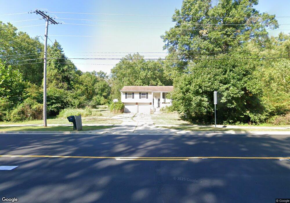
3527 N Mccord Rd Toledo, OH 43617
Estimated Value: $230,000 - $283,841
3
Beds
2
Baths
1,634
Sq Ft
$160/Sq Ft
Est. Value
About This Home
This home is located at 3527 N Mccord Rd, Toledo, OH 43617 and is currently estimated at $261,710, approximately $160 per square foot. 3527 N Mccord Rd is a home located in Lucas County with nearby schools including Stranahan Elementary School, Sylvania Timberstone Junior High School, and Sylvania Southview High School.
Ownership History
Date
Name
Owned For
Owner Type
Purchase Details
Closed on
Aug 1, 2025
Sold by
Glover Wanda M and Glover Albert
Bought by
Crosby James and Gombash Mary
Current Estimated Value
Purchase Details
Closed on
Mar 27, 2023
Sold by
Glover Wanda M
Bought by
Glover Wanda M and Glover Ceana M
Purchase Details
Closed on
Mar 25, 2009
Sold by
Glover Wanda and Glover Albert L
Bought by
Board Of Lucas County Ohio Commissioners
Purchase Details
Closed on
Dec 18, 2007
Sold by
Peabody Karen and Glover Wanda
Bought by
Peabody Karen and Glover Wanda
Purchase Details
Closed on
Oct 9, 2007
Sold by
Estate Of Lester G Peabody
Bought by
Glover Wanda and Peabody Karen M
Purchase Details
Closed on
Dec 7, 2004
Sold by
Estate Of Pauline Peabody
Bought by
Peabody Lester G
Create a Home Valuation Report for This Property
The Home Valuation Report is an in-depth analysis detailing your home's value as well as a comparison with similar homes in the area
Home Values in the Area
Average Home Value in this Area
Purchase History
| Date | Buyer | Sale Price | Title Company |
|---|---|---|---|
| Crosby James | $188,000 | Liberty Title | |
| Glover Wanda M | -- | None Listed On Document | |
| Board Of Lucas County Ohio Commissioners | $2,924 | None Available | |
| Board Of Lucas County Ohio Commissioners | $2,924 | None Available | |
| Peabody Karen | -- | Attorney | |
| Glover Wanda | -- | None Available | |
| Peabody Lester G | -- | -- |
Source: Public Records
Tax History Compared to Growth
Tax History
| Year | Tax Paid | Tax Assessment Tax Assessment Total Assessment is a certain percentage of the fair market value that is determined by local assessors to be the total taxable value of land and additions on the property. | Land | Improvement |
|---|---|---|---|---|
| 2024 | $2,578 | $79,800 | $27,405 | $52,395 |
| 2023 | $3,567 | $56,280 | $24,500 | $31,780 |
| 2022 | $3,597 | $56,280 | $24,500 | $31,780 |
| 2021 | $4,347 | $56,280 | $24,500 | $31,780 |
| 2020 | $4,754 | $54,565 | $23,730 | $30,835 |
| 2019 | $4,580 | $54,565 | $23,730 | $30,835 |
| 2018 | $4,983 | $54,565 | $23,730 | $30,835 |
| 2017 | $5,832 | $63,420 | $29,855 | $33,565 |
| 2016 | $5,720 | $181,200 | $85,300 | $95,900 |
| 2015 | $5,395 | $181,200 | $85,300 | $95,900 |
| 2014 | $5,134 | $60,970 | $28,700 | $32,270 |
| 2013 | $5,134 | $60,970 | $28,700 | $32,270 |
Source: Public Records
Map
Nearby Homes
- 6606 Blossman Rd
- 3507 Indian Oaks Ln
- 3302 Zone Ave
- 3757 N Mccord Rd
- 3330 Wilford Dr
- 3655 Woodspring Rd
- 3800 Harrowsfield Rd
- 6243 Bonsels Pkwy
- 6537 Woodhall Dr Unit 8
- 4022 Stonehenge Dr Unit 4022
- 2822 Page Lindsay Ln
- 6657 Margate Blvd Unit 3
- 21 Shenandoah Cir
- 22 Shenandoah Cir
- 6537 Abbey Run Unit D5
- 6830 Carrietowne Ln Unit 6830
- 6554 Abbey Run Unit 5
- 6718 5th Ave Unit F
- 6636 Kingsbridge Dr Unit 4
- 6626 Kingsbridge Dr Unit 4
- 3501 N Mccord Rd
- 3541 N Mccord Rd
- 3516 N Mccord Rd
- 3504 N Mccord Rd
- 3540 N Mccord Rd
- 3452 N Mccord Rd
- 6648 Blossman Rd
- 3521 Zone Ave
- 3527 Zone Ave
- 3509 Zone Ave
- 3503 Zone Ave
- 3451 Zone Ave
- 3434 N Mccord Rd
- 6642 Blossman Rd
- 3611 Swallow Tail Ln
- 3608 Swallow Tail Ln
- 3439 Zone Ave
- 3621 N Mccord Rd
- 3427 N Mccord Rd
- 3433 Zone Ave