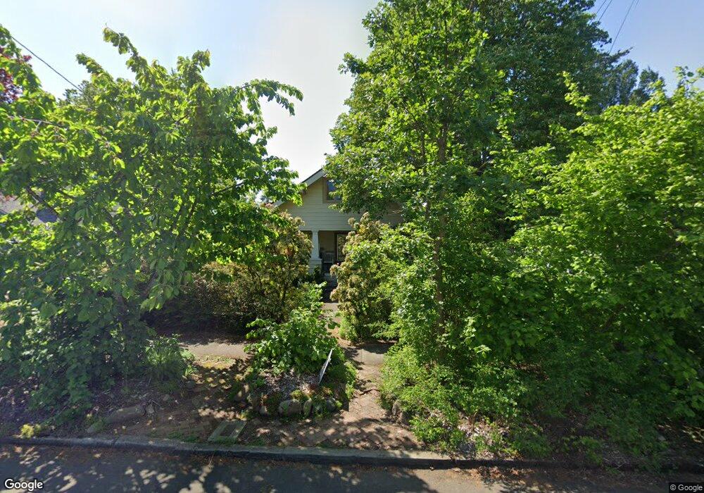
3527 NE 67th Ave Portland, OR 97213
Roseway NeighborhoodEstimated Value: $508,000 - $575,000
2
Beds
1
Bath
1,525
Sq Ft
$354/Sq Ft
Est. Value
About This Home
This home is located at 3527 NE 67th Ave, Portland, OR 97213 and is currently estimated at $539,543, approximately $353 per square foot. 3527 NE 67th Ave is a home located in Multnomah County with nearby schools including Scott Elementary School, Roseway Heights School, and Leodis V. McDaniel High School.
Ownership History
Date
Name
Owned For
Owner Type
Purchase Details
Closed on
Mar 4, 2008
Sold by
Kelley Carol
Bought by
Kelley Christy
Current Estimated Value
Purchase Details
Closed on
Oct 30, 2003
Sold by
Deale Alan G
Bought by
Kelley Carol H
Purchase Details
Closed on
Nov 19, 1996
Sold by
Sutton Ronald L
Bought by
Deale Alan G
Home Financials for this Owner
Home Financials are based on the most recent Mortgage that was taken out on this home.
Original Mortgage
$110,000
Interest Rate
8.5%
Mortgage Type
Purchase Money Mortgage
Create a Home Valuation Report for This Property
The Home Valuation Report is an in-depth analysis detailing your home's value as well as a comparison with similar homes in the area
Home Values in the Area
Average Home Value in this Area
Purchase History
| Date | Buyer | Sale Price | Title Company |
|---|---|---|---|
| Kelley Christy | -- | Accommodation | |
| Kelley Carol H | $200,000 | Fidelity Natl Title Co Of Or | |
| Deale Alan G | $137,500 | Fidelity National Title Co |
Source: Public Records
Mortgage History
| Date | Status | Borrower | Loan Amount |
|---|---|---|---|
| Previous Owner | Deale Alan G | $110,000 |
Source: Public Records
Tax History Compared to Growth
Tax History
| Year | Tax Paid | Tax Assessment Tax Assessment Total Assessment is a certain percentage of the fair market value that is determined by local assessors to be the total taxable value of land and additions on the property. | Land | Improvement |
|---|---|---|---|---|
| 2024 | $5,915 | $221,090 | -- | -- |
| 2023 | $5,688 | $214,660 | $0 | $0 |
| 2022 | $5,565 | $208,410 | $0 | $0 |
| 2021 | $5,471 | $202,340 | $0 | $0 |
| 2020 | $5,019 | $196,450 | $0 | $0 |
| 2019 | $4,834 | $190,730 | $0 | $0 |
| 2018 | $4,692 | $185,180 | $0 | $0 |
| 2017 | $4,497 | $179,790 | $0 | $0 |
| 2016 | $4,116 | $174,560 | $0 | $0 |
| 2015 | $4,008 | $169,480 | $0 | $0 |
| 2014 | $3,947 | $164,550 | $0 | $0 |
Source: Public Records
Map
Nearby Homes
- 3406 NE 63rd Ave
- 3235 NE 65th Ave
- 4026 NE 64th Ave
- 3541 NE 72nd Ave
- 3310 NE 70th Ave
- 3606 NE 72nd Ave
- 6013 NE Milton St
- 6020 NE Mason St Unit 9
- 6022 NE Mason St Unit 7
- 6016 NE Mason St Unit 11
- 6026 NE Mason St Unit 3
- 6028 NE Mason St Unit 1
- 6010 NE Mason St Unit 6
- 6006 NE Mason St Unit 2
- 3255 NE 73rd Ave
- 4230 NE 71st Ave
- 7411 NE Fremont St
- 7417 NE Fremont St
- 7423 NE Fremont St
- 3307 NE 74th Ave
- 3537 NE 67th Ave
- 3515 NE 67th Ave
- 3605 NE 67th Ave
- 6629 NE Fremont St
- 3536 NE 66th Ave
- 3516 NE 66th Ave
- 6605 NE Fremont St New Price
- 3600 NE 66th Ave
- 6605 NE Fremont St
- 3611 NE 67th Ave
- 3528 NE 67th Ave
- 3516 NE 67th Ave
- 6705 NE Fremont St
- 3536 NE 67th Ave
- 3612 NE 66th Ave
- 3548 NE 67th Ave
- 3546 NE 67th Ave
- 3623 NE 67th Ave
- 6715 NE Fremont St
- 3441 NE 67th Ave