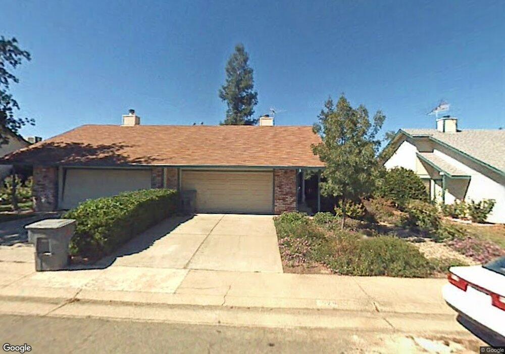
3528 Laird St Loomis, CA 95650
Estimated Value: $444,000 - $531,000
3
Beds
2
Baths
1,204
Sq Ft
$396/Sq Ft
Est. Value
About This Home
This home is located at 3528 Laird St, Loomis, CA 95650 and is currently estimated at $476,494, approximately $395 per square foot. 3528 Laird St is a home located in Placer County with nearby schools including Del Oro High School, Loomis Basin Charter School, and Sierra Foothills Academy.
Ownership History
Date
Name
Owned For
Owner Type
Purchase Details
Closed on
Mar 13, 2000
Sold by
Burcher Paula J Trustee
Bought by
Wright Jennifer T
Current Estimated Value
Home Financials for this Owner
Home Financials are based on the most recent Mortgage that was taken out on this home.
Original Mortgage
$114,450
Outstanding Balance
$38,928
Interest Rate
8.34%
Estimated Equity
$437,566
Purchase Details
Closed on
Nov 3, 1998
Sold by
Morris Rae Thomas and Morris Mary Rae
Bought by
Burcher Paula J
Home Financials for this Owner
Home Financials are based on the most recent Mortgage that was taken out on this home.
Original Mortgage
$84,800
Interest Rate
6.61%
Create a Home Valuation Report for This Property
The Home Valuation Report is an in-depth analysis detailing your home's value as well as a comparison with similar homes in the area
Home Values in the Area
Average Home Value in this Area
Purchase History
| Date | Buyer | Sale Price | Title Company |
|---|---|---|---|
| Wright Jennifer T | $120,500 | North American Title Guarant | |
| Burcher Paula J | $106,000 | North Ameican Title Guaranty | |
| Burcher Paula J | $106,000 | -- |
Source: Public Records
Mortgage History
| Date | Status | Borrower | Loan Amount |
|---|---|---|---|
| Open | Wright Jennifer T | $114,450 | |
| Previous Owner | Burcher Paula J | $84,800 |
Source: Public Records
Tax History
| Year | Tax Paid | Tax Assessment Tax Assessment Total Assessment is a certain percentage of the fair market value that is determined by local assessors to be the total taxable value of land and additions on the property. | Land | Improvement |
|---|---|---|---|---|
| 2025 | $2,285 | $185,176 | $73,760 | $111,416 |
| 2023 | $2,285 | $177,988 | $70,897 | $107,091 |
| 2022 | $2,225 | $174,499 | $69,507 | $104,992 |
| 2021 | $2,162 | $171,079 | $68,145 | $102,934 |
| 2020 | $2,131 | $169,326 | $67,447 | $101,879 |
| 2019 | $2,091 | $166,007 | $66,125 | $99,882 |
| 2018 | $1,985 | $162,753 | $64,829 | $97,924 |
| 2017 | $1,946 | $159,562 | $63,558 | $96,004 |
| 2016 | $1,900 | $156,434 | $62,312 | $94,122 |
| 2015 | $1,857 | $154,086 | $61,377 | $92,709 |
| 2014 | $1,825 | $151,068 | $60,175 | $90,893 |
Source: Public Records
Map
Nearby Homes
- 3586 Sun Knoll Dr
- 6139 Smoke Wood Ct
- 3437 Taylor Rd
- 0 Webb St
- 3390 Taylor Rd Unit 12
- 6300 Arcadia Ave
- 3473 Corwin Ct
- 5782 King Rd
- 6154 S Walnut St Unit 40
- 5950 Becky Way
- 6100 Helens Ct
- 5750 Connie Ct
- 3899 Martin Ln
- 3838 Circle Dr
- 5705 Tudor Way
- 3955 Stonegate Ct
- 3301 Stone Field Way
- 5833 Mareta Ln
- 5813 Mareta Ln
- 5854 Brace Rd
- 3524 Laird St
- 3532 Laird St
- 3520 Laird St
- 3536 Laird St
- 6086 Thornwood Dr
- 6090 Thornwood Dr
- 6082 Thornwood Dr
- 3516 Laird St
- 3540 Laird St
- 6094 Thornwood Dr
- 6078 Thornwood Dr
- 3527 Laird St
- 3531 Laird St
- 6098 Thornwood Dr
- 3544 Laird St
- 3523 Laird St
- 6074 Thornwood Dr
- 3535 Laird St
- 3490 Laird St
- 3519 Laird St
Your Personal Tour Guide
Ask me questions while you tour the home.