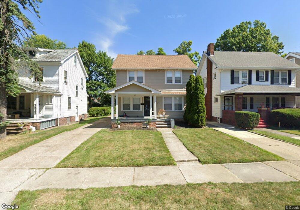
3529 Antisdale Ave Cleveland Heights, OH 44118
Estimated Value: $154,925 - $189,000
3
Beds
2
Baths
1,230
Sq Ft
$137/Sq Ft
Est. Value
About This Home
This home is located at 3529 Antisdale Ave, Cleveland Heights, OH 44118 and is currently estimated at $168,981, approximately $137 per square foot. 3529 Antisdale Ave is a home located in Cuyahoga County with nearby schools including Canterbury Elementary School, Roxboro Middle School, and Cleveland Heights High School.
Ownership History
Date
Name
Owned For
Owner Type
Purchase Details
Closed on
Mar 14, 2012
Sold by
Vim Properties Llc
Bought by
Tapa Properties Llc
Current Estimated Value
Purchase Details
Closed on
Apr 2, 2008
Sold by
Citimortgage Inc
Bought by
Vim Properties Llc
Purchase Details
Closed on
Feb 6, 2007
Sold by
Singleton Eva
Bought by
Citifinancial Mortgage
Purchase Details
Closed on
Jan 23, 2005
Sold by
Singleton Virgil
Bought by
Singleton Eva
Purchase Details
Closed on
Jan 1, 1975
Bought by
Singleton Virgil and Singleton Eva
Create a Home Valuation Report for This Property
The Home Valuation Report is an in-depth analysis detailing your home's value as well as a comparison with similar homes in the area
Home Values in the Area
Average Home Value in this Area
Purchase History
| Date | Buyer | Sale Price | Title Company |
|---|---|---|---|
| Tapa Properties Llc | $270,000 | Nova Title Agency Inc | |
| Vim Properties Llc | $20,000 | Quality Title Agency Inc | |
| Citifinancial Mortgage | $66,667 | Attorney | |
| Singleton Eva | -- | -- | |
| Singleton Virgil | -- | -- |
Source: Public Records
Tax History Compared to Growth
Tax History
| Year | Tax Paid | Tax Assessment Tax Assessment Total Assessment is a certain percentage of the fair market value that is determined by local assessors to be the total taxable value of land and additions on the property. | Land | Improvement |
|---|---|---|---|---|
| 2024 | $4,107 | $47,250 | $11,795 | $35,455 |
| 2023 | $3,830 | $34,380 | $9,630 | $24,750 |
| 2022 | $3,811 | $34,370 | $9,630 | $24,750 |
| 2021 | $3,737 | $34,370 | $9,630 | $24,750 |
| 2020 | $3,341 | $27,720 | $7,770 | $19,950 |
| 2019 | $3,161 | $79,200 | $22,200 | $57,000 |
| 2018 | $1,823 | $27,720 | $7,770 | $19,950 |
| 2017 | $2,140 | $17,230 | $6,830 | $10,400 |
| 2016 | $2,136 | $17,230 | $6,830 | $10,400 |
| 2015 | $2,174 | $17,230 | $6,830 | $10,400 |
| 2014 | $2,174 | $18,520 | $7,350 | $11,170 |
Source: Public Records
Map
Nearby Homes
- 1924 Janette Ave
- 3498 Cummings Rd
- 3566 Antisdale Ave
- 3575 Grosvenor Rd
- 3496 Blanche Ave
- 3599 Blanche Ave
- 3484 Bainbridge Rd
- 3631 Cummings Rd
- 3484 Berkeley Rd
- 3521 Berkeley Rd
- 3559 Berkeley Rd
- 3623 Bainbridge Rd
- 2083 Wynn Rd Unit 3
- 1913 Staunton Rd
- 2085 Wynn Rd Unit 2
- Unit 3 Plan at South Taylor Place
- 2087 Wynn Rd Unit 1
- Units 1 & 2 Plan at South Taylor Place
- 3525 Raymont Blvd
- 3526 Raymont Blvd
- 3533 Antisdale Ave
- 3525 Antisdale Ave
- 3537 Antisdale Ave
- 3521 Antisdale Ave
- 1941 Powell Ave
- 1940 Janette Ave
- 3539 Antisdale Ave
- 3517 Antisdale Ave
- 1937 Powell Ave
- 3499 Cummings Rd
- 1936 Janette Ave
- 1933 Powell Ave
- 1932 Janette Ave
- 3503 Cummings Rd
- 1927 Powell Ave
- 3547 Antisdale Ave
- 1928 Janette Ave
- 3507 Antisdale Ave
- 3540 Antisdale Ave
- 3507 Cummings Rd