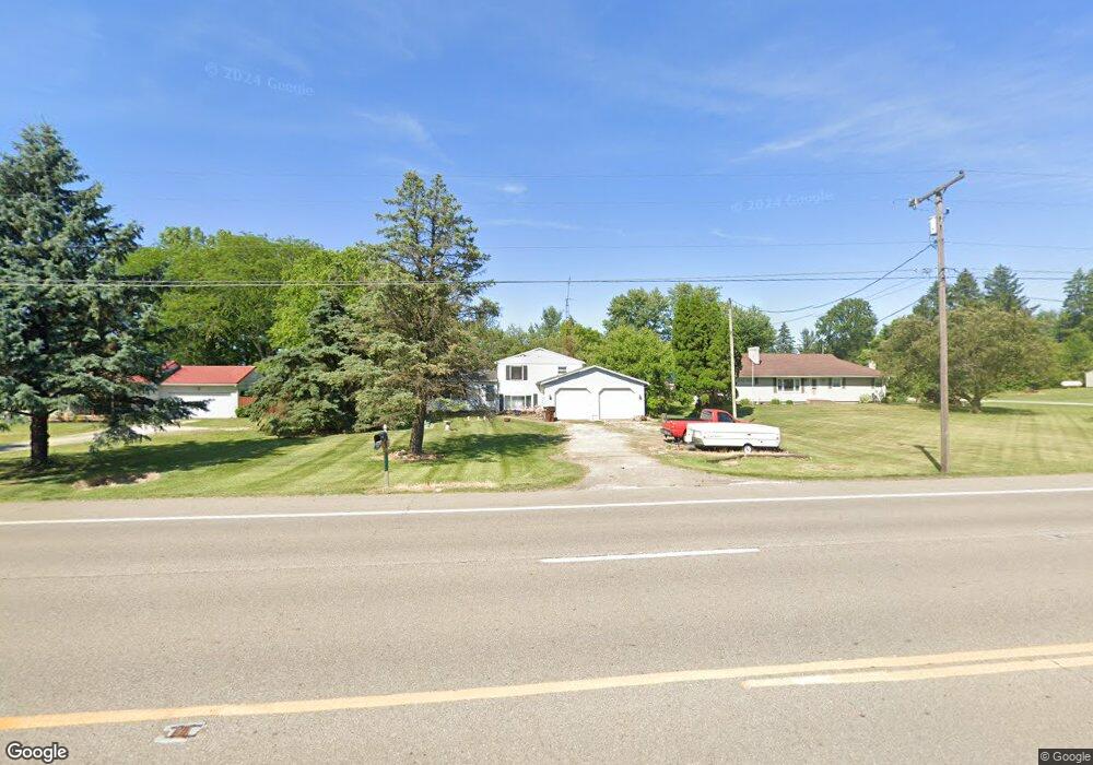
3529 State Route 39 Shelby, OH 44875
Estimated Value: $142,000 - $197,000
4
Beds
2
Baths
1,569
Sq Ft
$107/Sq Ft
Est. Value
About This Home
This home is located at 3529 State Route 39, Shelby, OH 44875 and is currently estimated at $168,065, approximately $107 per square foot. 3529 State Route 39 is a home located in Richland County with nearby schools including St. Mary's School.
Ownership History
Date
Name
Owned For
Owner Type
Purchase Details
Closed on
Sep 9, 2019
Sold by
Merwine Larry D and Merwine Larry
Bought by
Aji Properties Of Mansfield Llc
Current Estimated Value
Purchase Details
Closed on
Jun 15, 2015
Sold by
Smith Shannon L and Smith Bradley A
Bought by
Marwine Larry
Purchase Details
Closed on
Feb 5, 2009
Sold by
Smith Bradley A and Smith Shannon L
Bought by
Adams Julie and Adams Robert
Home Financials for this Owner
Home Financials are based on the most recent Mortgage that was taken out on this home.
Original Mortgage
$87,875
Interest Rate
7.5%
Mortgage Type
Seller Take Back
Purchase Details
Closed on
Sep 28, 2001
Sold by
Roscoe Frederic H
Bought by
Smith Shannon L and Smith Bradley A
Home Financials for this Owner
Home Financials are based on the most recent Mortgage that was taken out on this home.
Original Mortgage
$62,050
Interest Rate
6.97%
Mortgage Type
New Conventional
Purchase Details
Closed on
Jul 1, 1985
Create a Home Valuation Report for This Property
The Home Valuation Report is an in-depth analysis detailing your home's value as well as a comparison with similar homes in the area
Home Values in the Area
Average Home Value in this Area
Purchase History
| Date | Buyer | Sale Price | Title Company |
|---|---|---|---|
| Aji Properties Of Mansfield Llc | -- | None Available | |
| Marwine Larry | $27,000 | Attorney | |
| Adams Julie | $92,500 | Attorney | |
| Smith Shannon L | $64,000 | -- | |
| -- | $39,500 | -- |
Source: Public Records
Mortgage History
| Date | Status | Borrower | Loan Amount |
|---|---|---|---|
| Previous Owner | Adams Julie | $87,875 | |
| Previous Owner | Smith Shannon L | $62,050 |
Source: Public Records
Tax History Compared to Growth
Tax History
| Year | Tax Paid | Tax Assessment Tax Assessment Total Assessment is a certain percentage of the fair market value that is determined by local assessors to be the total taxable value of land and additions on the property. | Land | Improvement |
|---|---|---|---|---|
| 2024 | $1,315 | $33,850 | $5,850 | $28,000 |
| 2023 | $1,315 | $33,850 | $5,850 | $28,000 |
| 2022 | $1,207 | $27,720 | $5,650 | $22,070 |
| 2021 | $1,208 | $27,720 | $5,650 | $22,070 |
| 2020 | $1,209 | $27,720 | $5,650 | $22,070 |
| 2019 | $1,114 | $23,520 | $4,790 | $18,730 |
| 2018 | $1,092 | $23,520 | $4,790 | $18,730 |
| 2017 | $1,071 | $23,520 | $4,790 | $18,730 |
| 2016 | $1,059 | $23,240 | $3,990 | $19,250 |
| 2015 | $725 | $23,240 | $3,990 | $19,250 |
| 2014 | $991 | $23,240 | $3,990 | $19,250 |
| 2012 | $490 | $23,240 | $3,990 | $19,250 |
Source: Public Records
Map
Nearby Homes
- 3596 Ohio 39
- 3400 Rock Rd
- 3763 State Route 39
- 3389 Wareham Rd
- 3619 Springmill Rd N
- 0 Technology Pkwy
- 38 Woodland Rd
- 31 Sherwood Dr
- 116 Mansfield Ave
- 1845 Taylortown Rd
- 228 E Main St
- 226 E Main St
- 671 Bendle Ave
- 624 Bendle Ave
- 2674 Stiving Rd
- 70 Mansfield Ave
- 2392 E Smiley Rd
- 221 S Gamble St
- 2484 E Smiley Rd
- 37 Grand Blvd
- 3552 State Route 39
- 3520 State Route 39
- 3572 Alvin Rd
- 3556 State Route 39
- 3552 Ohio 39
- 3606 Alvin Rd
- 3568 Alvin Rd
- 3494 State Route 39
- 3517 State Route 39
- 3549 State Route 39
- 3560 State Route 39
- 3560 Alvin Rd
- 3551 Ohio 39
- 3491 State Route 39
- 3551 State Route 39
- 3484 State Route 39
- 2953 Dale Rd
- 3575 Alvin Rd
- 3611 Alvin Rd
- 3585 Alvin Rd