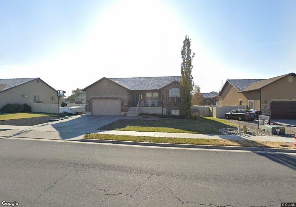
3529 W 1500 N Clearfield, UT 84015
Estimated Value: $567,000 - $591,000
5
Beds
3
Baths
2,754
Sq Ft
$211/Sq Ft
Est. Value
About This Home
This home is located at 3529 W 1500 N, Clearfield, UT 84015 and is currently estimated at $581,519, approximately $211 per square foot. 3529 W 1500 N is a home located in Davis County with nearby schools including West Point School, West Point Junior High School, and Syracuse High School.
Ownership History
Date
Name
Owned For
Owner Type
Purchase Details
Closed on
Jan 5, 2016
Sold by
Morrill Phillip L and Morrill Crystal H
Bought by
Haltinner Robert E
Current Estimated Value
Purchase Details
Closed on
Jan 5, 2015
Sold by
Haltinner Robert E
Bought by
Haltinner Robert E and Haltinner Heather
Purchase Details
Closed on
Sep 2, 2009
Sold by
Bartholomew Lane Llc
Bought by
Craythorne Construction Co Inc
Purchase Details
Closed on
Aug 28, 2009
Sold by
Craythorne Construction Co Inc
Bought by
Utah Housing Corporation
Purchase Details
Closed on
Apr 6, 2009
Sold by
Bretwood Company Inc
Bought by
Bartholomew Lane Llc
Create a Home Valuation Report for This Property
The Home Valuation Report is an in-depth analysis detailing your home's value as well as a comparison with similar homes in the area
Home Values in the Area
Average Home Value in this Area
Purchase History
| Date | Buyer | Sale Price | Title Company |
|---|---|---|---|
| Haltinner Robert E | -- | Stewart Title | |
| Haltinner Robert E | -- | Founders Title | |
| Craythorne Construction Co Inc | -- | Accommodation | |
| Utah Housing Corporation | -- | Security Title Of Davis Cnty | |
| Bartholomew Lane Llc | -- | Security Title Of Davis Co |
Source: Public Records
Tax History Compared to Growth
Tax History
| Year | Tax Paid | Tax Assessment Tax Assessment Total Assessment is a certain percentage of the fair market value that is determined by local assessors to be the total taxable value of land and additions on the property. | Land | Improvement |
|---|---|---|---|---|
| 2025 | $3,116 | $292,050 | $112,687 | $179,363 |
| 2024 | $2,992 | $281,600 | $101,452 | $180,148 |
| 2023 | $2,766 | $479,000 | $126,380 | $352,620 |
| 2022 | $3,000 | $284,350 | $65,716 | $218,634 |
| 2021 | $2,814 | $399,000 | $102,765 | $296,235 |
| 2020 | $2,416 | $338,000 | $86,316 | $251,684 |
| 2019 | $2,443 | $337,000 | $83,748 | $253,252 |
| 2018 | $2,250 | $306,000 | $83,784 | $222,216 |
| 2016 | $1,970 | $140,965 | $28,187 | $112,778 |
| 2015 | $1,996 | $135,355 | $28,187 | $107,168 |
| 2014 | $1,774 | $121,970 | $28,187 | $93,783 |
| 2013 | -- | $79,200 | $28,205 | $50,995 |
Source: Public Records
Map
Nearby Homes
- 1403 N 3850 W
- 3892 W 1450 N
- 3656 W 1800 N
- 3168 W 1300 N
- 2413 N Eurasian Crane Rd
- 3941 W 1800 N
- 2921 W 1300 N
- 2118 Snowy Crane Dr
- 4469 W 1000 N Unit 120
- 3918 W 825 N Unit WF6
- 3932 W 825 N Unit WF5
- 3877 W 825 N Unit WF21
- 4302 W 1550 N
- 3721 W 825 N Unit 101
- Torino Farmhouse Plan at Cranefield Estates
- 2000 Traditional Plan at Cranefield Estates - Estates Collection
- Murano Traditional Plan at Cranefield Estates - Estates Collection
- 2400 Farmhouse Plan at Cranefield Estates - Estates Collection
- 1825 Traditional Plan at Cranefield Estates - Estates Collection
- 1550 Craftsman Plan at Cranefield Estates - Estates Collection
- 3517 W 1500 N
- 3543 W 1500 N
- 3534 W 1450 N
- 3546 W 1450 N
- 3501 W 1500 N
- 3557 W 1500 N
- 3522 W 1450 N
- 3528 W 1500 N
- 3542 W 1500 N
- 3558 W 1450 N
- 3516 W 1500 N
- 3556 W 1500 N Unit 138
- 3556 W 1500 N Unit 136
- 3556 W 1500 N Unit 130
- 3569 W 1500 N
- 3502 W 1500 N
- 3518 W 1450 N
- 3572 W 1450 N
- 1497 N 3455 W
- 1497 N 3455 W Unit 9