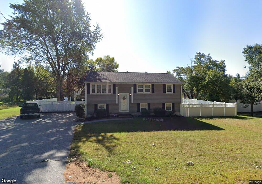
353 Andover Rd Billerica, MA 01821
Estimated Value: $660,000 - $706,141
3
Beds
2
Baths
1,570
Sq Ft
$436/Sq Ft
Est. Value
About This Home
This home is located at 353 Andover Rd, Billerica, MA 01821 and is currently estimated at $683,785, approximately $435 per square foot. 353 Andover Rd is a home located in Middlesex County with nearby schools including Billerica Memorial High School.
Ownership History
Date
Name
Owned For
Owner Type
Purchase Details
Closed on
Apr 16, 1987
Sold by
Shattes John J
Bought by
Buckley James H
Current Estimated Value
Home Financials for this Owner
Home Financials are based on the most recent Mortgage that was taken out on this home.
Original Mortgage
$130,500
Interest Rate
8.97%
Mortgage Type
Purchase Money Mortgage
Create a Home Valuation Report for This Property
The Home Valuation Report is an in-depth analysis detailing your home's value as well as a comparison with similar homes in the area
Home Values in the Area
Average Home Value in this Area
Purchase History
| Date | Buyer | Sale Price | Title Company |
|---|---|---|---|
| Buckley James H | $145,000 | -- |
Source: Public Records
Mortgage History
| Date | Status | Borrower | Loan Amount |
|---|---|---|---|
| Open | Buckley James H | $200,000 | |
| Closed | Buckley James H | $44,000 | |
| Closed | Buckley James H | $130,500 |
Source: Public Records
Tax History Compared to Growth
Tax History
| Year | Tax Paid | Tax Assessment Tax Assessment Total Assessment is a certain percentage of the fair market value that is determined by local assessors to be the total taxable value of land and additions on the property. | Land | Improvement |
|---|---|---|---|---|
| 2025 | $6,655 | $585,300 | $285,300 | $300,000 |
| 2024 | $5,874 | $520,300 | $258,100 | $262,200 |
| 2023 | $5,591 | $471,000 | $218,800 | $252,200 |
| 2022 | $5,344 | $422,800 | $201,400 | $221,400 |
| 2021 | $8,007 | $402,500 | $188,600 | $213,900 |
| 2020 | $6,015 | $395,100 | $181,200 | $213,900 |
| 2019 | $4,707 | $349,200 | $159,400 | $189,800 |
| 2018 | $4,626 | $326,000 | $147,700 | $178,300 |
| 2017 | $4,262 | $302,500 | $141,000 | $161,500 |
| 2016 | $4,253 | $300,800 | $139,300 | $161,500 |
| 2015 | $4,153 | $295,800 | $134,300 | $161,500 |
| 2014 | $4,157 | $290,900 | $126,200 | $164,700 |
Source: Public Records
Map
Nearby Homes
- 12 Brookside Dr
- 351 Andover Rd
- 14 Brookside Dr
- 349 Andover Rd
- 369 Andover Rd
- 10 Brookside Dr
- 8 Brookside Dr
- 338 Andover Rd
- 350 Andover Rd
- 352 Andover Rd
- 347 Andover Rd
- 354 Andover Rd
- 373 Andover Rd
- 13 Brookside Dr
- 11 Brookside Dr
- 18 Brookside Dr
- 3 Morningside Dr
- 9 Brookside Dr
- 15 Brookside Dr
- 7 Brookside Dr