Estimated Value: $314,000 - $360,000
4
Beds
2
Baths
2,828
Sq Ft
$119/Sq Ft
Est. Value
About This Home
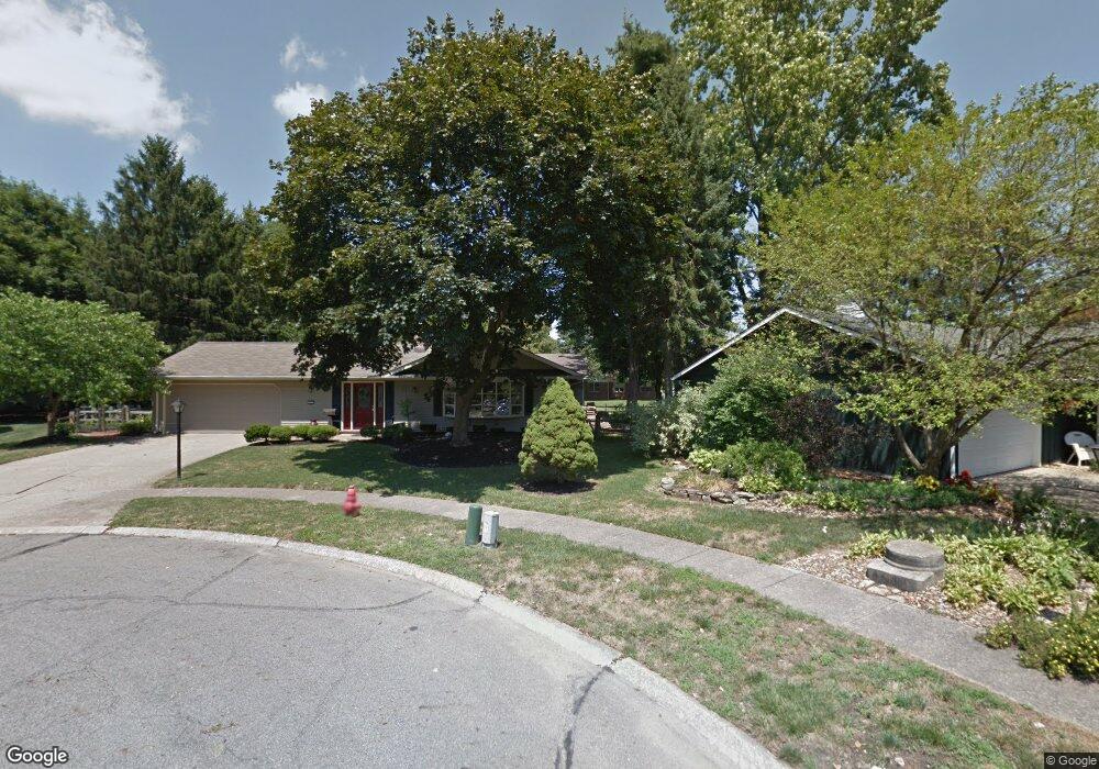
This home is located at 353 Brockton Cir, Berea, OH 44017 and is currently estimated at $335,415, approximately $118 per square foot. 353 Brockton Cir is a home located in Cuyahoga County with nearby schools including Grindstone Elementary School, Berea-Midpark Middle School, and Berea-Midpark High School.
Ownership History
Date
Name
Owned For
Owner Type
Purchase Details
Closed on
Feb 21, 2001
Sold by
Zuercher Ricky W
Bought by
Reitman Robert J and Reitman Barbara A
Current Estimated Value
Purchase Details
Closed on
May 10, 1996
Sold by
Wadovick David J
Bought by
Zuercher Ricky W and Zuercher Regan A
Home Financials for this Owner
Home Financials are based on the most recent Mortgage that was taken out on this home.
Original Mortgage
$139,400
Interest Rate
7.78%
Mortgage Type
Balloon
Purchase Details
Closed on
Jan 1, 1975
Bought by
Wadovick David J and Wadovick Carol E
Create a Home Valuation Report for This Property
The Home Valuation Report is an in-depth analysis detailing your home's value as well as a comparison with similar homes in the area
Home Values in the Area
Average Home Value in this Area
Purchase History
| Date | Buyer | Sale Price | Title Company |
|---|---|---|---|
| Reitman Robert J | $170,000 | Midland Title Security Inc | |
| Zuercher Ricky W | $154,900 | -- | |
| Wadovick David J | -- | -- |
Source: Public Records
Mortgage History
| Date | Status | Borrower | Loan Amount |
|---|---|---|---|
| Closed | Zuercher Ricky W | $139,400 |
Source: Public Records
Tax History Compared to Growth
Tax History
| Year | Tax Paid | Tax Assessment Tax Assessment Total Assessment is a certain percentage of the fair market value that is determined by local assessors to be the total taxable value of land and additions on the property. | Land | Improvement |
|---|---|---|---|---|
| 2024 | $6,337 | $109,620 | $15,855 | $93,765 |
| 2023 | $5,477 | $79,310 | $13,510 | $65,800 |
| 2022 | $5,443 | $79,310 | $13,510 | $65,800 |
| 2021 | $5,397 | $79,310 | $13,510 | $65,800 |
| 2020 | $5,155 | $67,200 | $11,450 | $55,760 |
| 2019 | $5,018 | $192,000 | $32,700 | $159,300 |
| 2018 | $4,982 | $67,200 | $11,450 | $55,760 |
| 2017 | $4,481 | $56,010 | $10,330 | $45,680 |
| 2016 | $4,448 | $56,010 | $10,330 | $45,680 |
| 2015 | $4,424 | $56,010 | $10,330 | $45,680 |
| 2014 | $4,424 | $58,950 | $10,890 | $48,060 |
Source: Public Records
Map
Nearby Homes
- 8797 Westlawn Blvd
- 396 Crossbrook Dr
- 617 Lindberg Blvd
- Passionflower II Plan at Aspire at Longbrooke
- Daffodil II Plan at Aspire at Longbrooke
- 549 Wyleswood Dr
- 543 Wyleswood Dr
- 537 Wyleswood Dr
- 517 Wyleswood Dr
- 294 West St
- 405 Baldwin Dr
- 266 Race St
- 732 Wyleswood Dr
- 540 Crossbrook Dr
- 626 Ensenada Ct Unit 5
- 580 Crossbrook Dr
- 214 Race St
- 8757 Roberts Ct Unit 25C
- 8873 Ashlyn Ct Unit 13A
- 585 Woodmere Dr
- 356 Brockton Cir
- 355 Brockton Cir
- 335 Crossbrook Dr
- 362 Brockton Cir
- 361 Brockton Cir
- 341 Crossbrook Dr
- 327 Crossbrook Dr
- 368 Brockton Cir
- 345 Crossbrook Dr
- 367 Brockton Cir
- 500 Brigton Dr
- 321 Crossbrook Dr
- 500 Race St
- 351 Crossbrook Dr
- 510 Race St
- 354 Beeler Dr
- 375 Brockton Cir
- 360 Beeler Dr
- 315 Crossbrook Dr
- 366 Beeler Dr