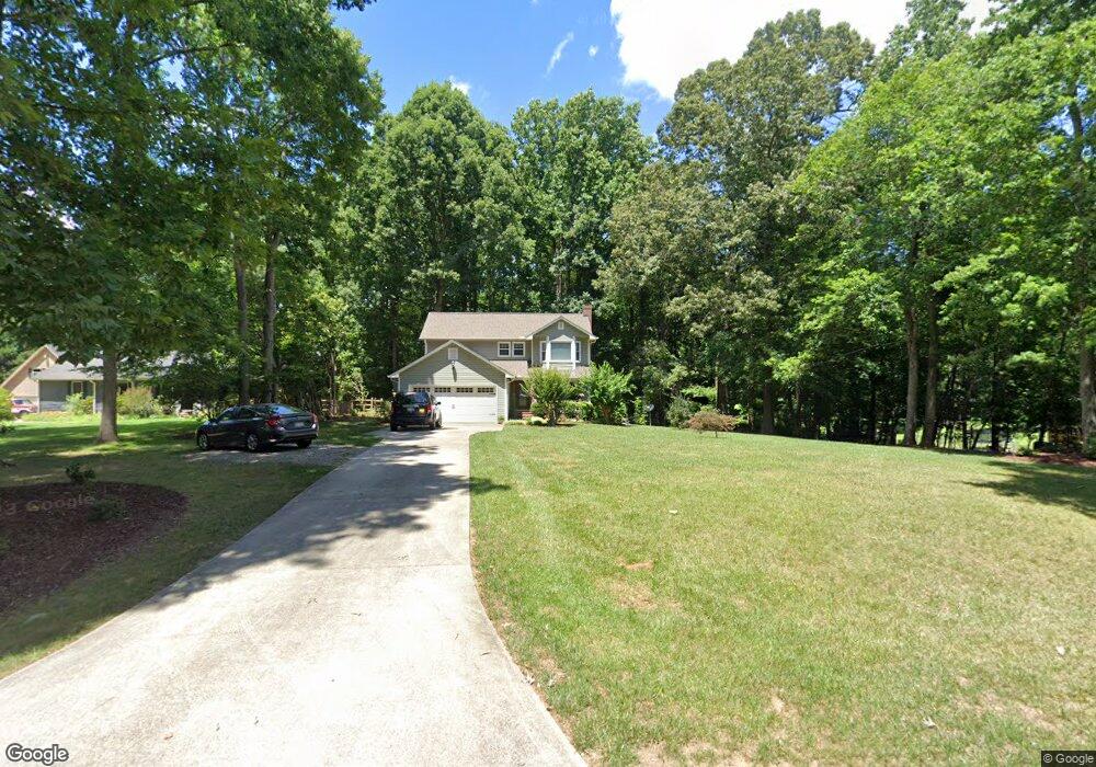
353 Canterwood Dr Mebane, NC 27302
Estimated Value: $388,000 - $485,000
3
Beds
3
Baths
1,912
Sq Ft
$217/Sq Ft
Est. Value
About This Home
This home is located at 353 Canterwood Dr, Mebane, NC 27302 and is currently estimated at $414,729, approximately $216 per square foot. 353 Canterwood Dr is a home located in Alamance County with nearby schools including E.M. Yoder Elementary School, Woodlawn Middle School, and Eastern Alamance High School.
Ownership History
Date
Name
Owned For
Owner Type
Purchase Details
Closed on
May 23, 2023
Sold by
Edwards Teresa Smith Le
Bought by
Kennedy Emily Blair and Cook Kevin Bryan
Current Estimated Value
Purchase Details
Closed on
Jun 23, 2015
Sold by
Edwards Dean R
Bought by
Edwards Teresa S
Home Financials for this Owner
Home Financials are based on the most recent Mortgage that was taken out on this home.
Original Mortgage
$93,500
Interest Rate
3.92%
Mortgage Type
New Conventional
Create a Home Valuation Report for This Property
The Home Valuation Report is an in-depth analysis detailing your home's value as well as a comparison with similar homes in the area
Home Values in the Area
Average Home Value in this Area
Purchase History
| Date | Buyer | Sale Price | Title Company |
|---|---|---|---|
| Kennedy Emily Blair | -- | None Listed On Document | |
| Edwards Teresa S | -- | -- |
Source: Public Records
Mortgage History
| Date | Status | Borrower | Loan Amount |
|---|---|---|---|
| Previous Owner | Edwards Teresa S | $93,500 |
Source: Public Records
Tax History Compared to Growth
Tax History
| Year | Tax Paid | Tax Assessment Tax Assessment Total Assessment is a certain percentage of the fair market value that is determined by local assessors to be the total taxable value of land and additions on the property. | Land | Improvement |
|---|---|---|---|---|
| 2025 | $1,819 | $322,600 | $78,312 | $244,288 |
| 2024 | $1,739 | $322,600 | $78,312 | $244,288 |
| 2023 | $1,611 | $322,600 | $78,312 | $244,288 |
| 2022 | $1,404 | $186,880 | $53,410 | $133,470 |
| 2021 | $1,422 | $186,880 | $53,410 | $133,470 |
| 2020 | $1,441 | $186,880 | $53,410 | $133,470 |
| 2019 | $1,448 | $186,880 | $53,410 | $133,470 |
| 2018 | $0 | $186,880 | $53,410 | $133,470 |
| 2017 | $1,274 | $186,880 | $53,410 | $133,470 |
| 2016 | $1,353 | $197,452 | $51,705 | $145,747 |
| 2015 | $1,346 | $197,452 | $51,705 | $145,747 |
| 2014 | $1,248 | $197,452 | $51,705 | $145,747 |
Source: Public Records
Map
Nearby Homes
- 106 Garrison Farm Rd
- 0 W Lake Trail Unit 10126145
- 0 W Lake Trail Unit 10127843
- 426 Fitch Dr
- 1002 Pleasant Dr
- 0 Smith Dr
- 3750 Mebane Rogers Rd
- 714 W Mckinley St
- 701 N Carr St
- 612 N Carr St
- 0 Roosevelt St
- 421 W Holt St
- 402 W Clay St
- 3656 Bason Rd
- 3542 Bason Rd
- 1289 Hammond Dr
- 1273 Hammond Dr
- 1239 Hammond Dr
- Litchfield Plan at North First Street Townes
- 1137 Tembrook Dr
- 363 Canterwood Dr
- 103 Canterwood Dr
- LOT35 Canterwood Dr
- 341 Canterwood Dr
- 375 Canterwood Dr
- 360 Canterwood Dr
- 346 Canterwood Dr
- 374 Canterwood Dr
- 329 Canterwood Dr
- 330 Canterwood Dr
- 407 Canterwood Dr
- 406 Canterwood Dr
- 317 Canterwood Dr
- 421 Canterwood Dr
- 318 Canterwood Dr
- 420 Canterwood Dr
- 35 Canterwood Dr
- 309 Canterwood Dr
- 433 Canterwood Dr
- 434 Canterwood Dr