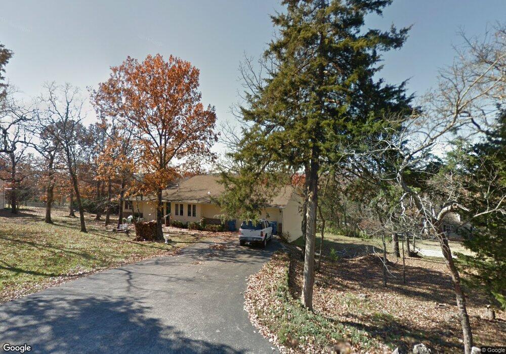
353 Cougar Trail E Branson, MO 65616
Estimated Value: $429,004 - $485,000
4
Beds
3
Baths
3,436
Sq Ft
$133/Sq Ft
Est. Value
About This Home
This home is located at 353 Cougar Trail E, Branson, MO 65616 and is currently estimated at $458,251, approximately $133 per square foot. 353 Cougar Trail E is a home located in Taney County with nearby schools including Cedar Ridge Primary, Cedar Ridge Intermediate School, and Cedar Ridge Elementary School.
Ownership History
Date
Name
Owned For
Owner Type
Purchase Details
Closed on
Oct 20, 2014
Sold by
Zieman Cindy and Howell Cindy L
Bought by
Stringer Jeffrey L and Stringer Shanda Lynn
Current Estimated Value
Home Financials for this Owner
Home Financials are based on the most recent Mortgage that was taken out on this home.
Original Mortgage
$202,000
Outstanding Balance
$154,530
Interest Rate
4.12%
Mortgage Type
Construction
Estimated Equity
$303,721
Purchase Details
Closed on
Jul 2, 2012
Sold by
Howell Clyde
Bought by
Howell Cindy
Purchase Details
Closed on
Jan 9, 2012
Sold by
Happy Hollow Community Dock
Bought by
Bausano Karen and Bausano Domenick
Purchase Details
Closed on
Aug 23, 2006
Sold by
Barnett Everlette E and Barnett Mary L
Bought by
Sunterra Fall Creek Development Llc
Create a Home Valuation Report for This Property
The Home Valuation Report is an in-depth analysis detailing your home's value as well as a comparison with similar homes in the area
Purchase History
| Date | Buyer | Sale Price | Title Company |
|---|---|---|---|
| Stringer Jeffrey L | -- | None Available | |
| Howell Cindy | -- | None Available | |
| Bausano Karen | -- | None Available | |
| Sunterra Fall Creek Development Llc | -- | -- |
Source: Public Records
Mortgage History
| Date | Status | Borrower | Loan Amount |
|---|---|---|---|
| Open | Stringer Jeffrey L | $202,000 |
Source: Public Records
Tax History
| Year | Tax Paid | Tax Assessment Tax Assessment Total Assessment is a certain percentage of the fair market value that is determined by local assessors to be the total taxable value of land and additions on the property. | Land | Improvement |
|---|---|---|---|---|
| 2025 | $2,111 | $35,810 | -- | -- |
| 2024 | $2,111 | $40,680 | -- | -- |
| 2023 | $2,111 | $40,680 | -- | -- |
| 2022 | $2,051 | $40,680 | $0 | $0 |
| 2021 | $2,040 | $40,680 | $0 | $0 |
| 2019 | $1,857 | $36,090 | $0 | $0 |
| 2018 | $1,860 | $36,090 | $0 | $0 |
| 2017 | $1,802 | $35,320 | $0 | $0 |
| 2016 | $1,799 | $35,320 | $0 | $0 |
| 2015 | $1,783 | $35,320 | $0 | $0 |
| 2014 | $1,632 | $33,800 | $0 | $0 |
Source: Public Records
Map
Nearby Homes
- 371 Cougar Trail E
- 272 Valencia Rd Unit 2
- 150 Woodson Bend Rd
- 182 Woodson Bend Rd
- 1413 Riverstone Dr
- 1206 Riverstone Dr
- 22 Willow Ct
- 521 Cozy Ln
- 245 William Place
- 5 Maple Ct
- 25 Oak Ct
- 216 Deano Rd
- 282 Thistle Rd
- 223 North Fork
- 165 Gloria Ct
- 7863 Cozy Cove Rd
- 7860 Cozy Cove Rd Unit 60
- 78 Cozy Cove Rd Unit 45
- 78 Cozy Cove Rd Unit 27
- 134 Cozy Ct Unit 149-4
- 348 Cougar Trail W
- 0 Cougar Trail E Unit 11116320
- 0 Cougar Trail E Unit 11215287
- Tbd Cougar Trail E
- 0 Cougar Trail E
- 379 Cougar Trail W
- 310 Cougar Trail W
- 310 Cougar Trail E
- 353 Cougar Trail W
- 372 Cougar Trail E
- 403 Cougar Trail E
- 339 Cougar Trail W
- 324 Cougar Trail E
- 394 Cougar Trail E
- 339 Cougar Trail E
- 279 Cougar Trail E
- 309 Cougar Trail E
- 309 Cougar Trail W
- 414 Cougar Trail E
- 278 Cougar Trail E
Your Personal Tour Guide
Ask me questions while you tour the home.