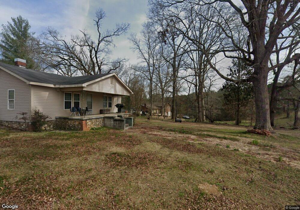
353 Edwards Rd Cedartown, GA 30125
Estimated Value: $164,000 - $283,000
3
Beds
2
Baths
1,856
Sq Ft
$116/Sq Ft
Est. Value
About This Home
This home is located at 353 Edwards Rd, Cedartown, GA 30125 and is currently estimated at $215,627, approximately $116 per square foot. 353 Edwards Rd is a home located in Polk County with nearby schools including Cedar Christian School.
Ownership History
Date
Name
Owned For
Owner Type
Purchase Details
Closed on
Apr 4, 2019
Sold by
Carney Patricia
Bought by
Patterson Butch
Current Estimated Value
Home Financials for this Owner
Home Financials are based on the most recent Mortgage that was taken out on this home.
Original Mortgage
$70,204
Outstanding Balance
$59,112
Interest Rate
4.87%
Mortgage Type
FHA
Estimated Equity
$156,515
Purchase Details
Closed on
Apr 11, 2013
Sold by
Puckett Patricia C
Bought by
Carney Daniel L and Carney Patricia A
Purchase Details
Closed on
Feb 22, 1980
Sold by
Puckett Kermit R
Bought by
Puckett Patricia C
Purchase Details
Closed on
Oct 1, 1972
Bought by
Puckett Kermit R
Create a Home Valuation Report for This Property
The Home Valuation Report is an in-depth analysis detailing your home's value as well as a comparison with similar homes in the area
Home Values in the Area
Average Home Value in this Area
Purchase History
| Date | Buyer | Sale Price | Title Company |
|---|---|---|---|
| Patterson Butch | $71,500 | -- | |
| Carney Daniel L | -- | -- | |
| Puckett Patricia C | -- | -- | |
| Puckett Kermit R | -- | -- |
Source: Public Records
Mortgage History
| Date | Status | Borrower | Loan Amount |
|---|---|---|---|
| Open | Patterson Butch | $70,204 |
Source: Public Records
Tax History Compared to Growth
Tax History
| Year | Tax Paid | Tax Assessment Tax Assessment Total Assessment is a certain percentage of the fair market value that is determined by local assessors to be the total taxable value of land and additions on the property. | Land | Improvement |
|---|---|---|---|---|
| 2024 | $1,249 | $59,735 | $1,516 | $58,219 |
| 2023 | $947 | $39,891 | $1,516 | $38,375 |
| 2022 | $817 | $34,414 | $1,011 | $33,403 |
| 2021 | $827 | $34,414 | $1,011 | $33,403 |
| 2020 | $689 | $34,414 | $1,011 | $33,403 |
| 2019 | $332 | $25,692 | $1,011 | $24,681 |
| 2018 | $307 | $24,477 | $1,011 | $23,466 |
| 2017 | $299 | $24,477 | $1,011 | $23,466 |
| 2016 | $289 | $24,106 | $640 | $23,466 |
| 2015 | $289 | $24,106 | $640 | $23,466 |
| 2014 | $663 | $24,106 | $640 | $23,466 |
Source: Public Records
Map
Nearby Homes
- 1849 Prior Station Rd Unit 76 ACRES
- 1849 Prior Station Rd
- 119 New Harmony Rd
- 0 Mountain Home Rd Unit 1020-C 10351948
- 0 Mountain Home Rd Unit 1020-B 10351940
- 0 Mountain Home Rd Unit 1020-A 10351930
- 151 Friendship Rd
- 255 Reynolds Rd
- 35 Harris Loop
- 0 Cornelius Rd Unit 7646589
- 123 Santa Claus Rd
- 1806 Piedmont Hwy
- 1810 Piedmont Hwy
- 382 5th St
- 293 4th St
- 516 Branch St
- 512 Branch St
- 508 Branch St
- 39 Summerwind Dr
- 28 Summerwind Dr
- 343 Edwards Rd
- 331 Edwards Rd
- 1612 Prior Station Rd
- 336 Edwards Rd
- 318 Edwards Rd
- 317 Edwards Rd
- 1626 Prior Station Rd
- 421 Edwards Rd
- 1495 Prior Station Rd
- 1485 Prior Station Rd
- 1472 Prior Station Rd
- 1475 Prior Station Rd
- 253 Edwards Rd
- 444 Edwards Rd
- 243 Edwards Rd
- 201 Edwards Rd
- 1028 Prior Station Rd
- 233 Edwards Rd
- 223 Edwards Rd
- 1431 Prior Station Rd