Estimated Value: $318,217 - $387,000
5
Beds
4
Baths
2,360
Sq Ft
$146/Sq Ft
Est. Value
About This Home
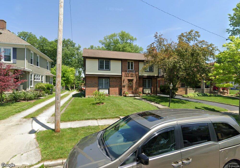
This home is located at 353 N King St, Xenia, OH 45385 and is currently estimated at $345,304, approximately $146 per square foot. 353 N King St is a home located in Greene County with nearby schools including Xenia High School, Summit Academy Community School for Alternative Learners - Xenia, and Legacy Christian Academy.
Ownership History
Date
Name
Owned For
Owner Type
Purchase Details
Closed on
May 10, 2017
Sold by
Hess Roy E and Hess Heather S
Bought by
Rutherford Kevin and Rutherford Cynthia A
Current Estimated Value
Home Financials for this Owner
Home Financials are based on the most recent Mortgage that was taken out on this home.
Original Mortgage
$148,000
Outstanding Balance
$123,013
Interest Rate
4.08%
Mortgage Type
Purchase Money Mortgage
Estimated Equity
$222,291
Purchase Details
Closed on
Jun 16, 2010
Sold by
Campbell J Timothy
Bought by
Hess Roy E and Hess Heather S
Home Financials for this Owner
Home Financials are based on the most recent Mortgage that was taken out on this home.
Original Mortgage
$181,555
Interest Rate
5.5%
Mortgage Type
FHA
Create a Home Valuation Report for This Property
The Home Valuation Report is an in-depth analysis detailing your home's value as well as a comparison with similar homes in the area
Home Values in the Area
Average Home Value in this Area
Purchase History
| Date | Buyer | Sale Price | Title Company |
|---|---|---|---|
| Rutherford Kevin | $185,000 | None Available | |
| Hess Roy E | $184,000 | Attorney |
Source: Public Records
Mortgage History
| Date | Status | Borrower | Loan Amount |
|---|---|---|---|
| Open | Rutherford Kevin | $148,000 | |
| Previous Owner | Hess Roy E | $181,555 |
Source: Public Records
Tax History Compared to Growth
Tax History
| Year | Tax Paid | Tax Assessment Tax Assessment Total Assessment is a certain percentage of the fair market value that is determined by local assessors to be the total taxable value of land and additions on the property. | Land | Improvement |
|---|---|---|---|---|
| 2024 | $3,784 | $90,750 | $9,640 | $81,110 |
| 2023 | $3,784 | $90,750 | $9,640 | $81,110 |
| 2022 | $3,240 | $66,260 | $6,030 | $60,230 |
| 2021 | $3,284 | $66,260 | $6,030 | $60,230 |
| 2020 | $3,143 | $66,260 | $6,030 | $60,230 |
| 2019 | $3,077 | $61,050 | $6,090 | $54,960 |
| 2018 | $3,171 | $61,050 | $6,090 | $54,960 |
| 2017 | $3,080 | $61,050 | $6,090 | $54,960 |
| 2016 | $3,240 | $61,210 | $6,090 | $55,120 |
| 2015 | $3,249 | $61,210 | $6,090 | $55,120 |
| 2014 | $3,111 | $61,210 | $6,090 | $55,120 |
Source: Public Records
Map
Nearby Homes
- 365 N King St
- 343 N King St
- 377 N King St
- 389 N King St
- 323 N King St
- 399 N King St
- 356 N King St
- 301 N King St
- 364 N King St
- 328 N King St
- 338 N King St
- 330 Detroit Blvd
- 330 N Detroit St
- 386 N King St
- 413 N King St
- 35 Union St
- 390 N Detroit St Unit 3
- 390 N Detroit St Unit 2
- 300 N King St
- 128 Shawnee St