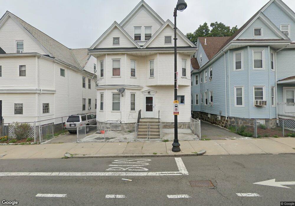
353 Norfolk St Dorchester Center, MA 02124
Franklin Field South NeighborhoodEstimated Value: $691,927 - $1,031,000
6
Beds
3
Baths
3,748
Sq Ft
$247/Sq Ft
Est. Value
About This Home
This home is located at 353 Norfolk St, Dorchester Center, MA 02124 and is currently estimated at $927,232, approximately $247 per square foot. 353 Norfolk St is a home located in Suffolk County with nearby schools including KIPP Academy Boston Charter School and Berea Seventh-day Adventist Academy.
Ownership History
Date
Name
Owned For
Owner Type
Purchase Details
Closed on
Dec 9, 2016
Sold by
Kenel Prinston Fritz and Kenel Prinston
Bought by
Prinston Fritz
Current Estimated Value
Purchase Details
Closed on
Oct 27, 1988
Sold by
Bien-Aime Y M
Bought by
Prinston Fritz
Home Financials for this Owner
Home Financials are based on the most recent Mortgage that was taken out on this home.
Original Mortgage
$124,000
Interest Rate
10.32%
Mortgage Type
Purchase Money Mortgage
Create a Home Valuation Report for This Property
The Home Valuation Report is an in-depth analysis detailing your home's value as well as a comparison with similar homes in the area
Home Values in the Area
Average Home Value in this Area
Purchase History
| Date | Buyer | Sale Price | Title Company |
|---|---|---|---|
| Prinston Fritz | -- | -- | |
| Prinston Fritz | $155,000 | -- |
Source: Public Records
Mortgage History
| Date | Status | Borrower | Loan Amount |
|---|---|---|---|
| Previous Owner | Prinston Fritz | $121,200 | |
| Previous Owner | Prinston Fritz | $124,000 | |
| Previous Owner | Prinston Fritz | $17,077 |
Source: Public Records
Tax History Compared to Growth
Tax History
| Year | Tax Paid | Tax Assessment Tax Assessment Total Assessment is a certain percentage of the fair market value that is determined by local assessors to be the total taxable value of land and additions on the property. | Land | Improvement |
|---|---|---|---|---|
| 2025 | $7,724 | $667,000 | $219,600 | $447,400 |
| 2024 | $7,582 | $695,600 | $267,800 | $427,800 |
| 2023 | $6,984 | $650,300 | $250,400 | $399,900 |
| 2022 | $6,488 | $596,300 | $229,600 | $366,700 |
| 2021 | $6,058 | $567,800 | $218,600 | $349,200 |
| 2020 | $5,426 | $513,800 | $215,100 | $298,700 |
| 2019 | $4,710 | $446,900 | $132,100 | $314,800 |
| 2018 | $4,071 | $388,500 | $132,100 | $256,400 |
| 2017 | $3,843 | $362,900 | $132,100 | $230,800 |
| 2016 | $3,472 | $315,600 | $132,100 | $183,500 |
| 2015 | $3,497 | $288,800 | $92,500 | $196,300 |
| 2014 | $3,158 | $251,000 | $92,500 | $158,500 |
Source: Public Records
Map
Nearby Homes
- 68 Mascot St
- 32 Crowell St
- 808 Morton St Unit 3
- 139 Selden St
- 18 Astoria St
- 251 Norfolk St Unit A
- 124 Selden St
- 14-16 Jacob St
- 10 Sutton St
- 240 Norfolk St
- 5 Sutton St
- 5 Sutton St Unit 3B
- 238 Norfolk St
- 67 Wildwood St
- 44 Evans St
- 71 Astoria St
- 69 Woolson St
- 10-12 Stow Rd
- 1 Lyford St
- 3 Lyford St Unit 1
- 351 Norfolk St
- 355 Norfolk St
- 100 Willowwood St
- 347 Norfolk St
- 347 Norfolk St Unit 3
- 98 Willowwood St
- 160 Ballou Ave Unit 162
- 158 Ballou Ave
- 383 Norfolk St
- 354 Norfolk St
- 354 Norfolk St Unit 3
- 343 Norfolk St
- 156 Ballou Ave
- 156 Ballou Ave Unit 2
- 368 Norfolk St
- 352 Norfolk St
- 352 Norfolk St
- 352 Norfolk St Unit 1
- 352 Norfolk St Unit 3
- 387 Norfolk St