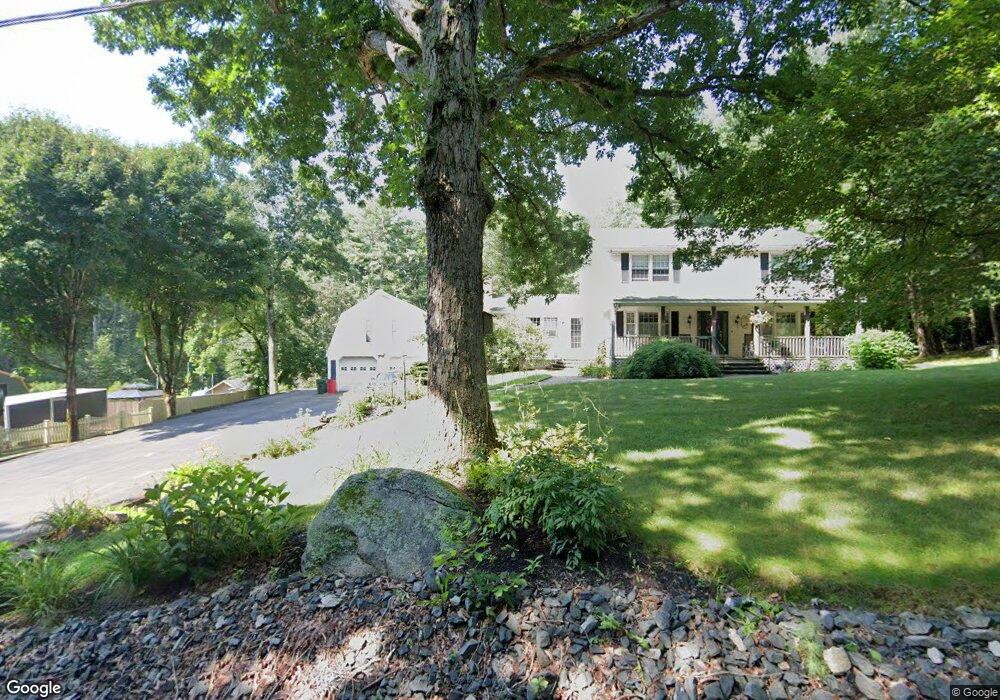
353 Pollard Rd Northbridge, MA 01534
Estimated Value: $641,033 - $717,000
3
Beds
3
Baths
2,002
Sq Ft
$339/Sq Ft
Est. Value
About This Home
This home is located at 353 Pollard Rd, Northbridge, MA 01534 and is currently estimated at $679,258, approximately $339 per square foot. 353 Pollard Rd is a home located in Worcester County with nearby schools including Northbridge Elementary School, Northbridge Middle School, and Northbridge High School.
Ownership History
Date
Name
Owned For
Owner Type
Purchase Details
Closed on
Aug 28, 1975
Bought by
Laflamme James L
Current Estimated Value
Create a Home Valuation Report for This Property
The Home Valuation Report is an in-depth analysis detailing your home's value as well as a comparison with similar homes in the area
Home Values in the Area
Average Home Value in this Area
Purchase History
| Date | Buyer | Sale Price | Title Company |
|---|---|---|---|
| Laflamme James L | -- | -- |
Source: Public Records
Mortgage History
| Date | Status | Borrower | Loan Amount |
|---|---|---|---|
| Open | Laflamme James L | $15,000 | |
| Closed | Laflamme James L | $35,000 |
Source: Public Records
Tax History Compared to Growth
Tax History
| Year | Tax Paid | Tax Assessment Tax Assessment Total Assessment is a certain percentage of the fair market value that is determined by local assessors to be the total taxable value of land and additions on the property. | Land | Improvement |
|---|---|---|---|---|
| 2025 | $7,260 | $615,800 | $192,900 | $422,900 |
| 2024 | $6,705 | $554,600 | $192,900 | $361,700 |
| 2023 | $6,540 | $504,600 | $177,200 | $327,400 |
| 2022 | $6,030 | $437,900 | $137,600 | $300,300 |
| 2021 | $3,070 | $404,600 | $131,200 | $273,400 |
| 2020 | $411 | $393,600 | $131,200 | $262,400 |
| 2019 | $4,926 | $379,800 | $131,200 | $248,600 |
| 2018 | $3,811 | $365,400 | $125,000 | $240,400 |
| 2017 | $4,721 | $348,900 | $125,000 | $223,900 |
| 2016 | $4,547 | $330,700 | $113,800 | $216,900 |
| 2015 | $4,425 | $330,700 | $113,800 | $216,900 |
| 2014 | $4,385 | $330,700 | $113,800 | $216,900 |
Source: Public Records
Map
Nearby Homes
- 191 Hartness Rd
- 12 Central Turnpike
- 90 Leland Hill Rd
- 7 Central Turnpike
- 5 Wildflower Dr
- 29 Sampson St Unit 29
- 4 Greenlawn Ave
- 19 Wildflower Dr
- 50 Highland View Dr
- 55 Fisherville Terrace
- 82 Central Turnpike
- 44 Fisherville Terrace
- 51 Fisherville Terrace
- 58 Fisherville Terrace
- 86 Mikes Way Unit 86
- 84 Mikes Way Unit 84
- 7 Pine Hill Rd
- 395 Providence Rd Unit 4
- 109 Main St
- 29 Highland View Dr
- 367 Pollard Rd
- 337 Pollard Rd
- 382 Pollard Rd
- 381 Pollard Rd
- 356 Pollard Rd
- 385 Pollard Rd
- 311 Pollard Rd
- 395 Pollard Rd
- 316 Pollard Rd
- 396 Pollard Rd
- 295 Pollard Rd
- 304 Pollard Rd
- 290 Pollard Rd
- 418 Pollard Rd
- 275 Pollard Rd
- 423 Pollard Rd
- 210 Chipper Hill Rd
- 268 Pollard Rd
- 170 Chipper Hill Rd
- 252 Pollard Rd