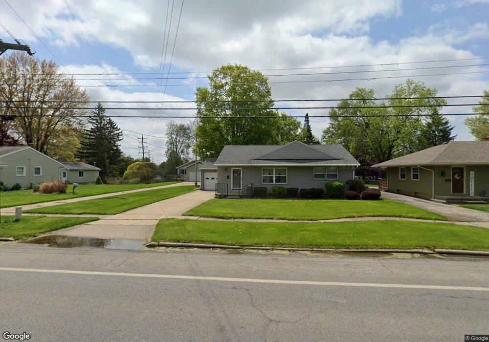
353 Riverside Ave Adrian, MI 49221
Estimated Value: $171,000 - $189,000
3
Beds
2
Baths
988
Sq Ft
$181/Sq Ft
Est. Value
About This Home
This home is located at 353 Riverside Ave, Adrian, MI 49221 and is currently estimated at $178,735, approximately $180 per square foot. 353 Riverside Ave is a home located in Lenawee County with nearby schools including Adrian High School, St. Joseph Academy, and St. Joseph's Academy.
Ownership History
Date
Name
Owned For
Owner Type
Purchase Details
Closed on
Jan 18, 2018
Sold by
Penney Virginia L
Bought by
Penney Virginia L
Current Estimated Value
Purchase Details
Closed on
May 8, 2009
Sold by
Dillon Linda S
Bought by
Penny Virginia L
Home Financials for this Owner
Home Financials are based on the most recent Mortgage that was taken out on this home.
Original Mortgage
$75,047
Outstanding Balance
$47,391
Interest Rate
4.84%
Mortgage Type
Purchase Money Mortgage
Estimated Equity
$131,344
Create a Home Valuation Report for This Property
The Home Valuation Report is an in-depth analysis detailing your home's value as well as a comparison with similar homes in the area
Home Values in the Area
Average Home Value in this Area
Purchase History
| Date | Buyer | Sale Price | Title Company |
|---|---|---|---|
| Penney Virginia L | -- | None Available | |
| Penny Virginia L | $75,000 | American Title Insurance Co |
Source: Public Records
Mortgage History
| Date | Status | Borrower | Loan Amount |
|---|---|---|---|
| Open | Penny Virginia L | $75,047 |
Source: Public Records
Tax History
| Year | Tax Paid | Tax Assessment Tax Assessment Total Assessment is a certain percentage of the fair market value that is determined by local assessors to be the total taxable value of land and additions on the property. | Land | Improvement |
|---|---|---|---|---|
| 2025 | $2,115 | $70,800 | $0 | $0 |
| 2024 | $18 | $64,500 | $0 | $0 |
| 2023 | $2,034 | $58,600 | $0 | $0 |
| 2022 | $1,723 | $52,400 | $0 | $0 |
| 2021 | $1,692 | $49,300 | $0 | $0 |
| 2020 | $1,686 | $46,600 | $0 | $0 |
| 2019 | $108,823 | $41,700 | $0 | $0 |
| 2018 | $1,630 | $45,953 | $0 | $0 |
| 2017 | $1,578 | $39,446 | $0 | $0 |
| 2016 | $1,566 | $37,950 | $0 | $0 |
| 2014 | -- | $36,700 | $0 | $0 |
Source: Public Records
Map
Nearby Homes
- 371 Riverside Ave
- 453 Riverside Ave
- 547 Riverside Ave
- 559 Northwestern Dr
- 710 Lakeshire Trail Unit 201E
- 306 Summer St
- 2550 Bent Oak Ave
- 770 Lakeshire Trail Unit 201 West
- 333 Greenly St
- 1001 Saw Mill Ct
- 1003 Saw Mill Ct
- 1005 Saw Mill Ct
- 1012 Saw Mill Ct
- 1007 Saw Mill Ct
- 227 Greenly St
- 1014 Saw Mill Ct
- 703 Company St
- 1016 Saw Mill Ct
- 1018 Saw Mill Ct
- 2697 Spielman Rd
- 359 Riverside Ave
- 347 Riverside Ave
- 365 Riverside Ave
- 335 Riverside Ave
- 329 Riverside Ave
- 722 Springbrook Ave
- 366 Helme Ave
- 366 Helme Ave Unit HELME
- 372 Helme Ave
- 360 Helme Ave
- 716 Springbrook Ave
- 716 Springbrook Ave Unit SPRING BROOK
- 728 Springbrook Ave
- 354 Helme Ave Unit Madison
- 354 Helme Ave
- 323 Riverside Ave
- 348 Helme Ave
- 377 Riverside Ave
- 342 Helme Ave
- 710 Springbrook Ave
Your Personal Tour Guide
Ask me questions while you tour the home.