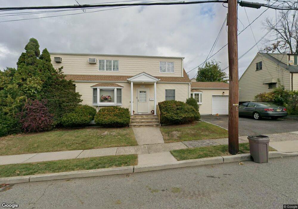
353 Thomas Ave Lyndhurst, NJ 07071
Estimated Value: $743,829 - $865,000
Studio
--
Bath
2,161
Sq Ft
$380/Sq Ft
Est. Value
About This Home
This home is located at 353 Thomas Ave, Lyndhurst, NJ 07071 and is currently estimated at $820,207, approximately $379 per square foot. 353 Thomas Ave is a home located in Bergen County with nearby schools including Lyndhurst High School and Sacred Heart School.
Ownership History
Date
Name
Owned For
Owner Type
Purchase Details
Closed on
Dec 17, 2002
Sold by
Padilla Xiomara
Bought by
Anastacio Valdemar A and Anastacio Alzira Neno
Current Estimated Value
Home Financials for this Owner
Home Financials are based on the most recent Mortgage that was taken out on this home.
Original Mortgage
$370,000
Outstanding Balance
$156,415
Interest Rate
6.02%
Estimated Equity
$663,792
Purchase Details
Closed on
Aug 9, 1996
Sold by
Cagnacci Terrence and Cagnacci Lillian
Bought by
Arias Zximoara and Padilla Richard
Home Financials for this Owner
Home Financials are based on the most recent Mortgage that was taken out on this home.
Original Mortgage
$209,000
Interest Rate
8.08%
Create a Home Valuation Report for This Property
The Home Valuation Report is an in-depth analysis detailing your home's value as well as a comparison with similar homes in the area
Home Values in the Area
Average Home Value in this Area
Purchase History
| Date | Buyer | Sale Price | Title Company |
|---|---|---|---|
| Anastacio Valdemar A | $420,000 | -- | |
| Arias Zximoara | $261,000 | -- |
Source: Public Records
Mortgage History
| Date | Status | Borrower | Loan Amount |
|---|---|---|---|
| Open | Anastacio Valdemar A | $370,000 | |
| Previous Owner | Arias Zximoara | $209,000 |
Source: Public Records
Tax History
| Year | Tax Paid | Tax Assessment Tax Assessment Total Assessment is a certain percentage of the fair market value that is determined by local assessors to be the total taxable value of land and additions on the property. | Land | Improvement |
|---|---|---|---|---|
| 2025 | $11,594 | $561,700 | $298,500 | $263,200 |
| 2024 | $11,172 | $555,800 | $295,500 | $260,300 |
| 2023 | $11,832 | $549,800 | $292,500 | $257,300 |
| 2022 | $11,832 | $373,000 | $195,000 | $178,000 |
| 2021 | $11,339 | $373,000 | $195,000 | $178,000 |
| 2020 | $11,093 | $373,000 | $195,000 | $178,000 |
| 2019 | $11,011 | $373,000 | $195,000 | $178,000 |
| 2018 | $11,100 | $373,000 | $195,000 | $178,000 |
| 2017 | $10,821 | $373,000 | $195,000 | $178,000 |
| 2016 | $10,578 | $373,000 | $195,000 | $178,000 |
| 2015 | $10,246 | $373,000 | $195,000 | $178,000 |
| 2014 | $10,112 | $373,000 | $195,000 | $178,000 |
Source: Public Records
Map
Nearby Homes
- 715 Tyler St
- 715 Stuyvesant Ave
- 471 Harding Ave
- 825 Riverside Ave Unit 204
- 609 Chase Ave
- 712 Meyer Ave
- 105 Jauncey Ave
- 103 Lincoln Ave
- 521 Weart Ave
- 230 New St
- 433 Chase Ave
- 200 Page Ave
- 752 Ridge Rd
- 651 Riverside Ave Unit A7
- 20 Bergen Ave
- 179 Page Ave
- 14 River Rd Unit F
- 11 River Rd Unit 11-L
- 75 Birchwood Dr
- 25 River Rd Unit B11
- 357 Thomas Ave
- 345 Thomas Ave
- 723 Monroe St
- 718 Lincoln St
- 714 Lincoln St
- 354 Thomas Ave Unit 2
- 354 Thomas Ave Unit 1
- 719 Monroe St
- 350 Thomas Ave
- 363 Thomas Ave
- 358 Thomas Ave
- 358 Thomas Ave Unit 2
- 346 Thomas Ave
- 339 Thomas Ave
- 710 Lincoln St
- 362 Thomas Ave
- 715 Monroe St
- 724 Monroe St
- 367 Thomas Ave
- 340 Thomas Ave
Your Personal Tour Guide
Ask me questions while you tour the home.