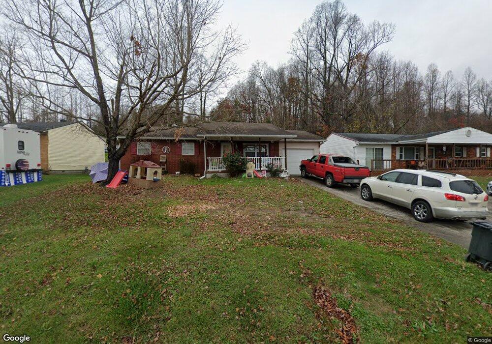
353 Township Road 253 E Ironton, OH 45638
Estimated Value: $123,342 - $146,000
3
Beds
1
Bath
912
Sq Ft
$147/Sq Ft
Est. Value
About This Home
This home is located at 353 Township Road 253 E, Ironton, OH 45638 and is currently estimated at $134,336, approximately $147 per square foot. 353 Township Road 253 E is a home located in Lawrence County with nearby schools including Dawson-Bryant Elementary School, Dawson-Bryant Middle School, and Dawson-Bryant High School.
Ownership History
Date
Name
Owned For
Owner Type
Purchase Details
Closed on
Mar 30, 2012
Sold by
Haas Stacy L and Neville Stacy L
Bought by
Bryant Arthur L and Bryant Brittany A
Current Estimated Value
Home Financials for this Owner
Home Financials are based on the most recent Mortgage that was taken out on this home.
Original Mortgage
$74,560
Outstanding Balance
$52,318
Interest Rate
4.25%
Mortgage Type
FHA
Estimated Equity
$82,018
Purchase Details
Closed on
Feb 27, 2003
Sold by
Willis Clayton D and Willis Sa
Bought by
Haas Stacy L
Create a Home Valuation Report for This Property
The Home Valuation Report is an in-depth analysis detailing your home's value as well as a comparison with similar homes in the area
Home Values in the Area
Average Home Value in this Area
Purchase History
| Date | Buyer | Sale Price | Title Company |
|---|---|---|---|
| Bryant Arthur L | $76,500 | Bestitle | |
| Haas Stacy L | $16,500 | -- |
Source: Public Records
Mortgage History
| Date | Status | Borrower | Loan Amount |
|---|---|---|---|
| Open | Bryant Arthur L | $74,560 |
Source: Public Records
Tax History Compared to Growth
Tax History
| Year | Tax Paid | Tax Assessment Tax Assessment Total Assessment is a certain percentage of the fair market value that is determined by local assessors to be the total taxable value of land and additions on the property. | Land | Improvement |
|---|---|---|---|---|
| 2024 | -- | $26,520 | $2,540 | $23,980 |
| 2023 | $755 | $26,520 | $2,540 | $23,980 |
| 2022 | $752 | $26,520 | $2,540 | $23,980 |
| 2021 | $675 | $23,960 | $2,030 | $21,930 |
| 2020 | $691 | $23,960 | $2,030 | $21,930 |
| 2019 | $688 | $23,960 | $2,030 | $21,930 |
| 2018 | $692 | $23,800 | $2,030 | $21,770 |
| 2017 | $690 | $23,800 | $2,030 | $21,770 |
| 2016 | $636 | $23,800 | $2,030 | $21,770 |
| 2015 | $670 | $23,160 | $2,030 | $21,130 |
| 2014 | $662 | $23,160 | $2,030 | $21,130 |
| 2013 | $616 | $21,540 | $2,030 | $19,510 |
Source: Public Records
Map
Nearby Homes
- 571 County Road 52
- 572 Township Road 145
- 572 Township Road 145 Unit KO-4
- 156 Township Road 181
- 2088 State Route 243
- 1122 Township Road 266
- 1122 Township Road 266
- 342 Township Road 296
- 103 Carrico Dr
- 119 Remy St
- 859 County Road 53
- 2480 County Road 181
- 885 County Road 53
- 0 County Road 181 Unit 24215136
- 0 County Road 181 Unit 11540303
- 135 Lane St
- 6881 State Route 243
- 309 High St
- 309 High St Unit LAO-5
- 519 Lane St
- 339 Township Road 253 E
- 365 Township Road 253 W
- 327 Township Road 253 E
- 377 Township Road 253 E
- 317 Township Road 253 E
- 386 Township Road 253 E
- 301 Township Road 253 E
- 411 Township Road 253 E
- 287 Township Road 253 E
- 277 Township Road 253 E
- 453 Township Road 253 E
- 47 Private Drive 476
- 61 Pvt Dr 338 Twp Rd 253 E
- 233 Township Road 253 E
- 233 Township Road 253 E
- 473 Township Road 253 E
- 493 Township Road 253 E
- 330 Township Road 372
- 213 Township Road 253 E
- 201 Township Road 253 E