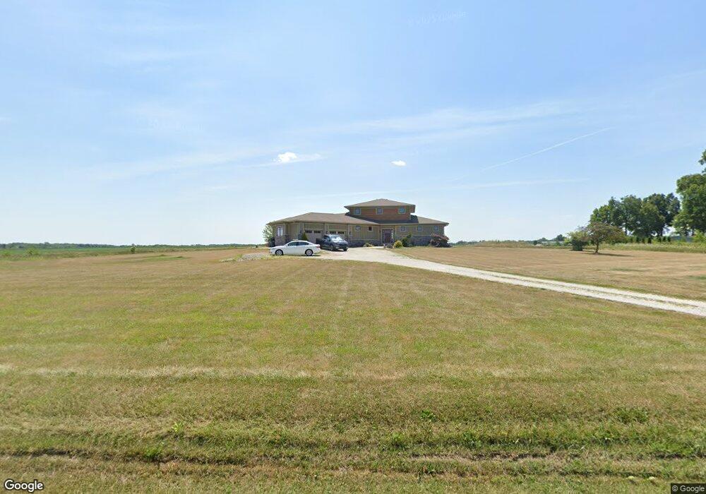
353 W 790 N West Lafayette, IN 47906
Estimated Value: $518,000 - $682,000
4
Beds
3
Baths
3,283
Sq Ft
$186/Sq Ft
Est. Value
About This Home
This home is located at 353 W 790 N, West Lafayette, IN 47906 and is currently estimated at $612,109, approximately $186 per square foot. 353 W 790 N is a home with nearby schools including Battle Ground Elementary School, Battle Ground Middle School, and William Henry Harrison High School.
Create a Home Valuation Report for This Property
The Home Valuation Report is an in-depth analysis detailing your home's value as well as a comparison with similar homes in the area
Home Values in the Area
Average Home Value in this Area
Tax History Compared to Growth
Tax History
| Year | Tax Paid | Tax Assessment Tax Assessment Total Assessment is a certain percentage of the fair market value that is determined by local assessors to be the total taxable value of land and additions on the property. | Land | Improvement |
|---|---|---|---|---|
| 2024 | $3,831 | $525,400 | $31,600 | $493,800 |
| 2023 | $4,362 | $519,000 | $31,600 | $487,400 |
| 2022 | $4,020 | $458,600 | $31,600 | $427,000 |
| 2021 | $2,548 | $337,600 | $31,600 | $306,000 |
| 2020 | $2,286 | $317,800 | $31,600 | $286,200 |
| 2019 | $2,212 | $310,900 | $31,600 | $279,300 |
| 2018 | $2,114 | $303,800 | $31,600 | $272,200 |
| 2017 | $2,070 | $295,100 | $31,600 | $263,500 |
| 2016 | $2,007 | $290,200 | $31,600 | $258,600 |
| 2014 | $1,747 | $262,100 | $31,600 | $230,500 |
| 2013 | $1,853 | $259,400 | $31,600 | $227,800 |
Source: Public Records
Map
Nearby Homes
- 1301 Lambsdowne Ln
- 689 Winslow Ln
- 6519 Ironclad Way
- 1189 Groom Ln
- Lincoln Plan at The Preserve
- Van Buren Plan at The Preserve
- Jefferson Plan at The Preserve
- Harrison Plan at The Preserve
- Reagan Plan at The Preserve
- Taylor Plan at The Preserve
- Arthur Plan at The Preserve
- Eisenhower Plan at The Preserve
- Monroe Plan at The Preserve
- Promenade Plan at The Courtyards at Belle Terra
- Capri Plan at The Courtyards at Belle Terra
- Palazzo Plan at The Courtyards at Belle Terra
- Verona Plan at The Courtyards at Belle Terra
- Portico Plan at The Courtyards at Belle Terra
- Torino Plan at The Courtyards at Belle Terra
- 6100 Gilwell Dr