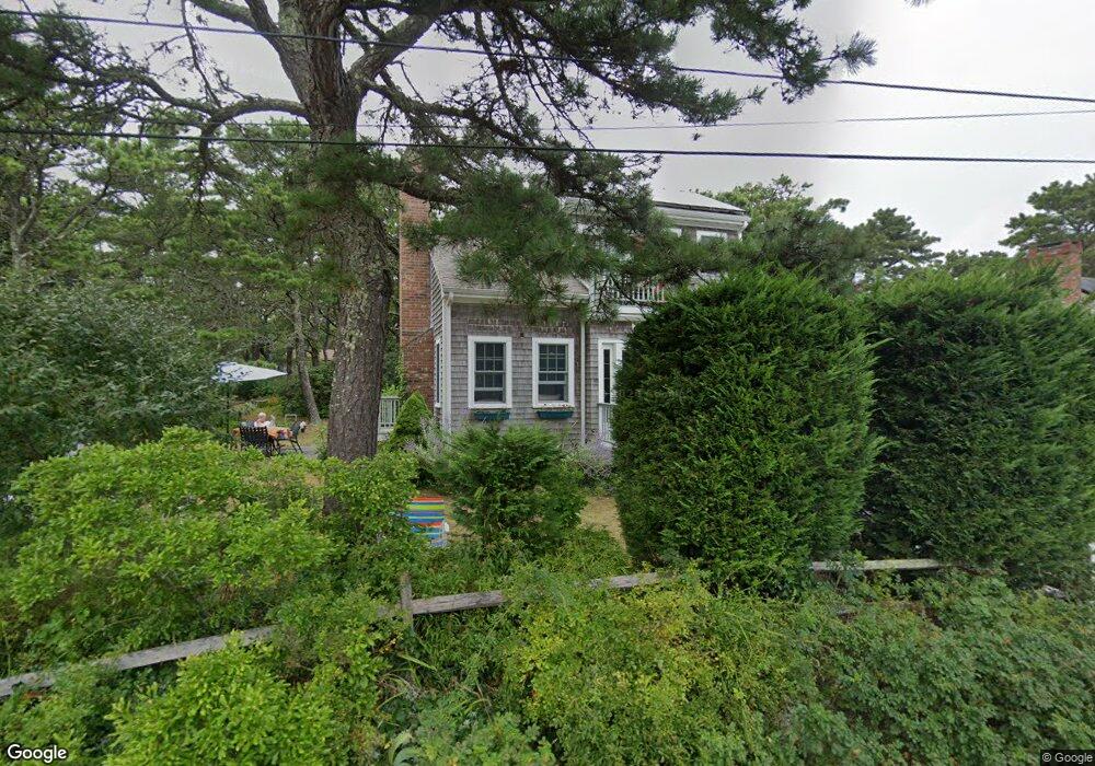
353 Wilson Ave Wellfleet, MA 02667
Estimated Value: $811,787 - $1,063,000
2
Beds
2
Baths
1,056
Sq Ft
$853/Sq Ft
Est. Value
About This Home
This home is located at 353 Wilson Ave, Wellfleet, MA 02667 and is currently estimated at $900,596, approximately $852 per square foot. 353 Wilson Ave is a home located in Barnstable County with nearby schools including Wellfleet Elementary School, Nauset Regional Middle School, and Nauset Regional High School.
Ownership History
Date
Name
Owned For
Owner Type
Purchase Details
Closed on
May 7, 2018
Sold by
Ledkovsky Louise A
Bought by
Ledkovsky Ft
Current Estimated Value
Purchase Details
Closed on
Dec 11, 1985
Bought by
Ledkovsky Louise Ann
Create a Home Valuation Report for This Property
The Home Valuation Report is an in-depth analysis detailing your home's value as well as a comparison with similar homes in the area
Home Values in the Area
Average Home Value in this Area
Purchase History
| Date | Buyer | Sale Price | Title Company |
|---|---|---|---|
| Ledkovsky Ft | -- | -- | |
| Ledkovsky Ft | -- | -- | |
| Ledkovsky Louise Ann | -- | -- |
Source: Public Records
Mortgage History
| Date | Status | Borrower | Loan Amount |
|---|---|---|---|
| Previous Owner | Ledkovsky Louise Ann | $232,500 |
Source: Public Records
Tax History Compared to Growth
Tax History
| Year | Tax Paid | Tax Assessment Tax Assessment Total Assessment is a certain percentage of the fair market value that is determined by local assessors to be the total taxable value of land and additions on the property. | Land | Improvement |
|---|---|---|---|---|
| 2025 | $5,480 | $770,800 | $413,900 | $356,900 |
| 2024 | $5,087 | $744,800 | $394,200 | $350,600 |
| 2023 | $4,489 | $644,900 | $334,100 | $310,800 |
| 2022 | $4,035 | $518,700 | $293,000 | $225,700 |
| 2021 | $3,620 | $460,600 | $261,600 | $199,000 |
| 2020 | $3,561 | $459,500 | $266,200 | $193,300 |
| 2019 | $3,485 | $450,800 | $266,200 | $184,600 |
| 2018 | $3,226 | $449,300 | $266,200 | $183,100 |
| 2017 | $3,023 | $445,800 | $266,200 | $179,600 |
| 2016 | $2,857 | $418,300 | $254,500 | $163,800 |
| 2015 | $2,810 | $414,400 | $252,000 | $162,400 |
Source: Public Records
Map
Nearby Homes
- 175 Cliff Rd
- 60 Long Ave Unit E
- 25 1st Ave
- 175 Delphi Path
- 80 Woodlot Rd
- 95 Barker St
- 90 Paine Hollow Rd
- 55 Harvard St
- 1937 State Hwy Rte 6 Unit 8
- 125 Governor Foss Dr
- 2032 State Hwy Rte 6 Unit F/ (6)
- 30 Sam Hollow Rd
- 40 Leilla Rich Dr
- 245 Paine Hollow Rd
- 215 Pilgrim Spring Rd Unit 6
- 20 Lils Way
- 40 Georges Way
- 90 Blue Heron Rd
- 345 Cove Rd
- 65 Belding Way
- 359 Wilson Ave
- 360 Nellie Rd
- 345 Wilson Ave
- 350 Wilson Ave
- 365 Wilson Ave
- 340 Wilson Ave
- 355 Nellie Rd
- 66 Wilson Ave
- 69 Wilson Ave
- 370 Wilson Ave Unit D
- 370 Wilson Ave Unit C
- 370 Wilson Ave Unit B
- 370 Wilson Ave Unit 4
- 370 Wilson Ave Unit 5
- 379 Nellie Rd
- 45 Ocean View Ave Unit G
- 45 Ocean View Ave Unit F
- 45 Ocean View Dr Unit 7
- 65 Ocean View Ave Unit S
- 65 Ocean View Ave Unit R