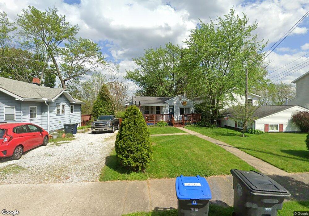
353 Wirth Ave Akron, OH 44312
Ellet NeighborhoodEstimated Value: $123,385 - $145,000
3
Beds
1
Bath
1,026
Sq Ft
$132/Sq Ft
Est. Value
About This Home
This home is located at 353 Wirth Ave, Akron, OH 44312 and is currently estimated at $135,596, approximately $132 per square foot. 353 Wirth Ave is a home located in Summit County with nearby schools including Ellet High School, Summit Academy Akron Elementary School, and Hatton Community Learning Center.
Ownership History
Date
Name
Owned For
Owner Type
Purchase Details
Closed on
Aug 3, 2005
Sold by
Ball Mearl J and Ball Marguerite M
Bought by
Meadows Travis T
Current Estimated Value
Home Financials for this Owner
Home Financials are based on the most recent Mortgage that was taken out on this home.
Original Mortgage
$78,764
Outstanding Balance
$41,509
Interest Rate
5.71%
Mortgage Type
FHA
Estimated Equity
$94,087
Create a Home Valuation Report for This Property
The Home Valuation Report is an in-depth analysis detailing your home's value as well as a comparison with similar homes in the area
Home Values in the Area
Average Home Value in this Area
Purchase History
| Date | Buyer | Sale Price | Title Company |
|---|---|---|---|
| Meadows Travis T | $80,000 | Falls Title Agency Inc |
Source: Public Records
Mortgage History
| Date | Status | Borrower | Loan Amount |
|---|---|---|---|
| Open | Meadows Travis T | $78,764 |
Source: Public Records
Tax History
| Year | Tax Paid | Tax Assessment Tax Assessment Total Assessment is a certain percentage of the fair market value that is determined by local assessors to be the total taxable value of land and additions on the property. | Land | Improvement |
|---|---|---|---|---|
| 2024 | $1,995 | $36,516 | $7,361 | $29,155 |
| 2023 | $1,995 | $36,516 | $7,361 | $29,155 |
| 2022 | $1,833 | $26,272 | $5,296 | $20,976 |
| 2021 | $1,834 | $26,272 | $5,296 | $20,976 |
| 2020 | $1,760 | $26,280 | $5,300 | $20,980 |
| 2019 | $1,821 | $24,740 | $5,300 | $19,440 |
| 2018 | $1,797 | $24,740 | $5,300 | $19,440 |
| 2017 | $1,596 | $24,740 | $5,300 | $19,440 |
| 2016 | $1,597 | $21,500 | $5,300 | $16,200 |
| 2015 | $1,596 | $21,500 | $5,300 | $16,200 |
| 2014 | $1,583 | $21,500 | $5,300 | $16,200 |
| 2013 | $1,688 | $22,580 | $5,300 | $17,280 |
Source: Public Records
Map
Nearby Homes
- 404 Wirth Ave
- 295 High Grove Blvd
- 412 Stevenson Ave
- 480 Wirth Ave
- 2616 Terrace Ave
- 2873 Shelburn Ave
- 328 Stull Ave
- 568 Stevenson Ave
- 2511 Ogden Ave
- 210 Davenport Ave
- 0 Kreiner Ave
- 6 Kreiner Ave
- 5 Kreiner Ave
- 147 Woolf Ave
- 674 Stevenson Ave
- 40 Hyland Dr
- 81 Hyland Dr
- 640 Plainfield Rd
- 228 Hawk Ave
- 479 Junior Ave
- 351 Wirth Ave
- 359 Wirth Ave
- 347 Wirth Ave
- 363 Wirth Ave
- 356 Wirth Ave
- 332 Stevenson Ave
- 352 Wirth Ave
- 344 Stevenson Ave
- 360 Wirth Ave
- 373 Wirth Ave
- 344 Wirth Ave
- 320 Stevenson Ave
- 335 Wirth Ave
- 368 Wirth Ave
- 348 Stevenson Ave
- 348 Stevenson Ave
- 374 Wirth Ave
- 308 Stevenson Ave
- 331 Wirth Ave
- 336 Wirth Ave