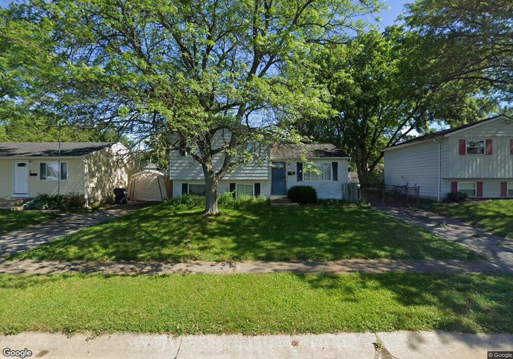
3532 Arnsby Rd Columbus, OH 43232
East Columbus-White Ash NeighborhoodEstimated Value: $188,301 - $220,000
3
Beds
1
Bath
1,332
Sq Ft
$154/Sq Ft
Est. Value
About This Home
This home is located at 3532 Arnsby Rd, Columbus, OH 43232 and is currently estimated at $204,825, approximately $153 per square foot. 3532 Arnsby Rd is a home located in Franklin County with nearby schools including Groveport Madison High School, A+ Arts Academy, and Brice Christian Academy Elementary School.
Ownership History
Date
Name
Owned For
Owner Type
Purchase Details
Closed on
Oct 1, 1999
Sold by
Santry Daniel S and Santry Mary A
Bought by
Ervin Christopher B and Ervin Tamara Lynn
Current Estimated Value
Home Financials for this Owner
Home Financials are based on the most recent Mortgage that was taken out on this home.
Original Mortgage
$77,400
Outstanding Balance
$23,370
Interest Rate
7.83%
Mortgage Type
FHA
Estimated Equity
$181,455
Purchase Details
Closed on
Jul 3, 1990
Bought by
Santry Daniel S and Santry Mary A
Create a Home Valuation Report for This Property
The Home Valuation Report is an in-depth analysis detailing your home's value as well as a comparison with similar homes in the area
Home Values in the Area
Average Home Value in this Area
Purchase History
| Date | Buyer | Sale Price | Title Company |
|---|---|---|---|
| Ervin Christopher B | $77,900 | Chicago Title West | |
| Santry Daniel S | $47,000 | -- |
Source: Public Records
Mortgage History
| Date | Status | Borrower | Loan Amount |
|---|---|---|---|
| Open | Ervin Christopher B | $77,400 |
Source: Public Records
Tax History Compared to Growth
Tax History
| Year | Tax Paid | Tax Assessment Tax Assessment Total Assessment is a certain percentage of the fair market value that is determined by local assessors to be the total taxable value of land and additions on the property. | Land | Improvement |
|---|---|---|---|---|
| 2024 | $2,602 | $53,730 | $14,910 | $38,820 |
| 2023 | $2,585 | $53,725 | $14,910 | $38,815 |
| 2022 | $1,737 | $28,630 | $5,530 | $23,100 |
| 2021 | $1,780 | $28,630 | $5,530 | $23,100 |
| 2020 | $1,784 | $28,630 | $5,530 | $23,100 |
| 2019 | $1,797 | $25,340 | $4,830 | $20,510 |
| 2018 | $1,827 | $25,340 | $4,830 | $20,510 |
| 2017 | $1,833 | $25,340 | $4,830 | $20,510 |
| 2016 | $1,850 | $23,460 | $3,610 | $19,850 |
| 2015 | $1,851 | $23,460 | $3,610 | $19,850 |
| 2014 | $1,698 | $23,460 | $3,610 | $19,850 |
| 2013 | $823 | $26,040 | $3,990 | $22,050 |
Source: Public Records
Map
Nearby Homes
- 3246 Latonia Rd
- 5397 Jack Russell Way
- 3387 Retriever Rd
- 5522 Newport Ct
- 5391 Newport Rd
- 5254 Sedalia Dr
- 5152 Burdett Dr
- 3773 Tylor Dr
- 3773 Clearwater Dr
- 5408 Rohden Dr
- 3289 Kady Ln
- 3739 Atkinson Rd
- 2998 Osgood Rd E
- 5416 Branchville Dr
- 3000 Whitlow Rd
- 5464 Rohden Dr
- 3496 Cadell Rd
- 3567 Wymore Place
- 5125 Upton Rd N
- 5373 Spire Ln
- 3524 Arnsby Rd
- 3540 Arnsby Rd
- 3548 Arnsby Rd
- 3516 Arnsby Rd
- 5459 Deforest Dr
- 5453 Deforest Dr
- 5467 Deforest Dr
- 5441 Deforest Dr
- 3556 Arnsby Rd
- 3508 Arnsby Rd
- 5475 Deforest Dr
- 5429 Deforest Dr
- 3564 Arnsby Rd
- 3505 Arnsby Rd
- 5483 Deforest Dr
- 3410 Everson Rd W
- 3572 Arnsby Rd
- 3493 Arnsby Rd
- 5470 Deforest Dr
- 5491 Deforest Dr