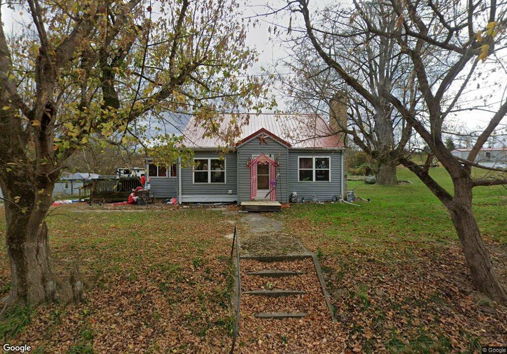
3532 Tatman Coe Rd Mc Dermott, OH 45652
Estimated Value: $113,547 - $206,000
3
Beds
1
Bath
932
Sq Ft
$182/Sq Ft
Est. Value
About This Home
This home is located at 3532 Tatman Coe Rd, Mc Dermott, OH 45652 and is currently estimated at $169,387, approximately $181 per square foot. 3532 Tatman Coe Rd is a home located in Scioto County with nearby schools including Northwest Elementary School, Northwest Middle School, and Northwest High School.
Ownership History
Date
Name
Owned For
Owner Type
Purchase Details
Closed on
Feb 12, 2009
Sold by
Deutsche Bank National Trust Company
Bought by
Knittel Timothy Lee and Knittel Teresa Ann
Current Estimated Value
Purchase Details
Closed on
Nov 17, 2008
Sold by
Donini Marty V and Donini
Bought by
Deutsche Bank National Trust Company As
Purchase Details
Closed on
Feb 1, 2006
Sold by
Andrews Scotty Lynn
Bought by
Cooper Randy M and Cooper
Purchase Details
Closed on
Feb 16, 2005
Sold by
Andrews Dana
Bought by
Andrews Scotty Lynn
Purchase Details
Closed on
Feb 3, 2005
Sold by
Andrews Dana + Peggy Jo J
Bought by
Andrews Dana
Purchase Details
Closed on
Feb 25, 1997
Sold by
Stephens Myrtle
Bought by
Andrews Dana + Peggy Jo J
Create a Home Valuation Report for This Property
The Home Valuation Report is an in-depth analysis detailing your home's value as well as a comparison with similar homes in the area
Home Values in the Area
Average Home Value in this Area
Purchase History
| Date | Buyer | Sale Price | Title Company |
|---|---|---|---|
| Knittel Timothy Lee | $16,900 | -- | |
| Deutsche Bank National Trust Company As | $34,657 | -- | |
| Cooper Randy M | -- | -- | |
| Andrews Scotty Lynn | -- | -- | |
| Andrews Dana | -- | -- | |
| Andrews Dana + Peggy Jo J | -- | -- |
Source: Public Records
Tax History Compared to Growth
Tax History
| Year | Tax Paid | Tax Assessment Tax Assessment Total Assessment is a certain percentage of the fair market value that is determined by local assessors to be the total taxable value of land and additions on the property. | Land | Improvement |
|---|---|---|---|---|
| 2024 | $1,117 | $25,630 | $5,890 | $19,740 |
| 2023 | $1,117 | $25,630 | $5,890 | $19,740 |
| 2022 | $1,115 | $25,630 | $5,890 | $19,740 |
| 2021 | $818 | $19,280 | $5,120 | $14,160 |
| 2020 | $769 | $19,280 | $5,120 | $14,160 |
| 2019 | $768 | $17,480 | $4,610 | $12,870 |
| 2018 | $712 | $17,480 | $4,610 | $12,870 |
| 2017 | $711 | $17,480 | $4,610 | $12,870 |
| 2016 | $707 | $18,100 | $4,600 | $13,500 |
| 2015 | $732 | $18,100 | $4,600 | $13,500 |
| 2013 | $702 | $18,100 | $4,600 | $13,500 |
Source: Public Records
Map
Nearby Homes
- 1447 Mc Dermott Pond Creek Rd
- 246C Rd
- 3153 McDermott Pond Creek Rd
- 125 Owensville Rd
- 133 Crystal Dr
- 656 Arion Rd
- 11192 Ohio 104
- 525 Martin Cemetery Rd
- 499 Coburn Dr
- 11683 Ohio 104
- 448 Houston Hollow Rd
- 0 Careys Run
- 139 Back St
- 873A Dewey Extension
- Acres Henley-Comstock Rd
- 358 Warren Ave
- 2840 Henley Comstock Rd
- 0 Shepard Fork Rd
- 303 Raymond Ave
- 669 Dry Run Rd
- 2866 Pollock Rd
- 3469 Tatman Coe Rd
- 3454 Tatman Coe Rd
- 3448 Tatman Coe Rd
- 2473 Pollock Rd
- 2911 Pollock Rd
- 3449 Tatman-Coe Rd
- 3350 Tatman Coe Rd
- 3370 Tatman Coe Rd
- 2657 Pollock Rd
- 3328 Tatman Coe Rd
- 2970 Pollock Rd
- 2969 Pollock Rd
- 3274 Tatman Coe McDermott
- 401 Colley Rd
- 3315 Tatman Coe Rd
- 2606 Pollock Rd
- 3303 Tatman Coe Rd
- 420 Colley Dr
- 2651 Pollock Rd