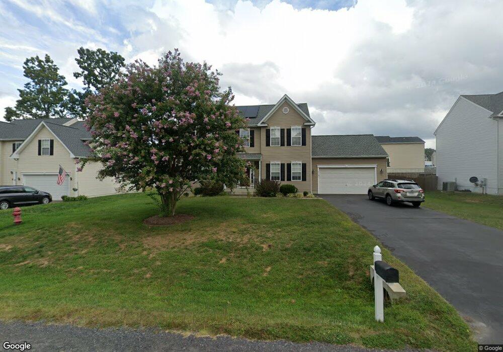
35321 Pheasant Ridge Rd Locust Grove, VA 22508
Estimated Value: $464,000 - $485,000
4
Beds
4
Baths
2,923
Sq Ft
$161/Sq Ft
Est. Value
About This Home
This home is located at 35321 Pheasant Ridge Rd, Locust Grove, VA 22508 and is currently estimated at $472,009, approximately $161 per square foot. 35321 Pheasant Ridge Rd is a home located in Orange County with nearby schools including Locust Grove Primary School, Locust Grove Elementary School, and Locust Grove Middle School.
Ownership History
Date
Name
Owned For
Owner Type
Purchase Details
Closed on
Jul 10, 2006
Sold by
Tricord Incorporated
Bought by
Macdaniel Philip and Macdaniel Teresa
Current Estimated Value
Home Financials for this Owner
Home Financials are based on the most recent Mortgage that was taken out on this home.
Original Mortgage
$209,206
Outstanding Balance
$120,955
Interest Rate
6.37%
Mortgage Type
New Conventional
Estimated Equity
$351,054
Create a Home Valuation Report for This Property
The Home Valuation Report is an in-depth analysis detailing your home's value as well as a comparison with similar homes in the area
Home Values in the Area
Average Home Value in this Area
Purchase History
| Date | Buyer | Sale Price | Title Company |
|---|---|---|---|
| Macdaniel Philip | $339,206 | None Available |
Source: Public Records
Mortgage History
| Date | Status | Borrower | Loan Amount |
|---|---|---|---|
| Open | Macdaniel Philip | $209,206 |
Source: Public Records
Tax History Compared to Growth
Tax History
| Year | Tax Paid | Tax Assessment Tax Assessment Total Assessment is a certain percentage of the fair market value that is determined by local assessors to be the total taxable value of land and additions on the property. | Land | Improvement |
|---|---|---|---|---|
| 2025 | $2,166 | $279,400 | $60,000 | $219,400 |
| 2024 | $2,166 | $279,400 | $60,000 | $219,400 |
| 2023 | $2,166 | $279,400 | $60,000 | $219,400 |
| 2022 | $2,166 | $279,400 | $60,000 | $219,400 |
| 2021 | $2,019 | $280,400 | $60,000 | $220,400 |
| 2020 | $2,019 | $280,400 | $60,000 | $220,400 |
| 2019 | $2,152 | $267,600 | $55,000 | $212,600 |
| 2018 | $2,152 | $267,600 | $55,000 | $212,600 |
| 2017 | $2,152 | $267,600 | $55,000 | $212,600 |
| 2016 | $2,152 | $267,600 | $55,000 | $212,600 |
| 2015 | $1,666 | $234,700 | $55,000 | $179,700 |
| 2014 | $1,666 | $234,700 | $55,000 | $179,700 |
Source: Public Records
Map
Nearby Homes
- 35049 Mansours Dr
- 2188 Mallard Ln
- 2082 Mallard Ln
- 2036 Mourning Dove Dr
- 35342 Hawks Nest Ct
- 35460 Quail Meadow Ln
- 35291 Gosling Ln
- 35326 Gosling Ln
- 35305 Wilderness Shores Way
- 35121 Wilderness Shores Way
- Coral Plan at Wilderness Shores - Seasons Collection
- Alexandrite Plan at Wilderness Shores - Seasons Collection
- Citrine Plan at Wilderness Shores - Seasons Collection
- Lapis Plan at Wilderness Shores - Seasons Collection
- 35618 Pine Needle Ln
- Hemingway Plan at Wilderness Shores - Seasons Collection
- Coronado Plan at Wilderness Shores - Seasons Collection
- 2809 White Tail Dr
- 35603 Pine Needle Ln
- 35599 Pine Needle Ln
- 35311 Pheasant Ridge Rd
- 35331 Pheasant Ridge Rd
- 2156 Mallard Ln
- 2164 Mallard Ln
- 0 Pheasant Ridge Rd Unit OR10171102
- 0 Pheasant Ridge Rd Unit OR10180304
- 005 Pheasant Ridge Rd
- 0005 Pheasant Ridge Rd
- 2148 Mallard Ln
- 0 Pheasant Ridge Rd Unit OR10180108
- 006 Pheasant Ridge Rd
- 35337 Pheasant Ridge Rd
- 0 Pheasant Ridge Rd Unit OR10247197
- 0 Pheasant Ridge Rd Unit OR10247180
- 0 Pheasant Ridge Rd Unit OR10247166
- 0 Pheasant Ridge Rd Unit OR10247152
- 0 Pheasant Ridge Rd Unit OR10247104
- 0 Pheasant Ridge Rd Unit OR10229921
- 0 Pheasant Ridge Rd Unit OR10198278
- 0 Pheasant Ridge Rd Unit OR10198252